Résultats
Nous avons trouvé 23 éléments semblables.


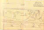
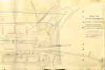
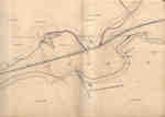
- Second Welland Canal - Book 1, Survey Map 1 - Entrance, Lock 1 and Port Dalhousie


 Survey map of the Second Welland Canal created by the Welland Canal Company showing the areas in and around Port Dalhousie and Grantham Township. Identified structures associated with the Canal include Lock 1, Lighthouse, Lighthouse Keeper's House, East and West Piers, Harbour, Waste Weir, Store House, Collector's Office, Collector Assistant …

 Survey map of the Second Welland Canal created by the Welland Canal Company showing the areas in and around Port Dalhousie and Grantham Township. Identified structures associated with the Canal …Brock University Archives
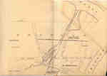
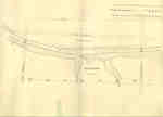
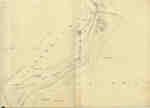
 - Second Welland Canal - Book 1, Survey Map 5 - Through Grantham Township


 Survey map of the Second Welland Canal created by the Welland Canal Company showing a portion of the Grantham Township near Port Dalhousie. Identified structures associated with the Canal include the tow path and floating tow path. The surveyors' measurements and notes can be seen in red and black ink …

 Survey map of the Second Welland Canal created by the Welland Canal Company showing a portion of the Grantham Township near Port Dalhousie. Identified structures associated with the Canal include …Brock University Archives
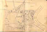
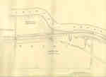
 - Second Welland Canal - Book 1, Survey Map 10 - St. Catharines


 Survey map of the Second Welland Canal created by the Welland Canal Company along the western edge of the Town of St. Catharines. Although not labelled, the Second Welland Canal can be seen running through the map along with its tow path, which is located on the southwestern edge of …

 Survey map of the Second Welland Canal created by the Welland Canal Company along the western edge of the Town of St. Catharines. Although not labelled, the Second Welland Canal …Brock University Archives
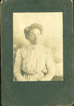
 - Photograph of Irene Bell age 16 years, 1909


 According to entries in the Bell Family Bible, Irene Frances Bell, daughter of George A. Bell and Nellie F. Bell, was born on Jan. 19, 1893. This would make her 16-years-old at the time this photograph was presented in 1909.

 According to entries in the Bell Family Bible, Irene Frances Bell, daughter of George A. Bell and Nellie F. Bell, was born on Jan. 19, 1893. This would make her …Brock University Archives
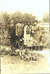
 - Photograph of Mildred Sloman [n.d.]


 Mildred Sloman is pictured with three unidentified gentlemen in this undated photograph, believed to be taken in London, Ontario. This black and white snapshot was in the possession of the Rick Bell family, whose ancestors include Black slaves from the United States.

 Mildred Sloman is pictured with three unidentified gentlemen in this undated photograph, believed to be taken in London, Ontario. This black and white snapshot was in the possession of the …Brock University Archives
 - Richard Nelson Bell - Iris Sloman Wedding Day Photo, 1939


 Bert Sloman (Albert Edward Sloman) passed away in 1986 at Kitchener-Waterloo, Ontario. His wife Vera Matilda Sloman passed away January 4, 2011 at Cambridge Memorial Hospital. They had a son, Ron Sloman.

 Bert Sloman (Albert Edward Sloman) passed away in 1986 at Kitchener-Waterloo, Ontario. His wife Vera Matilda Sloman passed away January 4, 2011 at Cambridge Memorial Hospital. They had a son, …Brock University Archives
 - Lizzie Sloman with Ab and son in London, Ontario [n.d.]


 A black and white photograph of Lizzie Sloman, with two men identified on the reverse as Ab (left) and son (right). The photograph is not dated but is recorded as being taken in London, Ontario. It appears the photo marks some occasion, as one gentleman is in full uniform, while …

 A black and white photograph of Lizzie Sloman, with two men identified on the reverse as Ab (left) and son (right). The photograph is not dated but is recorded as …Brock University Archives
 - Richard and Iris Bell Wedding Day, 1939


 Richard and Iris (Sloman) Bell are pictured on the grounds of unknown gardens, possibly in Niagara Falls, on their wedding day in 1939. This photo was among the family memorabilia in the possession of their son, Rick Bell, of St. Catharines.

 Richard and Iris (Sloman) Bell are pictured on the grounds of unknown gardens, possibly in Niagara Falls, on their wedding day in 1939. This photo was among the family memorabilia …Brock University Archives
 - Mary Tyrell Bell [n.d.]

 A cabinet card portrait of a young Mary Tyrell (later Bell). The photograph is undated, however, it is believed to be from the 1880s or 1890s. Mary Tyrell married Charles Bell in 1894 in St. Catharines, Ontario. They initially settled in Erie, Pennsylvania but relocated to St. Catharines less than …
 A cabinet card portrait of a young Mary Tyrell (later Bell). The photograph is undated, however, it is believed to be from the 1880s or 1890s. Mary Tyrell married Charles …Brock University Archives
 - Portrait of "Ruth", by George A. Hemstreet, Photographer, Milton [n.d.]


 G. A. Hemstreet, also known as George A. Hemstreet, was a photographer in Milton, Ontario from 1877 - 1887. Source: Phillips, Glen C. The Ontario photographers list (1851-1900). Sarnia: Iron Gate Publishing Co., 1990.

 G. A. Hemstreet, also known as George A. Hemstreet, was a photographer in Milton, Ontario from 1877 - 1887. Source: Phillips, Glen C. The Ontario photographers list (1851-1900). Sarnia: Iron …Brock University Archives
 - W.W. Tyrrill receipt, June 1888


 There are various spellings of the Tyrrill name within the Bell family archive. Other forms of the name include Tyrell, Tyrrell, and Terrell.

 There are various spellings of the Tyrrill name within the Bell family archive. Other forms of the name include Tyrell, Tyrrell, and Terrell.Brock University Archives
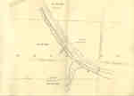
 - Second Welland Canal - Book 2, Survey Map 17 - Deep Cut and Port Robinson


 Survey map of the Second Welland Canal created by the Welland Canal Company showing the canal at Port Robinson. Identified structures and features associated with the Canal include the Deep Cut, Old Channel of Canal, and the towing path. The surveyors' measurements and notes can be seen in red and …

 Survey map of the Second Welland Canal created by the Welland Canal Company showing the canal at Port Robinson. Identified structures and features associated with the Canal include the Deep …Brock University Archives
 - Second Welland Canal - Book 3, Survey Map 1 - Canal to Chippewa Creek with Port Robinson


 Survey map of the Second Welland Canal created by the Welland Canal Company showing Port Robinson and the canal to Chippewa Creek. The surveyors' measurements and notes can be seen in red and black ink and pencil. Local area landmarks are also identified and include streets and roads (ex. Front …

 Survey map of the Second Welland Canal created by the Welland Canal Company showing Port Robinson and the canal to Chippewa Creek. The surveyors' measurements and notes can be seen …Brock University Archives
 - Second Welland Canal - Book 3, Survey Map 2 - Canal to Chippewa Creek with Port Robinson


 The current spelling of Chippewa Creek is Chippawa. Although it not possible to make out the entire name of the H. W. Timms hotel located at Front and Bridge Street on the map itself, it was discovered to belong to Henry W. Timms after consulting the 1851-52 Canada Directory.

 The current spelling of Chippewa Creek is Chippawa. Although it not possible to make out the entire name of the H. W. Timms hotel located at Front and Bridge Street …Brock University Archives
 - Second Welland Canal - Book 3, Survey Map 8 - Quaker Bridge in Thorold


 Survey map of the Second Welland Canal created by the Welland Canal Company showing the canal in the Thorold Township between Port Robinson and Welland. Identified structures and features associated with the Canal include the towing path, back ditch, and the waterway itself. The surveyors' measurements and notes can be …

 Survey map of the Second Welland Canal created by the Welland Canal Company showing the canal in the Thorold Township between Port Robinson and Welland. Identified structures and features associated …Brock University Archives
 - Second Welland Canal - Book 3, Survey Map 21 - Village of Port Colborne


 Survey map of the Second Welland Canal created by the Welland Canal Company showing the areas in and around Port Colborne. Identified structures associated with the Canal include Lighthouse, Pier Light, Old Lock House, Collector's Office, Harbour Master's House, Canal Boundary, Back Ditch, Reserved Back Ditch, Basin, Light-Keeper's House and …

 Survey map of the Second Welland Canal created by the Welland Canal Company showing the areas in and around Port Colborne. Identified structures associated with the Canal include Lighthouse, Pier …Brock University Archives
 - Second Welland Canal - Book 3, Survey Map 9 - Canal along Chippewa Creek in Thorold


 Survey map of the Second Welland Canal created by the Welland Canal Company showing the canal in the Thorold Township between Port Robinson and Welland. Identified structures and features associated with the Canal include the towing path, back ditches, and the waterway itself. The surveyors' measurements and notes can be …

 Survey map of the Second Welland Canal created by the Welland Canal Company showing the canal in the Thorold Township between Port Robinson and Welland. Identified structures and features associated …Brock University Archives
 - Second Welland Canal - Book 3, Survey Map 10 - Canal along Chippewa Creek in Thorold


 Survey map of the Second Welland Canal created by the Welland Canal Company showing the canal in the Thorold Township between Port Robinson and Welland. Identified structures and features associated with the Canal include the towing path, a ditch, foot of the slope of bank, and the waterway itself. The …

 Survey map of the Second Welland Canal created by the Welland Canal Company showing the canal in the Thorold Township between Port Robinson and Welland. Identified structures and features associated …Brock University Archives
 - Second Welland Canal - Book 3, Survey Map 20 - Village of Port Colborne


 Survey map of the Second Welland Canal created by the Welland Canal Company showing the areas in and around Port Colborne and Grantham Township. Identified structures associated with the Canal include Basin, Guard Lock, Two Lock Tender Houses, Lock House Lot, Collectors Office House, Towing Path, North and South Back …

 Survey map of the Second Welland Canal created by the Welland Canal Company showing the areas in and around Port Colborne and Grantham Township. Identified structures associated with the Canal …Brock University Archives
 - Second Welland Canal - Book 1, Survey Map 11 - St. Catharines and Locks 3 and 4


 Survey map of the Second Welland Canal created by the Welland Canal Company showing the Town of St. Catharines. Identified structures associated with the Canal include Lock 3 and its Lock House, Lock 4 and its Lock House, Hydraulic Race, and a floating tow path. The surveyors' measurements and notes …

 Survey map of the Second Welland Canal created by the Welland Canal Company showing the Town of St. Catharines. Identified structures associated with the Canal include Lock 3 and its …Brock University Archives


![Photograph of Mildred Sloman [n.d.] Photograph of Mildred Sloman [n.d.]](https://images.ourontario.ca/Partners/BUA/BUA002282536t.jpg)
![Lizzie Sloman with Ab and son in London, Ontario [n.d.] Lizzie Sloman with Ab and son in London, Ontario [n.d.]](https://images.ourontario.ca/Partners/BUA/BUA002282553t.jpg)
![Mary Tyrell Bell [n.d.] Mary Tyrell Bell [n.d.]](https://images.ourontario.ca/Partners/BUA/BUA002282832t.jpg)
![Portrait of "Ruth", by George A. Hemstreet, Photographer, Milton [n.d.] Portrait of "Ruth", by George A. Hemstreet, Photographer, Milton [n.d.]](https://images.ourontario.ca/Partners/BUA/BUA002283717t.jpg)

