Résultats
Nous avons trouvé 1331 éléments semblables.


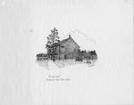
- McLain Hotel
 McLain Hotel. Petawawa Point Early 1900's
  McLain Hotel. Petawawa Point Early 1900'sPetawawa Public Library
 - Hershey's Canada Inc., Smiths Falls, ca. 1960
 Artist's drawing of Hershey's site, ca. 1960 showing the original size of the plant.
  Artist's drawing of Hershey's site, ca. 1960 showing the original size of the plant.Smiths Falls Public Library
 - Halton Hills Public Library drawing

 Halton Hills Public Library
 - Brantford Public Library Logo Illustration

 Brantford Public Library
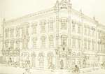
 - LH2994 Western Bank
 Artist: Joan Stacey
  Artist: Joan StaceyOshawa Public Libraries
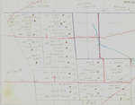
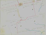
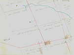
 - Waterloo Township map with names of early property owners
 These maps are hand drawn by Ellis Little and outline over 90000 acres of land granted (Block 2, Waterloo Township) to the Six Nations Indians by the British Crown in 1784 and sold in 1798 to Richard Beasley, James Wilson and John Baptist Rousseaux who looked to resell the land …
  These maps are hand drawn by Ellis Little and outline over 90000 acres of land granted (Block 2, Waterloo Township) to the Six Nations Indians by the British Crown in …Waterloo Public Library
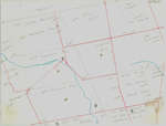
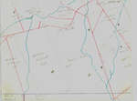
 - Waterloo Township map with names of early property owners
 These maps are hand drawn by Ellis Little and outline over 90000 acres of land granted (Block 2, Waterloo Township) to the Six Nations Indians by the British Crown in 1784 and sold in 1798 to Richard Beasley, James Wilson and John Baptist Rousseaux who looked to resell the land …
  These maps are hand drawn by Ellis Little and outline over 90000 acres of land granted (Block 2, Waterloo Township) to the Six Nations Indians by the British Crown in …Waterloo Public Library
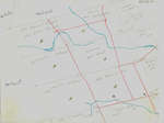
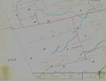
 - Waterloo Township map with names of early property owners
 These maps are hand drawn by Ellis Little and outline over 90000 acres of land granted (Block 2, Waterloo Township) to the Six Nations Indians by the British Crown in 1784 and sold in 1798 to Richard Beasley, James Wilson and John Baptist Rousseaux who looked to resell the land …
  These maps are hand drawn by Ellis Little and outline over 90000 acres of land granted (Block 2, Waterloo Township) to the Six Nations Indians by the British Crown in …Waterloo Public Library
 - Waterloo Township map with names of early property owners
 These maps are hand drawn by Ellis Little and outline over 90000 acres of land granted (Block 2, Waterloo Township) to the Six Nations Indians by the British Crown in 1784 and sold in 1798 to Richard Beasley, James Wilson and John Baptist Rousseaux who looked to resell the land …
  These maps are hand drawn by Ellis Little and outline over 90000 acres of land granted (Block 2, Waterloo Township) to the Six Nations Indians by the British Crown in …Waterloo Public Library
 - Rendering of Glen Recreation Centre
 An artist's depiction of the Glen Abbey Recreation Centre.
  An artist's depiction of the Glen Abbey Recreation Centre.Oakville Public Library
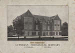
 - New Dormitory, Lutheran Theological Seminary
 Willison Hall was built in 1914, expanded in 1924, and demolished in 1970. It contained administration offices, classrooms and laboratories, a chapel, a dining hall, the library, a gymnasium, and student accommodations. The building was commonly known as “Old Main” until the mid 1950s when it was named in honour …
  Willison Hall was built in 1914, expanded in 1924, and demolished in 1970. It contained administration offices, classrooms and laboratories, a chapel, a dining hall, the library, a gymnasium, and …Wilfrid Laurier University Library
 - Waterloo Township map with names of early property owners
 These maps are hand drawn by Ellis Little and outline over 90000 acres of land granted (Block 2, Waterloo Township) to the Six Nations Indians by the British Crown in 1784 and sold in 1798 to Richard Beasley, James Wilson and John Baptist Rousseaux who looked to resell the land …
  These maps are hand drawn by Ellis Little and outline over 90000 acres of land granted (Block 2, Waterloo Township) to the Six Nations Indians by the British Crown in …Waterloo Public Library
 - Waterloo Township map with names of early property owners
 These maps are hand drawn by Ellis Little and outline over 90000 acres of land granted (Block 2, Waterloo Township) to the Six Nations Indians by the British Crown in 1784 and sold in 1798 to Richard Beasley, James Wilson and John Baptist Rousseaux who looked to resell the land …
  These maps are hand drawn by Ellis Little and outline over 90000 acres of land granted (Block 2, Waterloo Township) to the Six Nations Indians by the British Crown in …Waterloo Public Library
 - Waterloo Township map with names of early property owners
 These maps are hand drawn by Ellis Little and outline over 90000 acres of land granted (Block 2, Waterloo Township) to the Six Nations Indians by the British Crown in 1784 and sold in 1798 to Richard Beasley, James Wilson and John Baptist Rousseaux who looked to resell the land …
  These maps are hand drawn by Ellis Little and outline over 90000 acres of land granted (Block 2, Waterloo Township) to the Six Nations Indians by the British Crown in …Waterloo Public Library
 - Waterloo Township map with names of early property owners
 These maps are hand drawn by Ellis Little and outline over 90000 acres of land granted (Block 2, Waterloo Township) to the Six Nations Indians by the British Crown in 1784 and sold in 1798 to Richard Beasley, James Wilson and John Baptist Rousseaux who looked to resell the land …
  These maps are hand drawn by Ellis Little and outline over 90000 acres of land granted (Block 2, Waterloo Township) to the Six Nations Indians by the British Crown in …Waterloo Public Library
 - Waterloo Township map with names of early property owners
 These maps are hand drawn by Ellis Little and outline over 90000 acres of land granted (Block 2, Waterloo Township) to the Six Nations Indians by the British Crown in 1784 and sold in 1798 to Richard Beasley, James Wilson and John Baptist Rousseaux who looked to resell the land …
  These maps are hand drawn by Ellis Little and outline over 90000 acres of land granted (Block 2, Waterloo Township) to the Six Nations Indians by the British Crown in …Waterloo Public Library
 - Waterloo Township map with names of early property owners
 These maps are hand drawn by Ellis Little and outline over 90000 acres of land granted (Block 2, Waterloo Township) to the Six Nations Indians by the British Crown in 1784 and sold in 1798 to Richard Beasley, James Wilson and John Baptist Rousseaux who looked to resell the land …
  These maps are hand drawn by Ellis Little and outline over 90000 acres of land granted (Block 2, Waterloo Township) to the Six Nations Indians by the British Crown in …Waterloo Public Library
 - Maria's House
 ...
...  ...Thames Art Gallery
 - Still Life #7
 ...
...  ...Thames Art Gallery
 - Female Figure
 ...
...  ...Thames Art Gallery

