Résultats
Nous avons trouvé 62 éléments semblables.


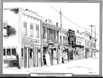
- East Side Main Street, Thessalon, circa 1920


 This is a black and white ink sketch of the east side of Thessalon's Main Street in the early 1920s. It shows a series of two-story buildings including the Imperial Bank of Canada and the People's Meat Market. the illustrator is Barbara Halyk.

 This is a black and white ink sketch of the east side of Thessalon's Main Street in the early 1920s. It shows a series of two-story buildings including the Imperial …Thessalon Union Public Library
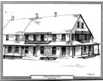
 - Drawing of the Queen's Royal Hotel, Thessalon, 1989

 This is a black and white ink sketch of the Queen's Royal Hotel, Thessalon, built in 1887. The sketch depicts the long two-story hotel with a covered porch around the building, There are also two small second floor balconies.
 This is a black and white ink sketch of the Queen's Royal Hotel, Thessalon, built in 1887. The sketch depicts the long two-story hotel with a covered porch around the …Thessalon Union Public Library
 - Sand Bay School S.S. #18 & 15

 (Condition: Good.)
 (Condition: Good.)Leeds & Thousand Islands Public Library
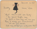
 - Springfield House Black Cat

 Little poem about black cats currently found at Springfield House / Escott Public Library.
 Little poem about black cats currently found at Springfield House / Escott Public Library.Leeds & Thousand Islands Public Library
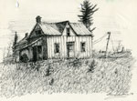
 - Pencil Sketch of an Abandoned House, 1978

 Signed by the artist. Part of a group of ten sketches which were donated to the Perry Township Public Library in 1978.
 Signed by the artist. Part of a group of ten sketches which were donated to the Perry Township Public Library in 1978.Perry Township Public Library
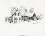
 - Pencil Sketch of a Snow-Covered Home, 1978

 Signed by the artist. Part of a group of ten sketches which were donated to the Perry Township Public Library in 1978.
 Signed by the artist. Part of a group of ten sketches which were donated to the Perry Township Public Library in 1978.Perry Township Public Library
 - Pencil Sketch of a Large Wooden Barn, 1977

 Signed by the artist. Part of a group of ten sketches which were donated to the Perry Township Public Library in 1978.
 Signed by the artist. Part of a group of ten sketches which were donated to the Perry Township Public Library in 1978.Perry Township Public Library
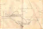
 - Second Welland Canal - Book 1, Survey Map 2 - Lock 1 and Port Dalhousie

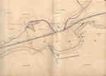
 Survey map of the Second Welland Canal created by the Welland Canal Company showing the areas in and around Port Dalhousie and Grantham Township. Identified structures associated with the Canal include Lock 1, East and West Piers, Collector's Office, Lock Tender's House and the new towing path. The surveyors' measurements …
 Survey map of the Second Welland Canal created by the Welland Canal Company showing the areas in and around Port Dalhousie and Grantham Township. Identified structures associated with the Canal …Brock University Archives
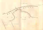
 - Second Welland Canal - Book 1, Survey Map 3 - Old Lock 2 in Grantham Township

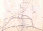
 Survey map of the Second Welland Canal created by the Welland Canal Company showing a portion of the Grantham Township near Port Dalhousie. Identified structures associated with the Canal include the new towing path. The surveyors' measurements and notes can be seen in red and black ink and pencil. Features …
 Survey map of the Second Welland Canal created by the Welland Canal Company showing a portion of the Grantham Township near Port Dalhousie. Identified structures associated with the Canal include …Brock University Archives
 - Second Welland Canal - Book 1, Survey Map 4 - Through Grantham Township

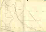
 Survey map of the Second Welland Canal created by the Welland Canal Company showing a portion of the Grantham Township. Identified structures associated with the Canal include the floating tow path and the canal itself. The surveyors' measurements and notes can be seen in red and black ink and pencil. …
 Survey map of the Second Welland Canal created by the Welland Canal Company showing a portion of the Grantham Township. Identified structures associated with the Canal include the floating tow …Brock University Archives
 - Second Welland Canal - Book 1, Survey Map 5 - Through Grantham Township


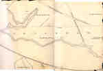
 Survey map of the Second Welland Canal created by the Welland Canal Company showing a portion of the Grantham Township near Port Dalhousie. Identified structures associated with the Canal include the tow path and floating tow path. The surveyors' measurements and notes can be seen in red and black ink …

 Survey map of the Second Welland Canal created by the Welland Canal Company showing a portion of the Grantham Township near Port Dalhousie. Identified structures associated with the Canal include …Brock University Archives
 - Second Welland Canal - Book 1, Survey Map 6 - Through Grantham and Louth Townships

 Survey map of the Second Welland Canal created by the Welland Canal Company showing the area between the Townships of Grantham and Louth. Identified structures associated with the Canal include the floating tow path. The surveyors' measurements and notes can be seen in red and black ink and pencil. Features …
 Survey map of the Second Welland Canal created by the Welland Canal Company showing the area between the Townships of Grantham and Louth. Identified structures associated with the Canal include …Brock University Archives
 - Second Welland Canal - Book 1, Survey Map 8 - Through Grantham and Louth Townships

 Survey map of the Second Welland Canal created by the Welland Canal Company showing the area between the Townships of Louth and Grantham. Identified structures associated with the Canal include the floating tow path. It is not labelled, but runs along the bottom of the map. The surveyors' measurements and …
 Survey map of the Second Welland Canal created by the Welland Canal Company showing the area between the Townships of Louth and Grantham. Identified structures associated with the Canal include …Brock University Archives
 - Second Welland Canal - Book 1, Survey Map 7 - Through Grantham Township

 Survey map of the Second Welland Canal created by the Welland Canal Company showing a portion of the Grantham Township. Identified structures associated with the Canal include the floating tow path. The surveyors' measurements and notes can be seen in red and black ink and pencil. Local area landmarks are …
 Survey map of the Second Welland Canal created by the Welland Canal Company showing a portion of the Grantham Township. Identified structures associated with the Canal include the floating tow …Brock University Archives
 - Second Welland Canal - Book 1, Survey Map 10 - St. Catharines


 Survey map of the Second Welland Canal created by the Welland Canal Company along the western edge of the Town of St. Catharines. Although not labelled, the Second Welland Canal can be seen running through the map along with its tow path, which is located on the southwestern edge of …

 Survey map of the Second Welland Canal created by the Welland Canal Company along the western edge of the Town of St. Catharines. Although not labelled, the Second Welland Canal …Brock University Archives
 - Second Welland Canal - Book 1, Survey Map 9 - Lock 2 in Grantham Township

 Survey map of the Second Welland Canal created by the Welland Canal Company showing a portion of the Grantham Township sometimes referred to as the Welland Vale. Identified structures associated with the Canal include Lock 2, several weirs, and the Lock Tender's House. The surveyors' measurements and notes can be …
 Survey map of the Second Welland Canal created by the Welland Canal Company showing a portion of the Grantham Township sometimes referred to as the Welland Vale. Identified structures associated …Brock University Archives
 - Second Welland Canal - Book 1, Survey Map 11 - St. Catharines and Locks 3 and 4


 Survey map of the Second Welland Canal created by the Welland Canal Company showing the Town of St. Catharines. Identified structures associated with the Canal include Lock 3 and its Lock House, Lock 4 and its Lock House, Hydraulic Race, and a floating tow path. The surveyors' measurements and notes …

 Survey map of the Second Welland Canal created by the Welland Canal Company showing the Town of St. Catharines. Identified structures associated with the Canal include Lock 3 and its …Brock University Archives
 - Second Welland Canal - Book 1, Survey Map 12 - St. Catharines and Lock 4


 Survey map of the Second Welland Canal created by the Welland Canal Company showing the Town of St. Catharines. Identified structures associated with the Canal include Lock 4, Hydraulic Race, floating tow path, and the Canal waterway itself. The surveyors' measurements and notes can be seen in red and black …

 Survey map of the Second Welland Canal created by the Welland Canal Company showing the Town of St. Catharines. Identified structures associated with the Canal include Lock 4, Hydraulic Race, …Brock University Archives
 - Second Welland Canal - Book 1, Survey Map 13 - St. Catharines and Locks 4 and 5

 Survey map of the Second Welland Canal created by the Welland Canal Company showing the Town of St. Catharines. Identified structures associated with the Canal include Lock 4, Lock House, Lock 5, Small Lock House, the towing path, and Gasometer for Canal. The surveyors' measurements and notes can be seen …
 Survey map of the Second Welland Canal created by the Welland Canal Company showing the Town of St. Catharines. Identified structures associated with the Canal include Lock 4, Lock House, …Brock University Archives
 - Second Welland Canal - Book 1, Survey Map 14 - St. Catharines and Lock 5

 Survey map of the Second Welland Canal created by the Welland Canal Company showing the Canal along the eastern edge of the Town of St. Catharines. Identified structures associated with the Canal include Lock 5 and the towing path. The surveyors' measurements and notes can be seen in red and …
 Survey map of the Second Welland Canal created by the Welland Canal Company showing the Canal along the eastern edge of the Town of St. Catharines. Identified structures associated with …Brock University Archives

