Résultats
Nous avons trouvé 3657 éléments semblables.


- Ear Falls, Hydro Colony

 The new permanent homes in the Hydro Colony housed radio operator Jack Schwass, and his wife, line foreman Art Westran and his wife Ena, station maintenance man Harold Evans and his wife, operator Ed Smith, his wife and son, operator Royden and Gladys McDonald, Andy and Petra (MOM) Inguard. Clara …
 The new permanent homes in the Hydro Colony housed radio operator Jack Schwass, and his wife, line foreman Art Westran and his wife Ena, station maintenance man Harold Evans and …Ear Falls Public Library
 - Ear Falls Generating Station

 Photo of turbine used for generating power at the station. The gentleman in the photo is unidentified.
 Photo of turbine used for generating power at the station. The gentleman in the photo is unidentified.Ear Falls Public Library
 - Ear Falls Hydro Colony

 Construction of the Hydro colony began in 1937 to house employees and their families. However, when the second unit of the power plant was installed, the construction camp was built on the west side of the dam away from the Hydro colony, at the present site of the transformer yard …
 Construction of the Hydro colony began in 1937 to house employees and their families. However, when the second unit of the power plant was installed, the construction camp was built …Ear Falls Public Library
 - Lac Seul Dam - aerial view (1957)

 An aerial view (looking south to the U.S). of Lac Seul Dam, Ear Falls Generating station on the English River, November 22, 1957.
 An aerial view (looking south to the U.S). of Lac Seul Dam, Ear Falls Generating station on the English River, November 22, 1957.Ear Falls Public Library
 - Group of Prospectors, One Man Holding Gold Brick


 Group of unidentified prospectors, one of them holding a gold brick.

 Group of unidentified prospectors, one of them holding a gold brick.Greenstone Public Library
 - Little Long Lac Mine and Townsite (~1937)

 Aerial view looking northeast across Barton Bay. Inscription reads 'Little Long Lac Gold mine'. In the foreground is the clearing for Errington Avenue. It would later be called Arena Road and in 1939, it would become part of Highway 11. At the extreme left is the townsite of Little Long …
 Aerial view looking northeast across Barton Bay. Inscription reads 'Little Long Lac Gold mine'. In the foreground is the clearing for Errington Avenue. It would later be called Arena Road …Greenstone Public Library
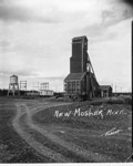
 - Mosher Mine

 Greenstone, Geraldton, Mosher mine, mining, mines, gold, Ontario
 Greenstone, Geraldton, Mosher mine, mining, mines, gold, OntarioGreenstone Public Library
 - Hydro Colony - Ear Falls (1957)

 Aerial photograph of the Hydro colony of Ear Falls, Ontario 1957. The area was created to house the hydro workers and their families.
 Aerial photograph of the Hydro colony of Ear Falls, Ontario 1957. The area was created to house the hydro workers and their families.Ear Falls Public Library
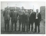
 - Groupe d'homme / Group of men


 Reproduction of the photo

 Reproduction of the photoMusée Sturgeon River House Museum
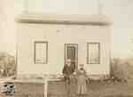
 - Cornish Home


 Condition: Fine. Image is dirty and slightly faded

 Condition: Fine. Image is dirty and slightly fadedSt. Marys Museum
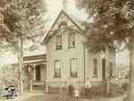
 - The Doupe Family


 Condition: Fair. Image is dirty and matte is very worn.

 Condition: Fair. Image is dirty and matte is very worn.St. Marys Museum
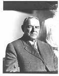
 - Bust portrait of William Griffin, Keeper of the Wellington County House of Industry and Refuge.


 McLaughlin Library ASC: Agricultural, Rural, & Scottish Images
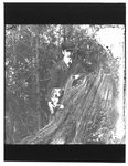
 - Portrait of John Connon, as a young man, with a dog, by a tree stump.


 McLaughlin Library ASC: Agricultural, Rural, & Scottish Images
 - Seven Men and Two Horses, Building the Railroad, 1890

 Four men sitting an three men standing with two horses on the side of the railroad tracks. These men are working on Grant Trunk Railroad. There is a utility pole in the background.
 Four men sitting an three men standing with two horses on the side of the railroad tracks. These men are working on Grant Trunk Railroad. There is a utility pole …Sundridge - Strong Union PL
 - Grand Trunk Railroad Station and Johnstone's Hardware Store, Sundridge, circa 1920

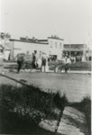
 Black and white photograph a town square and a street. The square has many people in it, including a man riding a bicycle. Across the street there's a white building which is Johnstone's Hardware Store. To the right is the Grand Trunk Railway station.
 Black and white photograph a town square and a street. The square has many people in it, including a man riding a bicycle. Across the street there's a white building …Sundridge - Strong Union PL
 - Aerial Photograph of Main Street and Highway 11, Sundridge, circa 1960

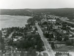
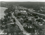
 Black and white aerial photograph of Sundridge and Lake Bernard. In the middle is the Main Street and Highway 11.
 Black and white aerial photograph of Sundridge and Lake Bernard. In the middle is the Main Street and Highway 11.Sundridge - Strong Union PL
 - Aerial Photograph of Main Street and Highway 11, Sundridge, circa 1960

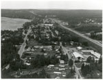
 Black and white aerial photograph of Sundridge Ontario during the 1960s. Lake Bernard is on the left of the photograph. In the middle of the image is the Main Street and Highway 11 is on the right side of the photograph.
 Black and white aerial photograph of Sundridge Ontario during the 1960s. Lake Bernard is on the left of the photograph. In the middle of the image is the Main Street …Sundridge - Strong Union PL
 - Aerial Photograph of Sundridge, circa 1960

 Black and white aerial photograph of Sundridge Ontario during the 1960s. A small portion of Lake Bernard can be seen in the upper left hand portion of the image. Hwy 11 can be seen on the right hand side of the photograph.
 Black and white aerial photograph of Sundridge Ontario during the 1960s. A small portion of Lake Bernard can be seen in the upper left hand portion of the image. Hwy …Sundridge - Strong Union PL
 - Aerial Photograph of Main Street and Highway 11, Sundridge, ON, circa 1960

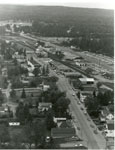
 Black and white aerial photograph of Sundridge during the 1960s. Highway 11 is on the right side of the image, and the main street of Sundridge is the prominent road on the left side of the photograph.
 Black and white aerial photograph of Sundridge during the 1960s. Highway 11 is on the right side of the image, and the main street of Sundridge is the prominent road …Sundridge - Strong Union PL
 - 162nd Battalion Group Photograph, circa 1914

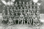
 Black and white group photograph of the 162nd Battalion. The platoon is divided into four rows. The back three rows are standing, The front row is sitting on a bench. There are also two men sitting on the ground. The soldiers are sitting in front of a white picket fence, …
 Black and white group photograph of the 162nd Battalion. The platoon is divided into four rows. The back three rows are standing, The front row is sitting on a bench. …Sundridge - Strong Union PL


