Résultats
Nous avons trouvé 91243 éléments semblables.


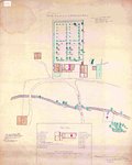
- Plan of Fort's George, Mississauga, and Niagara, The Military Reserves and the Town of Newark- 1908 Copy of an 1817 Original
 A plan by H.H. Willson[s] of Fort's George, Mississauga and Niagara, the Military Reserves and the Town of Newark. It is dated 2 May 1817 and has "Royal Regiment Office, Quebec". A memo above the title states the plan "shows a new proposed military reserve in red lines." This is …
  A plan by H.H. Willson[s] of Fort's George, Mississauga and Niagara, the Military Reserves and the Town of Newark. It is dated 2 May 1817 and has "Royal Regiment Office, …
 - Mr. President Russel's Estate- 1915 copy
 A 1915 copy of Mr. President Russel's (president and acting administrator of Upper Canada from 1796-1799) estate plan in 1797. It illustrates the house and garden plans of his estate including site descriptions and dimensions.
  A 1915 copy of Mr. President Russel's (president and acting administrator of Upper Canada from 1796-1799) estate plan in 1797. It illustrates the house and garden plans of his estate …
 - Plan of the Township of Grantham and Louth 1814
 A copy of a map from the National Archives.
  A copy of a map from the National Archives.St. Catharines Museum
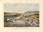
 - Map of Historic Niagara, Showing the Principal Points of Interest in Connection with the History of the Niagara River
 Made for Peter A. Porter. It outlines all the major historical sites for the War of 1812 in Niagara.
  Made for Peter A. Porter. It outlines all the major historical sites for the War of 1812 in Niagara.
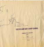
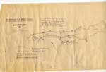
 - Georgian Bay Ship Canal Map: Pembroke to Des Joachims
 Line map of the canal system drawn in bluish coloured ink, outlines routes along the Ottawa River between Pembroke and the rapids at Des Joachims. The left-hand side of the map has very prominent ink blotches and finger prints made from the same colour of ink as the map itself. …
  Line map of the canal system drawn in bluish coloured ink, outlines routes along the Ottawa River between Pembroke and the rapids at Des Joachims. The left-hand side of the …Petawawa Public Library
 - Georgian Bay Ship Canal Map: Des Joachims to Pembroke
 "Traced by members of Deep River Y.C. from photographic copy of original Dept. of Public Works chart. Supplemented from 1" Survey Maps and from personal experience."
  "Traced by members of Deep River Y.C. from photographic copy of original Dept. of Public Works chart. Supplemented from 1" Survey Maps and from personal experience."Petawawa Public Library
 - Map: Laura Secord’s Route from Queenston to Beaverdams
 A handwritten map of Laura Secord’s route from Queenston to Beaverdams during the War of 1812. There is also a short history of the map itself included. It is black ink on three pieces of cream paper. It is believed that this map was made for Mrs. Curzon when writing …
  A handwritten map of Laura Secord’s route from Queenston to Beaverdams during the War of 1812. There is also a short history of the map itself included. It is black …
 - Fire Insurance Map 1942, Map 16
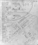
 Fire Insurance map from 1942 of north central Waterloo in two sections, along Albert Street from Dearborn (later University Avenue) to North (later Columbia) Street, considered the city limits; and along King Street from Schneider's Road (later University Avenue) to North (later Columbia Street). Also shown is Hill Street at …
  Fire Insurance map from 1942 of north central Waterloo in two sections, along Albert Street from Dearborn (later University Avenue) to North (later Columbia) Street, considered the city limits; and …Waterloo Public Library
 - Fire Insurance Map 1942, Map 5
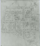
 Fire Insurance map from 1942 of the southeast business district of Waterloo, Erb Street to the north, George Street to the south, King Street to the west and Willow Street (not visible) to the east. Some of the businesses visible on the map include: L.J. Klopp, Dry Goods; Rennel Drugs; …
  Fire Insurance map from 1942 of the southeast business district of Waterloo, Erb Street to the north, George Street to the south, King Street to the west and Willow Street …Waterloo Public Library
 - Fire Insurance Map 1942, Map 6
 Earl Street became Severn Avenue. Fischer Street became Belmont Avenue. Victoria Street became Avondale Avenue.
  Earl Street became Severn Avenue. Fischer Street became Belmont Avenue. Victoria Street became Avondale Avenue.Waterloo Public Library
 - Fire Insurance Map 1942, Map 13
 1946, 1951 and 1956 show a service station and White Rose Inn and restaurant at 188 King north. Unclear if the service station and inn were jointly owned or two separate businesses. Main Street became Lodge Street. Schneider's Road became University Avenue at King Street. Snider Street became Fountain Street. …
  1946, 1951 and 1956 show a service station and White Rose Inn and restaurant at 188 King north. Unclear if the service station and inn were jointly owned or two …Waterloo Public Library
 - Fire Insurance Map 1942, Map 14
 Fire Insurance map from 1942 of a northwest section of of Waterloo, Erb Street between McDougall Avenue and Amos Avenue. A separate section showing Bridgeport Road and Margaret Avenue is included.
  Fire Insurance map from 1942 of a northwest section of of Waterloo, Erb Street between McDougall Avenue and Amos Avenue. A separate section showing Bridgeport Road and Margaret Avenue is …Waterloo Public Library
 - Fire Insurance Map 1942, Map 15
 Victoria Street became Avondale Avenue. Shantz Street became Canbar Avenue and no longer exists. Knox Avenue no longer exists. Elizabeth Street became Beverley Street. Rudy Street became Roslin Avenue. Charles Street became Dunbar Avenue.
  Victoria Street became Avondale Avenue. Shantz Street became Canbar Avenue and no longer exists. Knox Avenue no longer exists. Elizabeth Street became Beverley Street. Rudy Street became Roslin Avenue. Charles …Waterloo Public Library
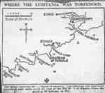
 - Map of where the Lusitania was torpedoed
 The Lusitania was an ocean liner that was sunk by a German U-boat, killing around 1,200 people. To this day, it remains one of the most famous civilian liner disasters in the world.
  The Lusitania was an ocean liner that was sunk by a German U-boat, killing around 1,200 people. To this day, it remains one of the most famous civilian liner disasters …Joshua Creek Heritage Art Centre
 - County of Simcoe
 Very fragile condition. Row 1 large map stand
  Very fragile condition. Row 1 large map standOrillia Public Library
 - Map of Mississaga St.
 Row 7 on large map stand
  Row 7 on large map standOrillia Public Library
 - Orillia 1880's and 1890's
 Row 7 large map stand
  Row 7 large map standOrillia Public Library
 - Orillia 1890's
 Row 7 large map stand
  Row 7 large map standOrillia Public Library
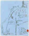
 - Ink Sketch of the Site of Sir Isaac Brock's death
 This is a sketch, done in pen, of the site of Brock's death. It includes a sketch of the monument, details of Queenston Heights and the site of where it was believed Brock fell. The creator also mentions Wynn's Tavern and writes "where Body was taken" just beside it.
  This is a sketch, done in pen, of the site of Brock's death. It includes a sketch of the monument, details of Queenston Heights and the site of where it …
 - West Half of the Westport to Farmersville Macadamized Road, from Westport to Phillipsville only
 {Poor - Map is dilapidated.) A map from April 1852 showing the "Macadamized Road" from Westport to Farmersville, Ontario. This map shows the west half of the Westport to Farmersville Macadamized Road, from Westport to Phillipsville only.
  {Poor - Map is dilapidated.) A map from April 1852 showing the "Macadamized Road" from Westport to Farmersville, Ontario. This map shows the west half of the Westport to Farmersville …Leeds & Thousand Islands Public Library

