Résultats
Nous avons trouvé 422 éléments semblables.


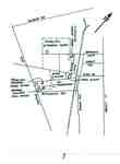
- Map of Mississaga St.
 Row 7 on large map stand
  Row 7 on large map standOrillia Public Library
 - Orillia 1880's and 1890's
 Row 7 large map stand
  Row 7 large map standOrillia Public Library
 - Orillia 1890's
 Row 7 large map stand
  Row 7 large map standOrillia Public Library
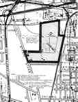
 - Map Of The North Channel And Surrounding Townships, Circa 1980
 In addition to showing the location of the Townships and various islands it notes the 4 places where ships could enter Georgian Bay.
  In addition to showing the location of the Townships and various islands it notes the 4 places where ships could enter Georgian Bay.Huron Shores Museum
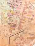
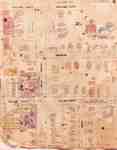
 - Fire Insurance Map 1942, Map 16
 Fire Insurance map from 1942 of north central Waterloo in two sections, along Albert Street from Dearborn (later University Avenue) to North (later Columbia) Street, considered the city limits; and along King Street from Schneider's Road (later University Avenue) to North (later Columbia Street). Also shown is Hill Street at …
  Fire Insurance map from 1942 of north central Waterloo in two sections, along Albert Street from Dearborn (later University Avenue) to North (later Columbia) Street, considered the city limits; and …Waterloo Public Library
 - Fire Insurance Map 1942
 See detail photographs for enhanced view of the map.
  See detail photographs for enhanced view of the map.Waterloo Public Library
 - Fire Insurance Map 1920 - 1929
 1920 map updated in 1929. Queen Street later became Regina Street. Weaver Street was a small lane approximately where Willis Way is today. On the east side of King Street and south it continued as Weaver and later became Herbert Street. Park Avenue later became Alexandra Avenue. Morley Street no …
  1920 map updated in 1929. Queen Street later became Regina Street. Weaver Street was a small lane approximately where Willis Way is today. On the east side of King Street …Waterloo Public Library
 - Fire Insurance Map 1920 - 1929
 1920 map updated in 1929. See detail photographs for enhanced view of the map.
  1920 map updated in 1929. See detail photographs for enhanced view of the map.Waterloo Public Library
 - Map annotated with Almas family farms (detail) ,
 ...
...  ...Burlington Historical Society
 - Plan of Burlington Beach at the Canal in 1833
 A copy of a plan from an unknown source.
  A copy of a plan from an unknown source.Burlington Historical Society
 - Map of Almas family farms, redrawn ca 1992
 Redrawn by Alan G. Hall, ca 1992 from an annotated map supplied by Paul Almas (see Reverse image). Al Hall (1923 - 2008) and his wife Hazel were active volunteers with the BHS after his retirement. He served as Surveyor for the City of Burlington from 1964 to 1987.
  Redrawn by Alan G. Hall, ca 1992 from an annotated map supplied by Paul Almas (see Reverse image). Al Hall (1923 - 2008) and his wife Hazel were active volunteers …Burlington Historical Society
 - Plan of John Chisholm and Joseph Brant properties on the old channel and outlet, ca 1794

 Drawn from a copy made after a plan owned by Mr F. Macklen, which he received from Mr [John] Chisholm in 1794. The original map, attributed to S. H. Ghent, is in the McMaster University Library Special Collections. Copies are held in the Map Room of the Geography Department, McMaster …
 Drawn from a copy made after a plan owned by Mr F. Macklen, which he received from Mr [John] Chisholm in 1794. The original map, attributed to S. H. Ghent, …Burlington Historical Society
 - Plan of Freeman, ca 1960
 ...
...  ...Burlington Historical Society
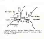
 - Plan of Freeman, ca 1950

 Explanatory key provided by George Kush. North East Block: A - British-American Service Station; B - Farmstead of R. West & family; C - the abandoned nail factory in the upper right corner (excluded by the digital scan). South East Block: A - Supertest (not Texaco) service station; B - …
 Explanatory key provided by George Kush. North East Block: A - British-American Service Station; B - Farmstead of R. West & family; C - the abandoned nail factory in the …Burlington Historical Society
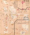
 - Fire Insurance Plan for Burford, Ontario, July 1894

 ...
... 
 ...County of Brant Public Library
 - Survey of Thessalon Township - Dyment Mill Location, 1876
 The is a black and white photo of a survey of the Thessalon Township - Dyment Mill site dated 1876. Lake Huron, The Thessalon River along with survey measurements, post locations and local landmarks are noted. The wharf, light house, boarding house and Dyment saw mill locations are all shown …
  The is a black and white photo of a survey of the Thessalon Township - Dyment Mill site dated 1876. Lake Huron, The Thessalon River along with survey measurements, post …Heritage Park Museum
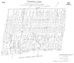
 - Map of Trafalgar Township 1806
 Trafalgar Plan of the Second Township In the tract of Land lately Purchased from the Mississagna Indians [sic] Sam T. Wilmot Surveyor "Trafalgar Dist of Gore Partial"...
  Trafalgar Plan of the Second Township In the tract of Land lately Purchased from the Mississagna Indians [sic] Sam T. Wilmot Surveyor "Trafalgar Dist of Gore Partial"...Oakville Public Library
 - Plan of the Township of Grantham and Louth 1814
 A copy of a map from the National Archives.
  A copy of a map from the National Archives.St. Catharines Museum
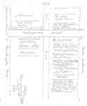
 - Hand Drawn Map of Sundridge, circa 1880 - 1890, with Typed Legend
 The maps were on two pieces of 8.5" x 11" paper which were stitched together with Photoshop Elements
  The maps were on two pieces of 8.5" x 11" paper which were stitched together with Photoshop ElementsSundridge - Strong Union PL
 - Village of Sundridge Map, Lots 21 - 25 Con. 10, Township of Strong
 Map of the village of Sundridge 1957. It includes all the main streets and secondary streets of Sundridge. The map shows the deed numbers of all the properties in the village.
  Map of the village of Sundridge 1957. It includes all the main streets and secondary streets of Sundridge. The map shows the deed numbers of all the properties in the …Sundridge - Strong Union PL

