Résultats
Nous avons trouvé 2588 éléments semblables.


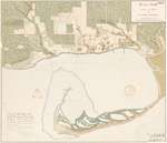
- Historical Maps of Toronto

 Featuring simple and free access to a broad selection of notable historical maps of Toronto, this site aims to generate curiosity, and to serve as an easy entry point for discovery and further investigation.
 Featuring simple and free access to a broad selection of notable historical maps of Toronto, this site aims to generate curiosity, and to serve as an easy entry point for …Nathan Ng
 - Through The Years Iron Bridge United Church Volume Three

 This is a hard covered scrapbook that is Volume 3 of a 4 volume set covering the history, events and changes that took place within the Iron Bridge United Church between 1963 and 1992.
 This is a hard covered scrapbook that is Volume 3 of a 4 volume set covering the history, events and changes that took place within the Iron Bridge United Church …Huron Shores Museum
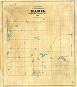
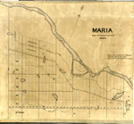
 - Maria Township ca. 1886


 Early surveyors, like William E. Logan, used Rochon micrometer telescopes and targets (disk on a calibrated pole) to measure distance. Each microscope had a different calibration and therefore a different range. The instruments were calibrated against a distance measured with a surveyors chain (also known as Gunter’s chain). One chain …

 Early surveyors, like William E. Logan, used Rochon micrometer telescopes and targets (disk on a calibrated pole) to measure distance. Each microscope had a different calibration and therefore a different …Head, Clara and Maria Public Library
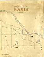
 - Maria Township ca. 1866


 Early surveyors, like William E. Logan, used Rochon micrometer telescopes and targets (disk on a calibrated pole) to measure distance. Each microscope had a different calibration and therefore a different range. The instruments were calibrated against a distance measured with a surveyors chain (also known as Gunter’s chain). One chain …

 Early surveyors, like William E. Logan, used Rochon micrometer telescopes and targets (disk on a calibrated pole) to measure distance. Each microscope had a different calibration and therefore a different …Head, Clara and Maria Public Library
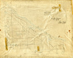
 - Maria Township ca.1869


 Early surveyors, like William E. Logan, used Rochon micrometer telescopes and targets (disk on a calibrated pole) to measure distance. Each microscope had a different calibration and therefore a different range. The instruments were calibrated against a distance measured with a surveyors chain (also known as Gunter’s chain). One chain …

 Early surveyors, like William E. Logan, used Rochon micrometer telescopes and targets (disk on a calibrated pole) to measure distance. Each microscope had a different calibration and therefore a different …Head, Clara and Maria Public Library
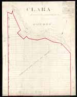
 - Clara Township Map ca.1885


 Early surveyors, like William E. Logan, used Rochon micrometer telescopes and targets (disk on a calibrated pole) to measure distance. Each microscope had a different calibration and therefore a different range. The instruments were calibrated against a distance measured with a surveyors chain (also known as Gunter’s chain). One chain …

 Early surveyors, like William E. Logan, used Rochon micrometer telescopes and targets (disk on a calibrated pole) to measure distance. Each microscope had a different calibration and therefore a different …Head, Clara and Maria Public Library
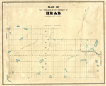
 - Head Township ca.1859


 Early surveyors, like William E. Logan, used Rochon micrometer telescopes and targets (disk on a calibrated pole) to measure distance. Each microscope had a different calibration and therefore a different range. The instruments were calibrated against a distance measured with a surveyors chain (also known as Gunter’s chain). One chain …

 Early surveyors, like William E. Logan, used Rochon micrometer telescopes and targets (disk on a calibrated pole) to measure distance. Each microscope had a different calibration and therefore a different …Head, Clara and Maria Public Library
 - Map of Head Township


 Early surveyors, like William E. Logan, used Rochon micrometer telescopes and targets (disk on a calibrated pole) to measure distance. Each microscope had a different calibration and therefore a different range. The instruments were calibrated against a distance measured with a surveyors chain (also known as Gunter’s chain). One chain …

 Early surveyors, like William E. Logan, used Rochon micrometer telescopes and targets (disk on a calibrated pole) to measure distance. Each microscope had a different calibration and therefore a different …Head, Clara and Maria Public Library
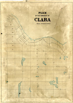
 - Map of Clara Township


 Early surveyors, like William E. Logan, used Rochon micrometer telescopes and targets (disk on a calibrated pole) to measure distance. Each microscope had a different calibration and therefore a different range. The instruments were calibrated against a distance measured with a surveyors chain (also known as Gunter’s chain). One chain …

 Early surveyors, like William E. Logan, used Rochon micrometer telescopes and targets (disk on a calibrated pole) to measure distance. Each microscope had a different calibration and therefore a different …Head, Clara and Maria Public Library
 - County of Elgin Women's Institutes Tweedsmuir Histories

 In many ways, the members of the Women’s Institutes were the unofficial archivists of their communities. They acquired records, oral histories, photographs and much more for inclusion in their volumes, leaving us today with an outstanding resource on the history of rural Ontario.
 In many ways, the members of the Women’s Institutes were the unofficial archivists of their communities. They acquired records, oral histories, photographs and much more for inclusion in their volumes, …Elgin County Archives
 - Powassan Highlights 1983 - Newspaper Scrapbook


 This scrapbook contains newspaper clippings from 1983. Many of them are the Powassan Highlights column in the Almaguin News newspaper. Articles focus on local community activities / happenings including: Powassan Royal Canadian Legion Branch 453, Powassan Cubs, Brownies, and Boy Scouts, Eastholme Hawaiian Day, obituaries, Powassan Carnival, Ontario Historical Society, …

 This scrapbook contains newspaper clippings from 1983. Many of them are the Powassan Highlights column in the Almaguin News newspaper. Articles focus on local community activities / happenings including: Powassan …Powassan & District Union Public Library
 - Powassan Highlights 1992 - Newspaper Scrapbook


 This scrapbook contains various newspaper clippings from 1992. Many of the clippings are from the "Powassan Highlights" section of the Almaguin News newspaper. The clippings include stories about events, weddings, engagements, condolence messages, graduations, anniversaries, milestone birthdays along with other community interest activities, gatherings and meetings for Powassan, Ontario and …

 This scrapbook contains various newspaper clippings from 1992. Many of the clippings are from the "Powassan Highlights" section of the Almaguin News newspaper. The clippings include stories about events, weddings, …Powassan & District Union Public Library
 - Powassan Highlights 1982 - Newspaper Scrapbook


 This scrapbook contains various newspaper clippings from 1982. Many of the clippings are from the "Powassan Highlights" section of the Almaguin News newspaper. The clippings include stories about events, weddings, engagements, condolence messages, graduations, anniversaries, milestone birthdays along with other community interest activities, gatherings and meetings for Powassan, Ontario and …

 This scrapbook contains various newspaper clippings from 1982. Many of the clippings are from the "Powassan Highlights" section of the Almaguin News newspaper. The clippings include stories about events, weddings, …Powassan & District Union Public Library
 - Plan of Fort's George, Mississauga, and Niagara, The Military Reserves and the Town of Newark- 1908 Copy of an 1817 Original
 A plan by H.H. Willson[s] of Fort's George, Mississauga and Niagara, the Military Reserves and the Town of Newark. It is dated 2 May 1817 and has "Royal Regiment Office, Quebec". A memo above the title states the plan "shows a new proposed military reserve in red lines." This is …
  A plan by H.H. Willson[s] of Fort's George, Mississauga and Niagara, the Military Reserves and the Town of Newark. It is dated 2 May 1817 and has "Royal Regiment Office, …
 - Mr. President Russel's Estate- 1915 copy
 A 1915 copy of Mr. President Russel's (president and acting administrator of Upper Canada from 1796-1799) estate plan in 1797. It illustrates the house and garden plans of his estate including site descriptions and dimensions.
  A 1915 copy of Mr. President Russel's (president and acting administrator of Upper Canada from 1796-1799) estate plan in 1797. It illustrates the house and garden plans of his estate …
 - Plan of the Township of Grantham and Louth 1814
 A copy of a map from the National Archives.
  A copy of a map from the National Archives.St. Catharines Museum
 - Map of Historic Niagara, Showing the Principal Points of Interest in Connection with the History of the Niagara River
 Made for Peter A. Porter. It outlines all the major historical sites for the War of 1812 in Niagara.
  Made for Peter A. Porter. It outlines all the major historical sites for the War of 1812 in Niagara.
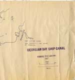
 - Georgian Bay Ship Canal Map: Pembroke to Des Joachims
 Line map of the canal system drawn in bluish coloured ink, outlines routes along the Ottawa River between Pembroke and the rapids at Des Joachims. The left-hand side of the map has very prominent ink blotches and finger prints made from the same colour of ink as the map itself. …
  Line map of the canal system drawn in bluish coloured ink, outlines routes along the Ottawa River between Pembroke and the rapids at Des Joachims. The left-hand side of the …Petawawa Public Library
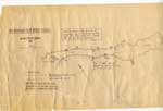
 - Georgian Bay Ship Canal Map: Des Joachims to Pembroke
 "Traced by members of Deep River Y.C. from photographic copy of original Dept. of Public Works chart. Supplemented from 1" Survey Maps and from personal experience."
  "Traced by members of Deep River Y.C. from photographic copy of original Dept. of Public Works chart. Supplemented from 1" Survey Maps and from personal experience."Petawawa Public Library
 - Map: Laura Secord’s Route from Queenston to Beaverdams
 A handwritten map of Laura Secord’s route from Queenston to Beaverdams during the War of 1812. There is also a short history of the map itself included. It is black ink on three pieces of cream paper. It is believed that this map was made for Mrs. Curzon when writing …
  A handwritten map of Laura Secord’s route from Queenston to Beaverdams during the War of 1812. There is also a short history of the map itself included. It is black …

