Résultats
Nous avons trouvé 8 éléments semblables.


Page 1 de 1
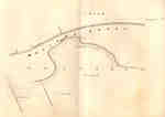
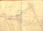
- Second Welland Canal - Book 1, Survey Map 3 - Old Lock 2 in Grantham Township

 Survey map of the Second Welland Canal created by the Welland Canal Company showing a portion of the Grantham Township near Port Dalhousie. Identified structures associated with the Canal include the new towing path. The surveyors' measurements and notes can be seen in red and black ink and pencil. Features …
 Survey map of the Second Welland Canal created by the Welland Canal Company showing a portion of the Grantham Township near Port Dalhousie. Identified structures associated with the Canal include …Brock University Archives
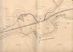
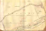
 - Second Welland Canal - Book 1, Survey Map 4 - Through Grantham Township

 Survey map of the Second Welland Canal created by the Welland Canal Company showing a portion of the Grantham Township. Identified structures associated with the Canal include the floating tow path and the canal itself. The surveyors' measurements and notes can be seen in red and black ink and pencil. …
 Survey map of the Second Welland Canal created by the Welland Canal Company showing a portion of the Grantham Township. Identified structures associated with the Canal include the floating tow …Brock University Archives
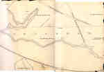
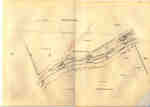
 - Second Welland Canal - Book 1, Survey Map 5 - Through Grantham Township


 Survey map of the Second Welland Canal created by the Welland Canal Company showing a portion of the Grantham Township near Port Dalhousie. Identified structures associated with the Canal include the tow path and floating tow path. The surveyors' measurements and notes can be seen in red and black ink …

 Survey map of the Second Welland Canal created by the Welland Canal Company showing a portion of the Grantham Township near Port Dalhousie. Identified structures associated with the Canal include …Brock University Archives
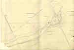
 - Second Welland Canal - Book 1, Survey Map 7 - Through Grantham Township

 Survey map of the Second Welland Canal created by the Welland Canal Company showing a portion of the Grantham Township. Identified structures associated with the Canal include the floating tow path. The surveyors' measurements and notes can be seen in red and black ink and pencil. Local area landmarks are …
 Survey map of the Second Welland Canal created by the Welland Canal Company showing a portion of the Grantham Township. Identified structures associated with the Canal include the floating tow …Brock University Archives
 - Second Welland Canal - Book 1, Survey Map 9 - Lock 2 in Grantham Township

 Survey map of the Second Welland Canal created by the Welland Canal Company showing a portion of the Grantham Township sometimes referred to as the Welland Vale. Identified structures associated with the Canal include Lock 2, several weirs, and the Lock Tender's House. The surveyors' measurements and notes can be …
 Survey map of the Second Welland Canal created by the Welland Canal Company showing a portion of the Grantham Township sometimes referred to as the Welland Vale. Identified structures associated …Brock University Archives
 - Second Welland Canal - Book 2, Survey Map 1 - Locks 5, 6 and 7 in Grantham

 Survey map of the Second Welland Canal created by the Welland Canal Company showing the Grantham Township just southeast of the Town of St. Catharines. Identified structures associated with the Canal include Locks 5, 6, and 7, two Lock House Lots, Small Lock House, waste weir, and the towing path. …
 Survey map of the Second Welland Canal created by the Welland Canal Company showing the Grantham Township just southeast of the Town of St. Catharines. Identified structures associated with the …Brock University Archives
 - Second Welland Canal - Book 2, Survey Map 2 - Locks 9 and 10 in Grantham

 Survey map of the Second Welland Canal created by the Welland Canal Company showing the Grantham Township between the Town of St. Catharines and Merritton. Identified structures associated with the Canal include Locks 9 and 10, waste weirs, the towing path, a 2nd towing path, and the Canal waterway itself. …
 Survey map of the Second Welland Canal created by the Welland Canal Company showing the Grantham Township between the Town of St. Catharines and Merritton. Identified structures associated with the …Brock University Archives
 - Second Welland Canal - Book 2, Survey Map 3 - Locks 8, 9 and 10 in Grantham

 Survey map of the Second Welland Canal created by the Welland Canal Company showing the Grantham Township between the Town of St. Catharines and Merritton. Identified structures associated with the Canal include Locks 8, 9, and 10, waste weirs, the towing path, and several floating bridges. The surveyors' measurements and …
 Survey map of the Second Welland Canal created by the Welland Canal Company showing the Grantham Township between the Town of St. Catharines and Merritton. Identified structures associated with the …Brock University Archives
Page 1 de 1


