Résultats


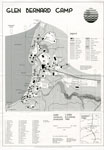
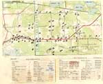
- Map of Glen Bernard Camp, circa 1985
 Black and white map of Glen Bernard Camp. The camp is near Sundridge Ontario. The map is on the top half of the image. In the lower half of the image is a legend and scale.
  Black and white map of Glen Bernard Camp. The camp is near Sundridge Ontario. The map is on the top half of the image. In the lower half of the …Sundridge - Strong Union PL
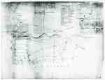
 - "Plan of Part of the Niagara Frontier Showing the Communications from Thence to the 15 Mile Creek July 1814"
 This photograph of a plan is titled “Plan of Part of the Niagara Frontier Showing the Communications from Thence to the 15 Mile Creek July 1814”. It was obtained by the Museum from the “National Archives of Canada, Cartographic and Architectural Archives Division” with the call number NMC-21586. It shows …
  This photograph of a plan is titled “Plan of Part of the Niagara Frontier Showing the Communications from Thence to the 15 Mile Creek July 1814”. It was obtained by …
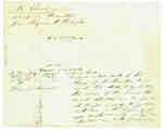
 - Diagram Explaining Where Sir Isaac Brock fell in Queenston
 This document is a diagram with explanations of the place where Sir Isaac Brock fell according to some who claim to have witness the event.
  This document is a diagram with explanations of the place where Sir Isaac Brock fell according to some who claim to have witness the event.
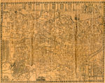
 - The Village of Sundridge, Kent, England

 A replica map of Sundridge, Kent England in 1640. The map is accompanied by a two page history of Sundridge, Kent, England. The history goes into the origins of the British Sundridge, what the area is like today, the history of the church in the area, and the impact of …
 A replica map of Sundridge, Kent England in 1640. The map is accompanied by a two page history of Sundridge, Kent, England. The history goes into the origins of the …Sundridge - Strong Union PL
 - Land holding map for Thessalon area, 1966


 The map does not include a scale. This map and legend can be found in the Tweedsmuir History created by the Princess Elizabeth Women's Institute.

 The map does not include a scale. This map and legend can be found in the Tweedsmuir History created by the Princess Elizabeth Women's Institute.Thessalon Union Public Library
 - 1876 Plan of the Town of Paris

 This 1876 town map shows Paris as it was at the time. The lots are numbered individually. A number of notable town landmarks are indicated, with the key in the lower centre of the map.
 This 1876 town map shows Paris as it was at the time. The lots are numbered individually. A number of notable town landmarks are indicated, with the key in the …County of Brant Public Library
 - Map of the Town of Paris, 1932

 Pages 2 through 4 of this map appear to have been cropped from an originally larger map, and cut off abruptly at the edges.
 Pages 2 through 4 of this map appear to have been cropped from an originally larger map, and cut off abruptly at the edges.County of Brant Public Library
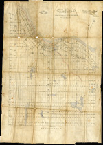
 - Plan of the township of Clara, Renfrew County
ca. 1888

 The Map came from Andre Boissonneault, a contractor. The map is hand written on an oil cloth, and covers a total area of 63922 (unit of measure unknown). Early surveyors, like William E. Logan, used Rochon micrometer telescopes and targets (disk on a calibrated pole) to measure distance. Each microscope …
 The Map came from Andre Boissonneault, a contractor. The map is hand written on an oil cloth, and covers a total area of 63922 (unit of measure unknown). Early surveyors, …Head, Clara and Maria Public Library
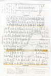
 - Map of Strong Township, 1942

 A map of Strong Township, produced in 1942. It shows the division of property in Strong Township and names of the land owners. Lake Bernard is near the center of the township. There is a legend at the bottom of the map. Machar Township borders on the north, Chapman on …
 A map of Strong Township, produced in 1942. It shows the division of property in Strong Township and names of the land owners. Lake Bernard is near the center of …Sundridge - Strong Union PL
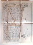
 - Road Map of United Counties of Northumberland and Durham. Dated 1928.

 Road Map of United Counties of Northumberland and Durham. Dated 1928.
 Road Map of United Counties of Northumberland and Durham. Dated 1928.Cobourg Museum Foundation
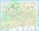
 - Oakville Community Map 2018


 Oakville Public Library
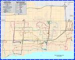
 - Oakville Cycleways Map 2018

 ...
... 
 ...Oakville Public Library
 - Oakville Transit Weekday Route Map Effective March 4, 2018

 ...
... 
 ...Oakville Public Library
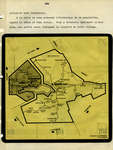
 - Carte géographique

 Il y a quatre volumes, Verner, aujourd'hui et autrefois 1883-1983
 Il y a quatre volumes, Verner, aujourd'hui et autrefois 1883-1983Société historique de Nipissing Ouest
 - Plan of Lot "L" and Parts of Lots "C" and "K" of the Township of Onondaga

 Easterly Part of Block K Registered Plan 210 2353 - Deed, November 4, 1886 From Joseph Charleton and Wife To - Thomas Dickenson Easterly Part of said Block K, 22 acres. Patent - April 7/88 From - The Crown To Joseph Charlton. Note: Instrument 2353 registered prior to patent. 2883 …
 Easterly Part of Block K Registered Plan 210 2353 - Deed, November 4, 1886 From Joseph Charleton and Wife To - Thomas Dickenson Easterly Part of said Block K, 22 …County of Brant Public Library
 - Onondaga Township Map

 This is a copy of an Onondaga Township map. The map was made circa 1920. The original document was provided by Barbara Plant during a Scan & Share Day event held at the Onondaga Hall on February 11, 2012.
 This is a copy of an Onondaga Township map. The map was made circa 1920. The original document was provided by Barbara Plant during a Scan & Share Day event …County of Brant Public Library
 - Map of Rosseau-Humphrey Union Cemetery by Sarah Neal April 2004 - CE0002

 Book 2 - page 7 -
 Book 2 - page 7 -Rosseau Historical Society
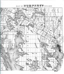
 - Map of Humphrey Township 1879 - RV0024a

 A map with many lakes on it. Map of Humphrey Township - 1879
 A map with many lakes on it. Map of Humphrey Township - 1879Rosseau Historical Society
 - Lake Rosseau Section of the Map of Humphrey Township 1879 - RV0024b

 A map of part of the Township of Humphrey with the names of the people who owned the lots in 1879.
 A map of part of the Township of Humphrey with the names of the people who owned the lots in 1879.Rosseau Historical Society
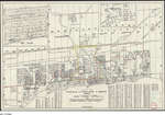
 - 1958 Map Oakville Trafalgar Bronte Area

 We were trying to ascertain where R.R. 1 Bronte was, what roads/streets it covered in the 1950's. Unfortunately this map doesn't have that information but it is as close as the Canada Post Archives can provide. In April 2020, we have added a 1918 Post Office "mail contract" asking for …
 We were trying to ascertain where R.R. 1 Bronte was, what roads/streets it covered in the 1950's. Unfortunately this map doesn't have that information but it is as close as …Trafalgar Township Historical Society

