Résultats
Nous avons trouvé 7 éléments semblables.


Page 1 de 1
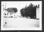
- Vineland Garage
 Looking north-west across Highway 8 (Regional Rd 81) to the north-west corner of Victoria Ave.
  Looking north-west across Highway 8 (Regional Rd 81) to the north-west corner of Victoria Ave.Lincoln Pelham Public Library
 - Elmon Moyer Birthplace
 A view of the front of a house.
  A view of the front of a house.Lincoln Pelham Public Library
 - Elmon Moyer's Birthplace
 The birthplace of Elmon Moyer in Vineland, Ont.
  The birthplace of Elmon Moyer in Vineland, Ont.Lincoln Pelham Public Library
 - Elmon Moyer's Birthplace
 The birthplace of Elmon Moyer, father of Kenneth Moyer, in Vineland, Ont.
  The birthplace of Elmon Moyer, father of Kenneth Moyer, in Vineland, Ont.Lincoln Pelham Public Library
 - Railway Bridge over Jordan Harbour
 The original bridge was constructed in 1853 and held up with a wooden structure. These were replaced by stone piers around 1867. The stone coming from the Gibson Quarry in Beamsville.
  The original bridge was constructed in 1853 and held up with a wooden structure. These were replaced by stone piers around 1867. The stone coming from the Gibson Quarry in …Lincoln Pelham Public Library
 - Bridge over Twenty Mile Creek
 The area on the right is currently used as a commercial camp ground. This bridge was replaced in the 1960s with an army surplus bridge (called a Bailey Bridge).
  The area on the right is currently used as a commercial camp ground. This bridge was replaced in the 1960s with an army surplus bridge (called a Bailey Bridge).Lincoln Pelham Public Library
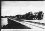
 - Queen Elizabeth Way at Jordan Station
 The Q.E.W. looking west. It is a 4-lane divided highway with trees lining the north side of the road. Jordan Harbour is on the left.
  The Q.E.W. looking west. It is a 4-lane divided highway with trees lining the north side of the road. Jordan Harbour is on the left.Lincoln Pelham Public Library
Page 1 de 1


