Résultats
Nous avons trouvé 7 éléments semblables.


Page 1 de 1
- Grass Park
 Grass Park is located at 41 Baldwin Street. It is a triangle shaped piece of land bounded by Roebuck Street, Baldwin Street and Mill Street (Cassels Road). This view is looking west from the intersection of Mill Street (Cassels Road) on the left, and Roebuck Street on the right. The …
  Grass Park is located at 41 Baldwin Street. It is a triangle shaped piece of land bounded by Roebuck Street, Baldwin Street and Mill Street (Cassels Road). This view is …Whitby Public Library
 - Baldwin Street looking north from Roebuck Street
 Jephsons Hardware store was located at the northeast corner of Baldwin and Roebuck Streets.
  Jephsons Hardware store was located at the northeast corner of Baldwin and Roebuck Streets.Whitby Public Library
 - Birds Eye View, Brooklin, Ontario
 This picture was taken from the Public and Continuation School on the south east corner of Highway 12 and Winchester Road. The United Church was located at the south-east corner of Mill Street (Cassels Road) and Princess Street.
  This picture was taken from the Public and Continuation School on the south east corner of Highway 12 and Winchester Road. The United Church was located at the south-east corner …Whitby Public Library
 - Brooklin Public and Continuation School
 The Brooklin Public and Continuation School was located on Baldwin Street. It was built in 1923 on the south east corner of Highway 12 and Winchester Road. It was officially opened on January 30, 1924 and closed in 1972. It was demolished in 1982.
  The Brooklin Public and Continuation School was located on Baldwin Street. It was built in 1923 on the south east corner of Highway 12 and Winchester Road. It was officially …Whitby Public Library
 - Community Park Gates
 This park is located on Winchester Road East opposite Simcoe Street. The stone gates were installed in 1921.
  This park is located on Winchester Road East opposite Simcoe Street. The stone gates were installed in 1921.Whitby Public Library
 - Georgetown cenotaph.
 Three cars drive up the Guelph Street hill towards the camera at Guelph and Main Streets. At the centre is the Georgetown cenotaph, unveiled here in 1924, in front of the ivy covered “Georgetown Hotel.” It was removed to Remembrance Park in 1960.
  Three cars drive up the Guelph Street hill towards the camera at Guelph and Main Streets. At the centre is the Georgetown cenotaph, unveiled here in 1924, in front of …Esquesing Historical Society
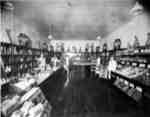
 - Interior of Dominion Food Store, c.1936
 Dominion Food Store was located at 104 Dundas Street West, Whitby from 1928 to 1955.
  Dominion Food Store was located at 104 Dundas Street West, Whitby from 1928 to 1955.Whitby Public Library
Page 1 de 1


