Résultats


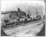
- Construction of Harris Cut, Canadian Pacific Railway, 1913

 The Harris Cut was located east of Cochrane Street in Whitby. It was constructed on the farm of Samuel Harris which extended from Beech Street to Rossland Road and from Cochrane Street to the Euclid Street road allowance.
 The Harris Cut was located east of Cochrane Street in Whitby. It was constructed on the farm of Samuel Harris which extended from Beech Street to Rossland Road and from …Whitby Public Library
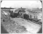
 - Construction of Harris Cut, Canadian Pacific Railway, 1913.

 The Harris Cut was located east of Cochrane Street in Whitby. It was constructed on the farm of Samuel Harris which extended from Beech Street to Rossland Road and from Cochrane Street to the Euclid Street road allowance.
 The Harris Cut was located east of Cochrane Street in Whitby. It was constructed on the farm of Samuel Harris which extended from Beech Street to Rossland Road and from …Whitby Public Library
 - Building of Canadian Pacific Railway

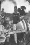
 Black and white negative of a photograph of a cement mixer for the construction of the Canadian Pacific Railway through Whitby. The photograph was taken on the Tweedie Farm. A worker can be seen in the background at left.
 Black and white negative of a photograph of a cement mixer for the construction of the Canadian Pacific Railway through Whitby. The photograph was taken on the Tweedie Farm. A …Whitby Public Library
 - Picnic at Corbett's Point 1913

 Corbett's Point is located on the shore of Lake Ontario east of Thickson Road. This view is looking east.In 1948 Corbett's Point was renamed Thickson Point.
 Corbett's Point is located on the shore of Lake Ontario east of Thickson Road. This view is looking east.In 1948 Corbett's Point was renamed Thickson Point.Whitby Public Library
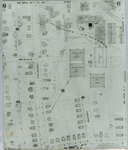
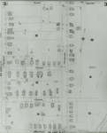
 - Fire Insurance Map, 1908 - 1913, Map 5
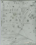
 1908 map updated to 1913. Duke Street later became Dupont Street. Bridgeport Road also called Laurel Street. See Detail images for closer view of map.
  1908 map updated to 1913. Duke Street later became Dupont Street. Bridgeport Road also called Laurel Street. See Detail images for closer view of map.Waterloo Public Library
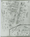
 - Fire Insurance Map, 1908 - 1913, Map 6
 1908 map updated to 1913. Weaver Street later became Dawson Street. See Detail images for closer view of map.
  1908 map updated to 1913. Weaver Street later became Dawson Street. See Detail images for closer view of map.Waterloo Public Library
 - Dam, 1913
 Condition: Copy is good.
  Condition: Copy is good.St. Marys Museum
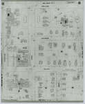
 - Fire Insurance Map 1908 - 1913, Map 7
 1908 map updated to 1913. Morley Street no longer exists.
  1908 map updated to 1913. Morley Street no longer exists.Waterloo Public Library
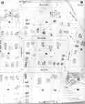
 - Fire Insurance Map 1908 - 1913, Map 8
 1908 map updated to 1913.
  1908 map updated to 1913.Waterloo Public Library
 - Fire Insurance Map 1908 - 1913, Map 9
 1908 map updated to 1913.
  1908 map updated to 1913.Waterloo Public Library
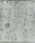
 - Fire Insurance Map 1908 - 1913, Map 10
 1908 map updated to 1913. Ontario Mutual Life Assurance Company was incorporated in 1868, name changed in 1900 to Mutual Life Assurance Company of Canada. They moved to 227 King Street south circa 1913. In 1988 became a part of the Mutual Group; company name changed to Clarica in 1999, …
  1908 map updated to 1913. Ontario Mutual Life Assurance Company was incorporated in 1868, name changed in 1900 to Mutual Life Assurance Company of Canada. They moved to 227 King …Waterloo Public Library
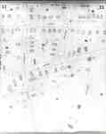
 - Fire Insurance Map 1908 - 1913, Map 11
 1908 map updated to 1913.
  1908 map updated to 1913.Waterloo Public Library
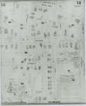
 - Fire Insurance Map 1908 - 1913, Map 12
 1908 map updated to 1913.
  1908 map updated to 1913.Waterloo Public Library
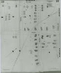
 - Fire Insurance Map 1908 - 1913, Map 13
 1908 map updated to 1913.
  1908 map updated to 1913.Waterloo Public Library
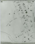
 - Fire Insurance Map 1908 - 1913, Map 14
 1908 map updated to 1913.
  1908 map updated to 1913.Waterloo Public Library
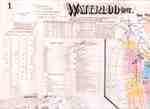
 - Fire Insurance Map 1908 - 1913 Legend
 1908 map updated to 1913. See detail photographs for enhanced view of the map.
  1908 map updated to 1913. See detail photographs for enhanced view of the map.Waterloo Public Library
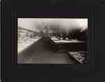
 - Woolworth's, ca. 1913
 A photograph of the interior of Woolworth's. It was located downtown at 18 King Street West, Oshawa.
  A photograph of the interior of Woolworth's. It was located downtown at 18 King Street West, Oshawa.Oshawa Community Museum and Archives
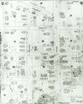
 - Fire Insurance Map, 1908 -1913, Map 2
 1908 map updated to 1913. Water Street later became Dorset Street. Cedar Street later became Bridgeport Road. See Detail images for closer view of map.
  1908 map updated to 1913. Water Street later became Dorset Street. Cedar Street later became Bridgeport Road. See Detail images for closer view of map.Waterloo Public Library
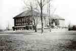
 - Strathcona School, Walkers Line, 1913
 In black marker pen on the reverse: "Strathcona / Public / School / 1913". ...
  In black marker pen on the reverse: "Strathcona / Public / School / 1913". ...Burlington Historical Society
 - Fire Insurance Map, 1908 - 1913, Map 3
 1908 map updated to 1913. Cedar Street later became Bridgeport Road and was also called Laurel Street east of Peppler. See Detail images for closer view of map.
  1908 map updated to 1913. Cedar Street later became Bridgeport Road and was also called Laurel Street east of Peppler. See Detail images for closer view of map.Waterloo Public Library

