Résultats


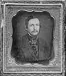
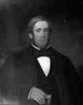
- George Wallace, c.1855
 George Wallace was a brother of Whitby merchant and entrepreneur, James Wallace. He was born in Scotland in 1831 and is first recorded in Whitby in 1851 as a general merchant in partnership with Thomas Wallace. He lived in a brick cottage on Byron Street south built about 1853 and …
  George Wallace was a brother of Whitby merchant and entrepreneur, James Wallace. He was born in Scotland in 1831 and is first recorded in Whitby in 1851 as a general …Whitby Public Library
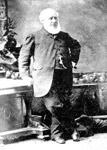
 - John McIntyre (~1855)
 Governor, Hudson's Bay Company
  Governor, Hudson's Bay CompanyThunder Bay Public Library
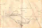
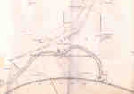
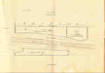
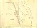
 - Second Welland Canal - Book 1, Survey Map 1 - Entrance, Lock 1 and Port Dalhousie


 Survey map of the Second Welland Canal created by the Welland Canal Company showing the areas in and around Port Dalhousie and Grantham Township. Identified structures associated with the Canal include Lock 1, Lighthouse, Lighthouse Keeper's House, East and West Piers, Harbour, Waste Weir, Store House, Collector's Office, Collector Assistant …

 Survey map of the Second Welland Canal created by the Welland Canal Company showing the areas in and around Port Dalhousie and Grantham Township. Identified structures associated with the Canal …Brock University Archives
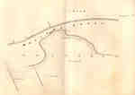
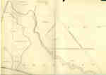
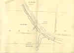
 - Second Welland Canal - Book 1, Survey Map 2 - Lock 1 and Port Dalhousie

 Survey map of the Second Welland Canal created by the Welland Canal Company showing the areas in and around Port Dalhousie and Grantham Township. Identified structures associated with the Canal include Lock 1, East and West Piers, Collector's Office, Lock Tender's House and the new towing path. The surveyors' measurements …
 Survey map of the Second Welland Canal created by the Welland Canal Company showing the areas in and around Port Dalhousie and Grantham Township. Identified structures associated with the Canal …Brock University Archives
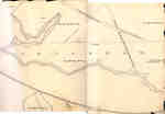
 - Second Welland Canal - Book 1, Survey Map 4 - Through Grantham Township

 Survey map of the Second Welland Canal created by the Welland Canal Company showing a portion of the Grantham Township. Identified structures associated with the Canal include the floating tow path and the canal itself. The surveyors' measurements and notes can be seen in red and black ink and pencil. …
 Survey map of the Second Welland Canal created by the Welland Canal Company showing a portion of the Grantham Township. Identified structures associated with the Canal include the floating tow …Brock University Archives
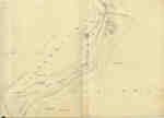
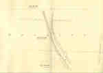
 - Second Welland Canal - Book 1, Survey Map 6 - Through Grantham and Louth Townships

 Survey map of the Second Welland Canal created by the Welland Canal Company showing the area between the Townships of Grantham and Louth. Identified structures associated with the Canal include the floating tow path. The surveyors' measurements and notes can be seen in red and black ink and pencil. Features …
 Survey map of the Second Welland Canal created by the Welland Canal Company showing the area between the Townships of Grantham and Louth. Identified structures associated with the Canal include …Brock University Archives
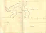
 - Second Welland Canal - Book 1, Survey Map 8 - Through Grantham and Louth Townships

 Survey map of the Second Welland Canal created by the Welland Canal Company showing the area between the Townships of Louth and Grantham. Identified structures associated with the Canal include the floating tow path. It is not labelled, but runs along the bottom of the map. The surveyors' measurements and …
 Survey map of the Second Welland Canal created by the Welland Canal Company showing the area between the Townships of Louth and Grantham. Identified structures associated with the Canal include …Brock University Archives
 - Second Welland Canal - Book 1, Survey Map 7 - Through Grantham Township

 Survey map of the Second Welland Canal created by the Welland Canal Company showing a portion of the Grantham Township. Identified structures associated with the Canal include the floating tow path. The surveyors' measurements and notes can be seen in red and black ink and pencil. Local area landmarks are …
 Survey map of the Second Welland Canal created by the Welland Canal Company showing a portion of the Grantham Township. Identified structures associated with the Canal include the floating tow …Brock University Archives
 - Second Welland Canal - Book 1, Survey Map 10 - St. Catharines


 Survey map of the Second Welland Canal created by the Welland Canal Company along the western edge of the Town of St. Catharines. Although not labelled, the Second Welland Canal can be seen running through the map along with its tow path, which is located on the southwestern edge of …

 Survey map of the Second Welland Canal created by the Welland Canal Company along the western edge of the Town of St. Catharines. Although not labelled, the Second Welland Canal …Brock University Archives
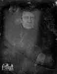
 - Ralph and Rebecca Breckon
 Portrait of Ralph Breckon (1832-1874) and Rebecca Breckon née Stephenson (1836-1867).
  Portrait of Ralph Breckon (1832-1874) and Rebecca Breckon née Stephenson (1836-1867).Trafalgar Township Historical Society
 - Chestnuts
 This Greek revival building known as The Chestnuts, was the home of Freeman Schemmerhorn Clench, Cobourg's most noted cabinetmaker. It was built in 1848. It is a little hard to distinguish now as it is now Jim's Pizzeria.
  This Greek revival building known as The Chestnuts, was the home of Freeman Schemmerhorn Clench, Cobourg's most noted cabinetmaker. It was built in 1848. It is a little hard to …Cobourg Public Library
 - James Rowe, c.1855
 James Rowe was born on October 20, 1799 near Montreath, Queen's County, Ireland. He came to Canada in 1824 and built piers and warehouses at Port Whitby in 1843 -1844. In 1849 he formed James Rowe & Co., a grain shipping business at Port Whitby. He was Reeve of Whitby …
  James Rowe was born on October 20, 1799 near Montreath, Queen's County, Ireland. He came to Canada in 1824 and built piers and warehouses at Port Whitby in 1843 -1844. …Whitby Public Library
 - Milner Harrison
 Condition: Copy is in very good condition. A little creased.
  Condition: Copy is in very good condition. A little creased.St. Marys Museum
 - John Langs

 The Lang Cemetery is behind the barn on the east corner of Hwy No.2 and the Madden Road. It is no more than half an acre in size. There are a number of graves without stones. Most of the stones had foot stones that have been removed. This is a …
 The Lang Cemetery is behind the barn on the east corner of Hwy No.2 and the Madden Road. It is no more than half an acre in size. There are …County of Brant Public Library
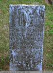
 - Allice Mariah Crandell
 Located right next to the Salt Springs Church on the Grand River, the Salt Springs Cemetery has been in operation since 1822. The cemetery is still active under the management of the Salt Springs Cemetery Board of Trustees. There is a plaque on the property that tells the history of …
  Located right next to the Salt Springs Church on the Grand River, the Salt Springs Cemetery has been in operation since 1822. The cemetery is still active under the management …County of Brant Public Library
 - Second Welland Canal - Book 2, Survey Map 16 - Deep Cut in Thorold

 Survey map of the Second Welland Canal created by the Welland Canal Company showing the canal in the Thorold Township between Allanburg and Port Robinson. Identified structures and features associated with the Canal include the Deep Cut and the towing path. The surveyors' measurements and notes can be seen in …
 Survey map of the Second Welland Canal created by the Welland Canal Company showing the canal in the Thorold Township between Allanburg and Port Robinson. Identified structures and features associated …Brock University Archives
 - Second Welland Canal - Book 3, Survey Map 4 - Back Water in Thorold

 Survey map of the Second Welland Canal created by the Welland Canal Company showing the Back Water from the canal in Thorold Township near Port Robinson. The surveyors' measurements and notes can be seen in red and black ink and pencil. Local area landmarks are also identified and include the …
 Survey map of the Second Welland Canal created by the Welland Canal Company showing the Back Water from the canal in Thorold Township near Port Robinson. The surveyors' measurements and …Brock University Archives
 - Second Welland Canal - Book 3, Survey Map 6 - Canal along Chippewa Creek in Thorold

 Survey map of the Second Welland Canal created by the Welland Canal Company showing the canal along Chippewa Creek in Thorold Township. Identified structures and features associated with the Canal include the towing path, the back ditch, and the waterway itself. The surveyors' measurements and notes can be seen in …
 Survey map of the Second Welland Canal created by the Welland Canal Company showing the canal along Chippewa Creek in Thorold Township. Identified structures and features associated with the Canal …Brock University Archives
 - Second Welland Canal - Book 3, Survey Map 7 - Through Thorold

 Survey map of the Second Welland Canal created by the Welland Canal Company showing the canal in the Thorold Township between Port Robinson and Welland. Identified structures and features associated with the Canal include the towing path, a ditch, and the waterway itself. The surveyors' measurements and notes can be …
 Survey map of the Second Welland Canal created by the Welland Canal Company showing the canal in the Thorold Township between Port Robinson and Welland. Identified structures and features associated …Brock University Archives
 - Second Welland Canal - Book 3, Survey Map 8 - Quaker Bridge in Thorold


 Survey map of the Second Welland Canal created by the Welland Canal Company showing the canal in the Thorold Township between Port Robinson and Welland. Identified structures and features associated with the Canal include the towing path, back ditch, and the waterway itself. The surveyors' measurements and notes can be …

 Survey map of the Second Welland Canal created by the Welland Canal Company showing the canal in the Thorold Township between Port Robinson and Welland. Identified structures and features associated …Brock University Archives

