Résultats
Nous avons trouvé 1 éléments semblables.


Page 1 de 1
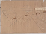
- West Half of the Westport to Farmersville Macadamized Road, from Westport to Phillipsville only
 {Poor - Map is dilapidated.) A map from April 1852 showing the "Macadamized Road" from Westport to Farmersville, Ontario. This map shows the west half of the Westport to Farmersville Macadamized Road, from Westport to Phillipsville only.
  {Poor - Map is dilapidated.) A map from April 1852 showing the "Macadamized Road" from Westport to Farmersville, Ontario. This map shows the west half of the Westport to Farmersville …Leeds & Thousand Islands Public Library
Page 1 de 1


