Résultats


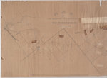
- West Half of the Westport to Farmersville Macadamized Road, from Westport to Phillipsville only
 {Poor - Map is dilapidated.) A map from April 1852 showing the "Macadamized Road" from Westport to Farmersville, Ontario. This map shows the west half of the Westport to Farmersville Macadamized Road, from Westport to Phillipsville only.
  {Poor - Map is dilapidated.) A map from April 1852 showing the "Macadamized Road" from Westport to Farmersville, Ontario. This map shows the west half of the Westport to Farmersville …Leeds & Thousand Islands Public Library
 - View of Cobourg from Weller's (Factory) Hill
 This picture from the mouth of Factory Creek is not totally accurate, but is important for its representation of the Globe Hotel (in the centre near the Church of England). The Globe Hotel stood on the northeast corner of King and McGill streets. It was destroyed by fire in 1864 …
  This picture from the mouth of Factory Creek is not totally accurate, but is important for its representation of the Globe Hotel (in the centre near the Church of England). …Cobourg Public Library
 - Martha Lampkin

 The Lang Cemetery is behind the barn on the east corner of Hwy No.2 and the Madden Road. It is no more than half an acre in size. There are a number of graves without stones. Most of the stones had foot stones that have been removed. This is a …
 The Lang Cemetery is behind the barn on the east corner of Hwy No.2 and the Madden Road. It is no more than half an acre in size. There are …County of Brant Public Library
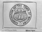
 - Town of Whitby Crest, March 8, 1952
 On January 20,1855 Whitby officially incorporated as a town bringing together Port Windsor (Port Whitby), Perry’s Corners, and Hamer’s Corners, a small settlement to the east of Perry’s Corners. The crest symbolizes the Corporation of the Town of Whitby. Marjorie Georgina Ruddy (1908-1980) was a prominent Whitby photographer and the …
  On January 20,1855 Whitby officially incorporated as a town bringing together Port Windsor (Port Whitby), Perry’s Corners, and Hamer’s Corners, a small settlement to the east of Perry’s Corners. The …Whitby Public Library
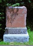
 - William and Lucy Angeline Mulligan
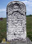
 This headstone is located in the Second Onondaga Baptist Church Cemetery which was established after the church was built in 1854. The Church and Cemetery are located on 330 Baptist Church Road, 0.3 km south of Mulligan Road. Location: 3-4
  This headstone is located in the Second Onondaga Baptist Church Cemetery which was established after the church was built in 1854. The Church and Cemetery are located on 330 Baptist …County of Brant Public Library
 - Certificate of appointment of James Newton as Quarter Master in the 6th Battalion of York Militia
 This document, dated at Quebec City, July 1, 1852, authorizing the appointment of James Newton, a resident of the district, as Quarter Master in the 6th Battalion of York Militia, bears the sign of the Earl Elgin and Kinkardine, Governor General of British North America at the time. Lord Elgin …
  This document, dated at Quebec City, July 1, 1852, authorizing the appointment of James Newton, a resident of the district, as Quarter Master in the 6th Battalion of York Militia, …Richmond Hill Public Library
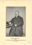
 - Reverend James Dick
 A photograph of Rev. James Dick, the first President of the Richmond Hill Library Association, Dec. 23rd 1852.
  A photograph of Rev. James Dick, the first President of the Richmond Hill Library Association, Dec. 23rd 1852.Richmond Hill Public Library
 - Graf Coverlet - Stars and Hearts Wreath Pattern

 985.71.1
 985.71.1Port Colborne Historical and Marine Museum
 - Library Minute Book

 Related document: Library Cash Book
 Related document: Library Cash BookRichmond Hill Public Library
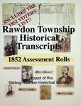
 - Rawdon Township Historical Transcripts: 1852 Assessment Rolls

 Transcription of assessment rolls was intended for use as a finding aid for the originals.
 Transcription of assessment rolls was intended for use as a finding aid for the originals.Stirling-Rawdon Public Library
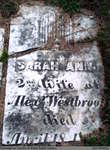
 - Sarah Ann Westbrook


 Westbrook Cemetery is an inactive cemetery in Brant County, under the jurisdiction of the Corporation of the County of Brant. It is located at 30 Shaver St., off of Hwy 2/53 East. Most of the headstones have been placed in concrete in a row, and most are legible and in …

 Westbrook Cemetery is an inactive cemetery in Brant County, under the jurisdiction of the Corporation of the County of Brant. It is located at 30 Shaver St., off of Hwy …County of Brant Public Library
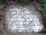
 - Margareta E. and George N. Day

 Westbrook Cemetery is an inactive cemetery in Brant County, under the jurisdiction of the Corporation of the County of Brant. It is located at 30 Shaver St., off of Hwy 2/53 East. Most of the headstones have been placed in concrete in a row, and most are legible and in …
 Westbrook Cemetery is an inactive cemetery in Brant County, under the jurisdiction of the Corporation of the County of Brant. It is located at 30 Shaver St., off of Hwy …County of Brant Public Library
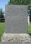
 - Aspden Family Headstone (Range 12-6)

 Range 12-6
 Range 12-6County of Brant Public Library
 - Old Paris 4-1


 Old Paris Cemetery is an inactive cemetery in Brant County, under the jurisdiction of the Corporation of the County of Brant. It is located on the south side of Church Street in Paris soon after turning off Dundas Street West (Highway #2). Range 4-1

 Old Paris Cemetery is an inactive cemetery in Brant County, under the jurisdiction of the Corporation of the County of Brant. It is located on the south side of Church …County of Brant Public Library
 - Mortgage between John Langs and George Tiffany

 A mortgage agreement between John Langs and George Tiffany dated May 1852 for one hundred and nineteen acres comprised of the East part of lot nine on the north side of Ancaster Road purchased for the sum of one hundred pounds.
 A mortgage agreement between John Langs and George Tiffany dated May 1852 for one hundred and nineteen acres comprised of the East part of lot nine on the north side …County of Brant Public Library
 - Deed of Land between Joseph Thomas, Deborah Thomas and William Duncan

 A Deed of Land between Joseph Thomas, his wife Deborah Thomas and William Duncan dated the sixth day of December 1852 for lots four and five on the north side of Ancaster Road in the village of Cayuga Heights for the sum of fifty two pounds.
 A Deed of Land between Joseph Thomas, his wife Deborah Thomas and William Duncan dated the sixth day of December 1852 for lots four and five on the north side …County of Brant Public Library
 - Indenture of Bargain and Sale Between Thomas C. Waring and Jacob Miller

 This item is an indenture of bargain and sale dated the 27th of November 1852 transferring land in Burford Township (part of the south half of lot 3, Concession 6) from Thomas C. Waring and his wife Anne Waring to Jacob Miller. The land was purchased for the sum of …
 This item is an indenture of bargain and sale dated the 27th of November 1852 transferring land in Burford Township (part of the south half of lot 3, Concession 6) …County of Brant Public Library
 - Indenture of Land Transfer Between Alexander Ellis to Thomas C. Waring

 This item is an indenture of land transfer dated the 27th of November 1852 transferring land in Burford township (86 acres, part of the south half of lot 3, Concession 6) from Alexander Ellis to Thomas C. Waring. The land was purchased for the sum of one hundred pounds.
 This item is an indenture of land transfer dated the 27th of November 1852 transferring land in Burford township (86 acres, part of the south half of lot 3, Concession …County of Brant Public Library
 - Miller Home, Burford

 Two photographs and a tax receipt related the Miller family home located on King street in Burford. The first photograph, taken in 1852, shows the house when Jacob and Bethia Miller resided. A porch was eventually added to the home in the 1940s. The tax receipt shows that the Miller …
 Two photographs and a tax receipt related the Miller family home located on King street in Burford. The first photograph, taken in 1852, shows the house when Jacob and Bethia …County of Brant Public Library
 - Emeline Burkholder

 Hill Cemetery is an inactive cemetery in Brant County (Burford Township), under the jurisdiction of the Corporation of the County of Brant. It is located on Middle Townline Road (Brant County Road # 25), about 0.7 kms north of Burford/Delhi Town Road in Burford Township. Range 2-4
 Hill Cemetery is an inactive cemetery in Brant County (Burford Township), under the jurisdiction of the Corporation of the County of Brant. It is located on Middle Townline Road (Brant …County of Brant Public Library

