Résultats


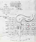
- Map of Oakville 1837
 The Drawing has been prepared from information gathered from a copy of the first registered plan of Oakville, by Deputy Provincial Surveyor, Robert W. Kerr in 1836, under the direction of Col. William Chisholm, the founder of Oakville. The Plan was registered January 12th 1850. James Madill, Oakville, 1973
  The Drawing has been prepared from information gathered from a copy of the first registered plan of Oakville, by Deputy Provincial Surveyor, Robert W. Kerr in 1836, under the direction …Oakville Public Library
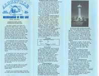
 - Brief history of the Alderville First Nation
 Brief history of the Alderville First Nation Source: Unknown Acquired: April 1, 1993
  Brief history of the Alderville First Nation Source: Unknown Acquired: April 1, 1993Cobourg Public Library
 - Brief history of the Alderville First Nation, the Mississaugas of Rice Lake, and the Cenotaph
 Brief history of the Alderville First Nation, the Mississaugas of Rice Lake, and the Cenotaph Source: Unknown Acquired: May 1993
  Brief history of the Alderville First Nation, the Mississaugas of Rice Lake, and the Cenotaph Source: Unknown Acquired: May 1993Cobourg Public Library
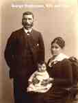
 - George Stephenson and Family
 George Stephenson with his wife, and daughter, Bridget Rebecca (1836-1867).
  George Stephenson with his wife, and daughter, Bridget Rebecca (1836-1867).Trafalgar Township Historical Society
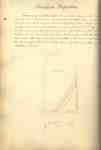
 - Welland Canal Survey of Lands Abraham Augustine, 1837
 Survey map and description of Jacob Augustine's land created by The Welland Canal Company. Included is a written description of the land along with a drawing of the land. The land surveyed is lot #26 in Humberstone.Noteable features include; canal, concession, line between Abraham and Jacob Augustine's land. The land …
  Survey map and description of Jacob Augustine's land created by The Welland Canal Company. Included is a written description of the land along with a drawing of the land. The …Brock University Archives
 - Welland Canal Survey of Lands Jacob Augustine, 1837
 Survey map and description of Jacob Augustine's land created by The Welland Canal Company. Included is a written description of the land along with a drawing of the land. The land surveyed is lot #27 in Humberstone. Noteable features include; canal, concession, line between Neff and J. Augustine's land. The …
  Survey map and description of Jacob Augustine's land created by The Welland Canal Company. Included is a written description of the land along with a drawing of the land. The …Brock University Archives
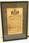
 - 1837 Proclamation by Governor Francis Bond Head
 Offering 1000 pound for capture of William Lyon Mackenze
  Offering 1000 pound for capture of William Lyon MackenzeCobourg Museum Foundation
 - Shooting of Robert Moodie
 Pen & ink drawing after an engraving.
  Pen & ink drawing after an engraving.Richmond Hill Public Library
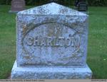
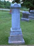
 - Joseph, Mary Ann, and Elizabeth S. Charlton
 Located right next to the Salt Springs Church on the Grand River, the Salt Springs Cemetery has been in operation since 1822. The cemetery is still active under the management of the Salt Springs Cemetery Board of Trustees. There is a plaque on the property that tells the history of …
  Located right next to the Salt Springs Church on the Grand River, the Salt Springs Cemetery has been in operation since 1822. The cemetery is still active under the management …County of Brant Public Library
 - A Map of Port Colborne: the termination of the Welland Canal on Lake Erie, 1837
 Original in collection of LAC H1/440/Port Colborne/[1837]
  Original in collection of LAC H1/440/Port Colborne/[1837]Port Colborne Historical and Marine Museum
 - Edward, Martha (Lyons), and Kenneth Edward Patterson
 This headstone is located in the Second Onondaga Baptist Church Cemetery which was established after the church was built in 1854. The Church and Cemetery are located on 330 Baptist Church Road, 0.3 km south of Mulligan Road. Location: 11-3
  This headstone is located in the Second Onondaga Baptist Church Cemetery which was established after the church was built in 1854. The Church and Cemetery are located on 330 Baptist …County of Brant Public Library
 - Lock at Lockport, N.Y.
 Slide file number: 05.86-D-4
  Slide file number: 05.86-D-4St. Catharines Public Library
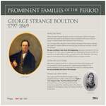
 - Boulton, George Strange

 Updated August 2020 - Changing Divivion st. to D'Arcy st. SI
 Updated August 2020 - Changing Divivion st. to D'Arcy st. SICobourg Museum Foundation
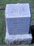
 - Amelia (Forsyth) Horning

 Papple Cemetery is an inactive cemetery in Brant County, under the jurisdiction of the Corporation of the County of Brant. It is located on Brant County Highway # 99, 2.5 kms east of the St George Road (Brant County Road # 13). Range 5-3
 Papple Cemetery is an inactive cemetery in Brant County, under the jurisdiction of the Corporation of the County of Brant. It is located on Brant County Highway # 99, 2.5 …County of Brant Public Library
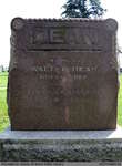
 - Walter, Theresa (Hahnel), Martha Alice, and Rose Dean


 Harley Cemetery is an active cemetery in Brant County (Burford Township), under the jurisdiction of the Corporation of the County of Brant. It is located at 125 Harley Rd (Brant Road #202). Range 8-9

 Harley Cemetery is an active cemetery in Brant County (Burford Township), under the jurisdiction of the Corporation of the County of Brant. It is located at 125 Harley Rd (Brant …County of Brant Public Library
 - Summons and Declaration: Luck vs. Owles & Langs

 A document of summons and declaration addressed to the sheriff of Gore district dated the thirtieth of December 1837 in the case of James Luck vs. John Owles and John Langs in what appears to be over the matter of an unpaid sum of forty pounds.
 A document of summons and declaration addressed to the sheriff of Gore district dated the thirtieth of December 1837 in the case of James Luck vs. John Owles and John …County of Brant Public Library
 - Edward and Margaret Shillington

 Harley Cemetery is an active cemetery in Brant County (Burford Township), under the jurisdiction of the Corporation of the County of Brant. It is located at 125 Harley Rd (Brant Road #202). Range 6-14
 Harley Cemetery is an active cemetery in Brant County (Burford Township), under the jurisdiction of the Corporation of the County of Brant. It is located at 125 Harley Rd (Brant …County of Brant Public Library
 - Old Paris Cemetery

 Old Paris Cemetery is an inactive cemetery in Brant County, under the jurisdiction of the Corporation of the County of Brant. It is located on the south side of Church Street in Paris soon after turning off Dundas Street West (Highway #2). The earliest burial at the Old Paris Cemetery …
 Old Paris Cemetery is an inactive cemetery in Brant County, under the jurisdiction of the Corporation of the County of Brant. It is located on the south side of Church …County of Brant Public Library
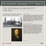
 - Beatty, John

 ...
... 
 ...Cobourg Museum Foundation
 - Burford Congregational Church


 Contributed by Janet Hilliker. This article originally appeared on the County of Brant wiki at ourbrant.wikia.com. It has been included in this collection for ease of research.

 Contributed by Janet Hilliker. This article originally appeared on the County of Brant wiki at ourbrant.wikia.com. It has been included in this collection for ease of research.County of Brant Public Library

