Résultats
Nous avons trouvé 148 éléments semblables.


- Welland Canal Survey of Lands Company Land in Dunnville, 1834
 See also Pp. 148-151
  See also Pp. 148-151Brock University Archives
 - Welland Canal Survey of Lands Welland Canal Company Land in Thorold, 1834
 Survey map of the lands of the Welland Canal Company in Thorold. Created by The Welland Canal Company. Noteable features include; Company's land, reservoir, channel of canal, bridge, Pine street, Mullen street, lot divisions. The plan is titled "Plan of Lands belonging to the Welland Canal Company being the West …
  Survey map of the lands of the Welland Canal Company in Thorold. Created by The Welland Canal Company. Noteable features include; Company's land, reservoir, channel of canal, bridge, Pine street, …Brock University Archives
 - Welland Canal Survey of Lands Alem Marr, 1834
 Survey map and description of Alem Marr's land created by The Welland Canal Company. Included is a written description of the land along with a drawing of the land. Noteable features include; line between Marr and Shotwell's land, road allowance. The land totals 10 acres, 1 road and 28 perches. …
  Survey map and description of Alem Marr's land created by The Welland Canal Company. Included is a written description of the land along with a drawing of the land. Noteable …Brock University Archives
 - Welland Canal Survey of Lands Elijah Shotwell, 1834
 See also page 138.
  See also page 138.Brock University Archives
 - Welland Canal Survey of Lands Jonathan Silverthorn, 1834
 See also page 138.
  See also page 138.Brock University Archives
 - Welland Canal Survey of Lands Smith Shotwell, 1834
 Survey map and description of Smith Shotwell's land created by The Welland Canal Company. Included is a written description of the land along with a drawing of the land. Noteable features include; the Welland River, road. The deed for the land is dated October 14, 1834. The land totals 10 …
  Survey map and description of Smith Shotwell's land created by The Welland Canal Company. Included is a written description of the land along with a drawing of the land. Noteable …Brock University Archives
 - Welland Canal Survey of Lands Jesse Wilson, 1834
 Survey map and description of Jesse Willson's land created by The Welland Canal Company. Included is a written description of the land along with a drawing of the land. Noteable features include; Welland river, aquaduct, canal and 'place of beginning'. The deed for the land is dated July 12, 1834. …
  Survey map and description of Jesse Willson's land created by The Welland Canal Company. Included is a written description of the land along with a drawing of the land. Noteable …Brock University Archives
 - Welland Canal Survey of Lands David Price, 1834
 Survey map and description of David Price's land created by The Welland Canal Company. Included is a written description of the land along with a drawing of the land. Noteable features include; Hellem's Creek, road, bridge, Chippewa, Griffith's land, canal. The deed for the land is dated October 14, 1834. …
  Survey map and description of David Price's land created by The Welland Canal Company. Included is a written description of the land along with a drawing of the land. Noteable …Brock University Archives
 - Welland Canal Survey of Lands Michael and Jacob Silverthorn, 1834
 Survey map and description of Michael and Jacob Silverthorn's land created by The Welland Canal Company. Included is a written description of the land along with a drawing of the land. Noteable features include; line between Burger and Silverthorn's land, reservoir, wood land, road leading to Quaker settlement, line between …
  Survey map and description of Michael and Jacob Silverthorn's land created by The Welland Canal Company. Included is a written description of the land along with a drawing of the …Brock University Archives
 - James Sydney Westbrook

 The Lang Cemetery is behind the barn on the east corner of Hwy No.2 and the Madden Road. It is no more than half an acre in size. There are a number of graves without stones. Most of the stones had foot stones that have been removed. This is a …
 The Lang Cemetery is behind the barn on the east corner of Hwy No.2 and the Madden Road. It is no more than half an acre in size. There are …County of Brant Public Library
 - Howell Block


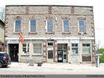
 Summary Howell Block has served a wide variety of functions within the St. George community, including a tinsmith, drug store, hardware store, library, museum, community hall, newspaper office, lawyers office, central telephone office, and post office. The original store and distillery was owned and operated by Nicholas Barmore in 1834 …

 Summary Howell Block has served a wide variety of functions within the St. George community, including a tinsmith, drug store, hardware store, library, museum, community hall, newspaper office, lawyers office, …
 - 1834-1850 Combination Register, St. Paul's Basilica

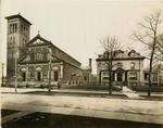
 In the Archdiocese of Toronto, original parish registers are not available to the public. Please DO NOT contact parishes for access to these registers.
 In the Archdiocese of Toronto, original parish registers are not available to the public. Please DO NOT contact parishes for access to these registers.Archives of the Roman Catholic Archdiocese of Toronto
 - Almena Landon

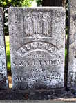
 St. Abner's Cemetery is an inactive cemetery in Brant County, under the jurisdiction of the Corporation of the County of Brant. It is located at 77 Henderson Rd., North-East of Burford. The stones have been moved from their original spot, and are now lined up in a row. All but …
 St. Abner's Cemetery is an inactive cemetery in Brant County, under the jurisdiction of the Corporation of the County of Brant. It is located at 77 Henderson Rd., North-East of …County of Brant Public Library
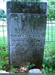
 - Mary Anna Macartney and Infant Son

 Old Paris Cemetery is an inactive cemetery in Brant County, under the jurisdiction of the Corporation of the County of Brant. It is located on the south side of Church Street in Paris soon after turning off Dundas Street West (Highway #2). Range 2-11
 Old Paris Cemetery is an inactive cemetery in Brant County, under the jurisdiction of the Corporation of the County of Brant. It is located on the south side of Church …County of Brant Public Library
 - Mary Ann Sanber


 Old Paris Cemetery is an inactive cemetery in Brant County, under the jurisdiction of the Corporation of the County of Brant. It is located on the south side of Church Street in Paris soon after turning off Dundas Street West (Highway #2). Range 3-1

 Old Paris Cemetery is an inactive cemetery in Brant County, under the jurisdiction of the Corporation of the County of Brant. It is located on the south side of Church …County of Brant Public Library
 - William Conworth


 Range 2-1

 Range 2-1County of Brant Public Library
 - Minerva A, Elizabeth E, and David McKay


 Papple Cemetery is an inactive cemetery in Brant County, under the jurisdiction of the Corporation of the County of Brant. It is located on Brant County Highway # 99, 2.5 kms east of the St George Road (Brant County Road # 13). Range 9-9

 Papple Cemetery is an inactive cemetery in Brant County, under the jurisdiction of the Corporation of the County of Brant. It is located on Brant County Highway # 99, 2.5 …County of Brant Public Library
 - David Currey


 Harley Cemetery is an active cemetery in Brant County (Burford Township), under the jurisdiction of the Corporation of the County of Brant. It is located at 125 Harley Rd (Brant Road #202). Range 7-3

 Harley Cemetery is an active cemetery in Brant County (Burford Township), under the jurisdiction of the Corporation of the County of Brant. It is located at 125 Harley Rd (Brant …County of Brant Public Library
 - Letter from the Most Rev. Ignace Bourget

 Letter to Michael Power at Ste. Martine, concerning a school teacher for the parish.
 Letter to Michael Power at Ste. Martine, concerning a school teacher for the parish.Archives of the Roman Catholic Archdiocese of Toronto
 - Upper Canada Herald (Kingston1819), 11 Jun 1834
 ...
...  ...Kingston Frontenac Public Library


