Résultats
Nous avons trouvé 7 éléments semblables.


Page 1 de 1
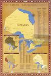
- LHM089 First Nations, Ontario (map)
 This map shows the different treaties, tribal councils, First Nations Communities and First Nations Political Organizations across Ontario.
  This map shows the different treaties, tribal councils, First Nations Communities and First Nations Political Organizations across Ontario.Oshawa Public Libraries
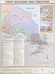
 - LHM090 First Nations and Treaties (map)
 This map shows the different treaties that impact different areas across Ontario.
  This map shows the different treaties that impact different areas across Ontario.Oshawa Public Libraries
 - Thunder Bay Area Rural Roads
 Map housed at the Brodie Resource Library
  Map housed at the Brodie Resource LibraryThunder Bay Public Library
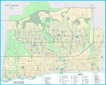
 - Oakville Community Map 2018


 Oakville Public Library
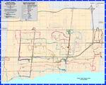
 - Oakville Cycleways Map 2018

 ...
... 
 ...Oakville Public Library
 - Oakville Transit Weekday Route Map Effective March 4, 2018

 ...
... 
 ...Oakville Public Library
 - North Oakville Map as in 2010 Overlayed With Historic Lots and Concessions
 The identification on each lot is the Concession number in Roman numeral followed by lot number. E.g. "I-35" is Concession 1, Lot 35. "II-30" is Concession 2, Lot 30.
  The identification on each lot is the Concession number in Roman numeral followed by lot number. E.g. "I-35" is Concession 1, Lot 35. "II-30" is Concession 2, Lot 30.Trafalgar Township Historical Society
Page 1 de 1


