Résultats
Nous avons trouvé 3 éléments semblables.


Page 1 de 1
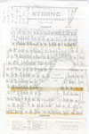
- Map of Strong Township, 1942

 A map of Strong Township, produced in 1942. It shows the division of property in Strong Township and names of the land owners. Lake Bernard is near the center of the township. There is a legend at the bottom of the map. Machar Township borders on the north, Chapman on …
 A map of Strong Township, produced in 1942. It shows the division of property in Strong Township and names of the land owners. Lake Bernard is near the center of …Sundridge - Strong Union PL
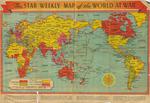
 - The Star Weekly Map of the World at War, 1944

 This is a map that was published in The Star Weekly, Toronto newspaper. The map was published on December 23, 1944 and shows the land that was occupied by the Allies and Axis powers, as well as the land that belonged to the British Empire and neutral countries. The map …
 This is a map that was published in The Star Weekly, Toronto newspaper. The map was published on December 23, 1944 and shows the land that was occupied by the …Waterloo Public Library
 - LHM043 Insurance Plan of the City of Oshawa, Ontario

 First page of the 1948 fire insurance plan for Oshawa.
 First page of the 1948 fire insurance plan for Oshawa.Oshawa Public Libraries
Page 1 de 1


