Résultats
Nous avons trouvé 23 éléments semblables.


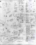
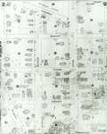
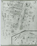
- Fire Insurance Map, 1908 - 1913, Map 4
 1908 map updated to 1913. Duke Street later became Dupont Street. See Detail images for closer view of map.
  1908 map updated to 1913. Duke Street later became Dupont Street. See Detail images for closer view of map.Waterloo Public Library
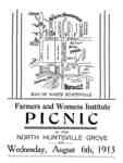
 - Flyer advertising Farmers and Womens Institute Picnic, Wednesday, August 6th, 1913, including a map of North Huntsville, Ontario.
 Across the river from the Anglo Canadian Leather Company a new suburb was begun consisting of several prosperous farms, a park and ball grounds, the Chaffey school, and Mr. Silver's saw and grist mill. Mr. J.H. Johnson lived in the suburb on a property called Avenue Farm. In the September …
  Across the river from the Anglo Canadian Leather Company a new suburb was begun consisting of several prosperous farms, a park and ball grounds, the Chaffey school, and Mr. Silver's …Huntsville Public Library
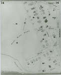
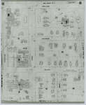
 - Fire Insurance Map 1908 - 1913, Map 14
 1908 map updated to 1913.
  1908 map updated to 1913.Waterloo Public Library
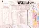
 - Fire Insurance Map 1908 - 1913 Legend
 1908 map updated to 1913. See detail photographs for enhanced view of the map.
  1908 map updated to 1913. See detail photographs for enhanced view of the map.Waterloo Public Library
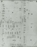
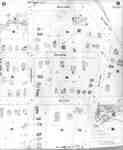
 - Fire Insurance Map, 1908 -1913, Map 2
 1908 map updated to 1913. Water Street later became Dorset Street. Cedar Street later became Bridgeport Road. See Detail images for closer view of map.
  1908 map updated to 1913. Water Street later became Dorset Street. Cedar Street later became Bridgeport Road. See Detail images for closer view of map.Waterloo Public Library
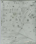
 - Fire Insurance Map, 1908 - 1913, Map 3
 1908 map updated to 1913. Cedar Street later became Bridgeport Road and was also called Laurel Street east of Peppler. See Detail images for closer view of map.
  1908 map updated to 1913. Cedar Street later became Bridgeport Road and was also called Laurel Street east of Peppler. See Detail images for closer view of map.Waterloo Public Library
 - Fire Insurance Map, 1908 - 1913, Map 5
 1908 map updated to 1913. Duke Street later became Dupont Street. Bridgeport Road also called Laurel Street. See Detail images for closer view of map.
  1908 map updated to 1913. Duke Street later became Dupont Street. Bridgeport Road also called Laurel Street. See Detail images for closer view of map.Waterloo Public Library
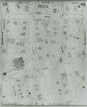
 - Fire Insurance Map 1908 - 1913, Map 10
 1908 map updated to 1913. Ontario Mutual Life Assurance Company was incorporated in 1868, name changed in 1900 to Mutual Life Assurance Company of Canada. They moved to 227 King Street south circa 1913. In 1988 became a part of the Mutual Group; company name changed to Clarica in 1999, …
  1908 map updated to 1913. Ontario Mutual Life Assurance Company was incorporated in 1868, name changed in 1900 to Mutual Life Assurance Company of Canada. They moved to 227 King …Waterloo Public Library
 - Fire Insurance Map 1908 - 1913, Map 11
 1908 map updated to 1913.
  1908 map updated to 1913.Waterloo Public Library
 - Fire Insurance Map 1908 - 1913, Map 12
 1908 map updated to 1913.
  1908 map updated to 1913.Waterloo Public Library
 - Fire Insurance Map 1908 - 1913, Map 13
 1908 map updated to 1913.
  1908 map updated to 1913.Waterloo Public Library
 - Fire Insurance Map, 1908 - 1913, Map 6
 1908 map updated to 1913. Weaver Street later became Dawson Street. See Detail images for closer view of map.
  1908 map updated to 1913. Weaver Street later became Dawson Street. See Detail images for closer view of map.Waterloo Public Library
 - Fire Insurance Map 1908 - 1913, Map 7
 1908 map updated to 1913. Morley Street no longer exists.
  1908 map updated to 1913. Morley Street no longer exists.Waterloo Public Library
 - Fire Insurance Map 1908 - 1913, Map 8
 1908 map updated to 1913.
  1908 map updated to 1913.Waterloo Public Library
 - Fire Insurance Map 1908 - 1913, Map 9
 1908 map updated to 1913.
  1908 map updated to 1913.Waterloo Public Library
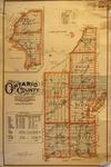
 - LHM054 Wall Map of Ontario County, Ontario
 Scale on map listed as 1" to 2 miles
  Scale on map listed as 1" to 2 milesOshawa Public Libraries
 - LHM067 Sand and Gravel Deposits Along the North Shore of Lake Ontario, Ontario (map)
 Map issued in 1916; note that map is "To accompany Section V of Memoir by L. Reinecke." Scale on map listed as 1" to 4 miles
  Map issued in 1916; note that map is "To accompany Section V of Memoir by L. Reinecke." Scale on map listed as 1" to 4 milesOshawa Public Libraries
 - Hand Drawn maps of streets
 3 hand drawn maps of the streets of Schreiber from approximately 1918.
  3 hand drawn maps of the streets of Schreiber from approximately 1918.Schreiber Public Library
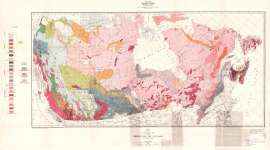
 - Geological Map of the Dominion of Canada and Newfoundland
 Map housed at the Brodie Resource Library
  Map housed at the Brodie Resource LibraryThunder Bay Public Library
 - Michipicoten Sheet : Thunder Bay, Algoma and Sudbury Districts
 Map housed at the Brodie Resource Library
  Map housed at the Brodie Resource LibraryThunder Bay Public Library

