Résultats
Nous avons trouvé 5 éléments semblables.


Page 1 de 1
- 1876 Plan of the Town of Paris

 This 1876 town map shows Paris as it was at the time. The lots are numbered individually. A number of notable town landmarks are indicated, with the key in the lower centre of the map.
 This 1876 town map shows Paris as it was at the time. The lots are numbered individually. A number of notable town landmarks are indicated, with the key in the …County of Brant Public Library
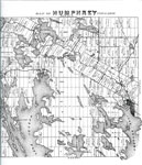
 - Map of Humphrey Township 1879 - RV0024a

 A map with many lakes on it. Map of Humphrey Township - 1879
 A map with many lakes on it. Map of Humphrey Township - 1879Rosseau Historical Society
 - Lake Rosseau Section of the Map of Humphrey Township 1879 - RV0024b

 A map of part of the Township of Humphrey with the names of the people who owned the lots in 1879.
 A map of part of the Township of Humphrey with the names of the people who owned the lots in 1879.Rosseau Historical Society
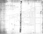
 - Plan of Ontario Methodist Camp Ground, 1875: Auditorium Circle and Victoria Terrace

 This is the plan for the Ontario Methodist Camp Ground in 1875. This was the first year that the Ontario Methodist Camp Ground owned the land sold to them by John B. Bowslaugh, which was approximately 12 1/2 acres. This map lays out the plots of land the company wanted …
 This is the plan for the Ontario Methodist Camp Ground in 1875. This was the first year that the Ontario Methodist Camp Ground owned the land sold to them by …Grimsby Chautauqua
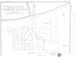
 - Plan of Ontario Methodist Camp Ground, Blocks B and C, 1875

 This map continues the survey of the Ontario Methodist Camp Grounds, plotting the lots for Blocks B. and C., and part of A., D., and F. This map accounts for another approximately 145 lots.
 This map continues the survey of the Ontario Methodist Camp Grounds, plotting the lots for Blocks B. and C., and part of A., D., and F. This map accounts for …Grimsby Chautauqua
Page 1 de 1


