Résultats
Nous avons trouvé 6 éléments semblables.


Page 1 de 1
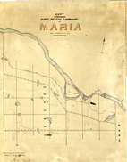
- Maria Township ca. 1866


 Early surveyors, like William E. Logan, used Rochon micrometer telescopes and targets (disk on a calibrated pole) to measure distance. Each microscope had a different calibration and therefore a different range. The instruments were calibrated against a distance measured with a surveyors chain (also known as Gunter’s chain). One chain …

 Early surveyors, like William E. Logan, used Rochon micrometer telescopes and targets (disk on a calibrated pole) to measure distance. Each microscope had a different calibration and therefore a different …Head, Clara and Maria Public Library
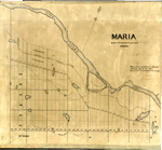
 - Maria Township ca.1869


 Early surveyors, like William E. Logan, used Rochon micrometer telescopes and targets (disk on a calibrated pole) to measure distance. Each microscope had a different calibration and therefore a different range. The instruments were calibrated against a distance measured with a surveyors chain (also known as Gunter’s chain). One chain …

 Early surveyors, like William E. Logan, used Rochon micrometer telescopes and targets (disk on a calibrated pole) to measure distance. Each microscope had a different calibration and therefore a different …Head, Clara and Maria Public Library
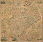
 - Map of the United Counties of Leeds and Grenville

 This item is a map of the United Counties of Leeds and Grenville, Canada West, as of 1861. It was based on surveys under the direction of H.F. Walling, and includes the townships of Leeds, Lansdowne, and Escott. This map includes some pictures, individual lot and concession numbers for each …
 This item is a map of the United Counties of Leeds and Grenville, Canada West, as of 1861. It was based on surveys under the direction of H.F. Walling, and …Leeds & Thousand Islands Public Library
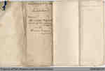
 - Indenture Between The Great Western Railway Company and Hiram Capron

 This land indenture documents an agreement between Capron and the Great Western Railway Company. This is not the first agreement between Capron and the Great Western Railway company; an earlier document was signed in 1848. Capron built a highway and sold several lots near the strip of land he had …
 This land indenture documents an agreement between Capron and the Great Western Railway Company. This is not the first agreement between Capron and the Great Western Railway company; an earlier …
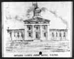
 - Ontario County Court House
 The Ontario County Courthouse was built from 1852-1854 on the west side of Centre Street between Ontario Street and Gilbert Streets. The architects were Frederic Cumberland and William Storm of Toronto. The extension at the north end was added in 1866. The building served as a courthouse from 1854-1964. In …
  The Ontario County Courthouse was built from 1852-1854 on the west side of Centre Street between Ontario Street and Gilbert Streets. The architects were Frederic Cumberland and William Storm of …Whitby Public Library
 - Whitby Grammar School, c.1860
 Whitby Grammar School was built in 1846 at 315 Colborne Street West on the south side between King and Centre Streets. A modern addition was put on the front of the building in 1872-1873 at which point the school became known as Whitby Collegiate Institute. The school was demolished in …
  Whitby Grammar School was built in 1846 at 315 Colborne Street West on the south side between King and Centre Streets. A modern addition was put on the front of …Whitby Public Library
Page 1 de 1

