Résultats
Nous avons trouvé 49 éléments semblables.


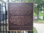
- Joseph Brant (Thayendanegea) Tomb Plaque
 This tomb is erected to the memory of THAYENDANEGEA, or Captain Joseph Brant, Principal Chief and Warrior of the Six Nations Indians, by his Fellow-Subjects, admirers of his fidelity and attachment to the British Crown. Born on the Banks of the Ohio River, 1742; died at Wellington Square, U.C., ...
  This tomb is erected to the memory of THAYENDANEGEA, or Captain Joseph Brant, Principal Chief and Warrior of the Six Nations Indians, by his Fellow-Subjects, admirers of his fidelity and …Brantford Public Library
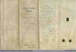
 - Certificate of appointment of James Newton as Quarter Master in the 6th Battalion of York Militia
 This document, dated at Quebec City, July 1, 1852, authorizing the appointment of James Newton, a resident of the district, as Quarter Master in the 6th Battalion of York Militia, bears the sign of the Earl Elgin and Kinkardine, Governor General of British North America at the time. Lord Elgin …
  This document, dated at Quebec City, July 1, 1852, authorizing the appointment of James Newton, a resident of the district, as Quarter Master in the 6th Battalion of York Militia, …Richmond Hill Public Library
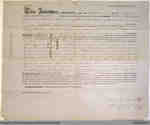
 - Quit Claim Deed Between James Fisher and Robert Fisher

 This 1853 deed transfers ownership of Lot 7, East side of Dumfries and Lot 7, West side of Burwell, and the site of the old Town Hall from James Fisher and his wife Frances to his brother Robert. James and Robert had bought this land in 1845 from Hiram Capron; …
 This 1853 deed transfers ownership of Lot 7, East side of Dumfries and Lot 7, West side of Burwell, and the site of the old Town Hall from James Fisher …
 - Land Indenture between Robert Rosebrugh and Neil Cook Love, 1855

 Robert Rosebrugh's name is subject to many eccentric spellings. A notable alternate is Robert Roseburgh.
 Robert Rosebrugh's name is subject to many eccentric spellings. A notable alternate is Robert Roseburgh.
 - Statement of No Ownership for Lot 7 East of Burwell and Lot 7 East Side Dumfries, 1853

 This document, written by County of Brant registrar T.S. Shenston, certifies that no conveyance of any type has been filed on the two lots he outlines in the title, Lot 7 East of Burwell and Lot 7 East Side Dumfries.
 This document, written by County of Brant registrar T.S. Shenston, certifies that no conveyance of any type has been filed on the two lots he outlines in the title, Lot …
 - Indenture between Trinity College and William Sharp, 1854

 The creases in the original document cannot be folded back, so some of the lines are illegible.
 The creases in the original document cannot be folded back, so some of the lines are illegible.County of Brant Public Library
 - John Tufford Land Indenture, 1857

 This item was digitized on November 14th, 2009, during a Digitization Days event at the Paris Branch of the County of Brant Public Library.
 This item was digitized on November 14th, 2009, during a Digitization Days event at the Paris Branch of the County of Brant Public Library.County of Brant Public Library
 - Land Indenture between William Patton and David Bucham, 1858

 This item was digitized on November 14th, 2009, during a Digitization Days event at the Paris Branch of the County of Brant Public Library.
 This item was digitized on November 14th, 2009, during a Digitization Days event at the Paris Branch of the County of Brant Public Library.County of Brant Public Library
 - Land Deed between David Somerville Ranaldson Dickson and William Geddie, 1855

 This 1855 land deed is between a number of the Dickson family members and William Geddie. The text of the original indenture is very significantly faded, which renders it difficult to read. Enhanced versions have also been made available.
 This 1855 land deed is between a number of the Dickson family members and William Geddie. The text of the original indenture is very significantly faded, which renders it difficult …County of Brant Public Library
 - Land indenture between Thomas Clark Street & Edward Clarke Campbell and George Girdwood, South Dumfries Township, 1856

 This 1856 land deed transfers a lot between Thomas Clark Street and Edward Clarke Campbell, and George Girdwell in return for £124, 11s, 5d. The land sold is in the north quarter of lot 36 in the third concession of South Dumfries Township.
 This 1856 land deed transfers a lot between Thomas Clark Street and Edward Clarke Campbell, and George Girdwell in return for £124, 11s, 5d. The land sold is in the …County of Brant Public Library
 - Abstract of Title to Gore North of Dundas Street

 The accession numbers are in reverse sequence from the page numbers.
 The accession numbers are in reverse sequence from the page numbers.
 - 1853 Land Grant to William Douglas

 This is the certificate granting land to William Douglas of the Township of Onondaga issued on September 7, 1853 by the Province of Canada. The original document was provided by John M. Douglas during a Scan & Share Day event held at the Onondaga Hall on January 14, 2012.
 This is the certificate granting land to William Douglas of the Township of Onondaga issued on September 7, 1853 by the Province of Canada. The original document was provided by …County of Brant Public Library
 - Will of John Armour

 This is the handwritten will of John Armour. It describes his last wishes, which bequeathed fifty acres of land to his brother Thomas Armour. The original document was provided by Al Robinson during a Scan & Share Day event held at the Onondaga Hall on February 11, 2012.
 This is the handwritten will of John Armour. It describes his last wishes, which bequeathed fifty acres of land to his brother Thomas Armour. The original document was provided by …County of Brant Public Library
 - Land Grant to John Armour

 This is a land grant issued to John Armour, in the Township of Onondaga, on November 24, 1858 by the Province of Canada. He received 100 acres of land for 100 pounds. The original document was provided by Al Robinson during a Scan & Share Day event held at the …
 This is a land grant issued to John Armour, in the Township of Onondaga, on November 24, 1858 by the Province of Canada. He received 100 acres of land for …County of Brant Public Library
 - Phrenological Chart of Samuel Armour

 This is a phrenological chart created for Samuel Armour, age 13, issued by Alfred Hagarty, practical phrenologist. Phrenology is a pseudoscience primarily focused on measurements of the human skull, based on the concept that the brain is the organ of the mind, and that certain brain areas have localized, specific …
 This is a phrenological chart created for Samuel Armour, age 13, issued by Alfred Hagarty, practical phrenologist. Phrenology is a pseudoscience primarily focused on measurements of the human skull, based …County of Brant Public Library
 - Phrenological Chart of Thomas Armour

 This is a phrenological chart describing the attributes of Thomas Armour, age 13, issued by Alfred Hagarty, practical phrenologist. Phrenology is a pseudoscience primarily focused on measurements of the human skull, based on the concept that the brain is the organ of the mind, and that certain brain areas have …
 This is a phrenological chart describing the attributes of Thomas Armour, age 13, issued by Alfred Hagarty, practical phrenologist. Phrenology is a pseudoscience primarily focused on measurements of the human …County of Brant Public Library
 - Phrenological Chart of John Armour

 This is a phrenological chart describing the attributes of Mr. John Armour issued by Alfred Hagarty, practical phrenologist. Phrenology is a pseudoscience primarily focused on measurements of the human skull, based on the concept that the brain is the organ of the mind, and that certain brain areas have localized, …
 This is a phrenological chart describing the attributes of Mr. John Armour issued by Alfred Hagarty, practical phrenologist. Phrenology is a pseudoscience primarily focused on measurements of the human skull, …County of Brant Public Library
 - Land Grant to William Douglas of the Township of Onondaga

 This is the image of a land grant issued to William Douglas of the Township of Onondaga on May 12, 1853. He received 94 acres for just over 123 pounds sterling. The original document was provided by Karen Richardson during a Scan & Share Day event held at the Onondaga …
 This is the image of a land grant issued to William Douglas of the Township of Onondaga on May 12, 1853. He received 94 acres for just over 123 pounds …County of Brant Public Library
 - Land Grant to William Douglas

 This is the image of a land grant issued to William Douglas of the Township of Onondaga on September 9, 1853. The original document was provided by Karen Richardson during a Scan & Share Day event held at the Onondaga Hall on January 14, 2012.
 This is the image of a land grant issued to William Douglas of the Township of Onondaga on September 9, 1853. The original document was provided by Karen Richardson during …County of Brant Public Library
 - Land Grant to Henry Fryer

 This is an image of the land grant issued to Henry Fryer of the Township of Onondaga on May 8, 1856. He received 50 acres for 50 pounds 5 shillings. The original document was provided by Ruth Doherty during a Scan & Share Day event held at the Onondaga Hall …
 This is an image of the land grant issued to Henry Fryer of the Township of Onondaga on May 8, 1856. He received 50 acres for 50 pounds 5 shillings. …County of Brant Public Library

