Résultats


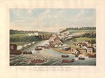
- The Battle of Queenston Heights October 13th 1813. By Thomas Sutherland
 An ink print created after James Dennis's drawing of the Battle of Queenston Heights. Note the flags, the colouring of the uniforms and their locations which is different from the James Dennis original. It is historically inaccurate as it portrays Americans defending Queenston Heights and the British attacking (with French …
  An ink print created after James Dennis's drawing of the Battle of Queenston Heights. Note the flags, the colouring of the uniforms and their locations which is different from the …
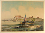
 - American Fort, Niagara River. By John Richard Coke Smyth
 An ink print created in England.
  An ink print created in England.
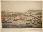
 - The Battle of Queenston Heights October 13th 1813. By Thomas Sutherland
 An ink print created after James Dennis's drawing of the Battle of Queenston Heights. Note the flags, the colouring of the uniforms and their locations which is different from the James Dennis original.
  An ink print created after James Dennis's drawing of the Battle of Queenston Heights. Note the flags, the colouring of the uniforms and their locations which is different from the …
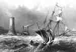
 - Cobourg light-tower, Gull Island
 Midway between Port Hope and Cobourg there is a dangerous shoal called Gull Island, which is about two miles long, and about one mile from the shore. Gull Island Lighthouse is somewhat exaggerated, though the force of the wind and water has several times necessitated re-building or repairs to this …
  Midway between Port Hope and Cobourg there is a dangerous shoal called Gull Island, which is about two miles long, and about one mile from the shore. Gull Island Lighthouse …Cobourg Public Library
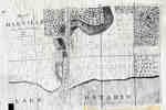
 - Map of Oakville 1837
 The Drawing has been prepared from information gathered from a copy of the first registered plan of Oakville, by Deputy Provincial Surveyor, Robert W. Kerr in 1836, under the direction of Col. William Chisholm, the founder of Oakville. The Plan was registered January 12th 1850. James Madill, Oakville, 1973
  The Drawing has been prepared from information gathered from a copy of the first registered plan of Oakville, by Deputy Provincial Surveyor, Robert W. Kerr in 1836, under the direction …Oakville Public Library
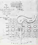
 - Plan of Oakville, Township of Trafalgar, Upper Canada, 1835
 A map from 1835 showing the town of Oakville from Brock Street to Allan Street, including the Sixteen Mile Creek. This map features the church, market square, wharf and an intended damn site north of the Colborne Street bridge.
  A map from 1835 showing the town of Oakville from Brock Street to Allan Street, including the Sixteen Mile Creek. This map features the church, market square, wharf and an …Oakville Public Library
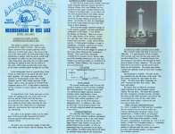
 - Brief history of the Alderville First Nation
 Brief history of the Alderville First Nation Source: Unknown Acquired: April 1, 1993
  Brief history of the Alderville First Nation Source: Unknown Acquired: April 1, 1993Cobourg Public Library
 - Brief history of the Alderville First Nation, the Mississaugas of Rice Lake, and the Cenotaph
 Brief history of the Alderville First Nation, the Mississaugas of Rice Lake, and the Cenotaph Source: Unknown Acquired: May 1993
  Brief history of the Alderville First Nation, the Mississaugas of Rice Lake, and the Cenotaph Source: Unknown Acquired: May 1993Cobourg Public Library
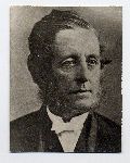
 - Dr. William Tassie
 Reprint
  ReprintOakville Historical Society
 - Cemetery Receipt to Joseph Oakley
 Since the receipt is signed by a member of the Munn family, it is possibly a receipt for Munn's Cemetery in Trafalgar Township, on the southeast corner of Dundas and Sixth Line.
  Since the receipt is signed by a member of the Munn family, it is possibly a receipt for Munn's Cemetery in Trafalgar Township, on the southeast corner of Dundas and …Trafalgar Township Historical Society
 - Family Reunion, Peacock family
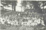
 A portrait taken at the 5th annual family reunion, celebrating the 100th Anniversary of the family history.
  A portrait taken at the 5th annual family reunion, celebrating the 100th Anniversary of the family history.Trafalgar Township Historical Society
 - First newspaper office in Cobourg

 The first newspaper in Cobourg was known as the Cobourg Star and Newcastle General Advertiser and had it's first issue on January 11, 1831. The first editor was R.D.Chatterton and there were over 500 subscribers.
 The first newspaper in Cobourg was known as the Cobourg Star and Newcastle General Advertiser and had it's first issue on January 11, 1831. The first editor was R.D.Chatterton and …Cobourg Public Library
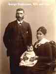
 - George Stephenson and Family
 George Stephenson with his wife, and daughter, Bridget Rebecca (1836-1867).
  George Stephenson with his wife, and daughter, Bridget Rebecca (1836-1867).Trafalgar Township Historical Society
 - Applegarth Family -- The Applegarth House
 ...
...  ...Burlington Public Library
 - "Cobourg, Lake Ontario" by J. P. Cockburn
 A study of this sketch of 1830 with travelers' descriptions of Cobourg at this time enabled identification of several of the buildings. The original Church of England is seen near the corner of King and College Street. A block westward from it, actually on the site of the present Registry …
  A study of this sketch of 1830 with travelers' descriptions of Cobourg at this time enabled identification of several of the buildings. The original Church of England is seen near …Cobourg Public Library
 - Portrait of Peter Perry, 1836

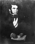
 Mr. Cook painted two portraits, one of Peter Perry and one of his wife, Mary Ham Perry. The paintings were donated to the Town of Whitby by the decedents of Peter Perry, Mr. R. L. Cowan and family of Bracebridge, Ontario in July 1972. The paintings hung in the Peter …
 Mr. Cook painted two portraits, one of Peter Perry and one of his wife, Mary Ham Perry. The paintings were donated to the Town of Whitby by the decedents of …Whitby Public Library
 - Welland Canal Survey of Lands Abraham Augustine, 1837
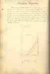
 Survey map and description of Jacob Augustine's land created by The Welland Canal Company. Included is a written description of the land along with a drawing of the land. The land surveyed is lot #26 in Humberstone.Noteable features include; canal, concession, line between Abraham and Jacob Augustine's land. The land …
  Survey map and description of Jacob Augustine's land created by The Welland Canal Company. Included is a written description of the land along with a drawing of the land. The …Brock University Archives
 - Welland Canal Survey of Lands Jacob Augustine, 1837
 Survey map and description of Jacob Augustine's land created by The Welland Canal Company. Included is a written description of the land along with a drawing of the land. The land surveyed is lot #27 in Humberstone. Noteable features include; canal, concession, line between Neff and J. Augustine's land. The …
  Survey map and description of Jacob Augustine's land created by The Welland Canal Company. Included is a written description of the land along with a drawing of the land. The …Brock University Archives
 - Welland Canal Survey of Lands Abraham Neff, 1836
 Survey map and description of Abraham Neff's land created by The Welland Canal Company. Included is a written description of the land along with a drawing of the land. Noteable features include; line between A. Neff and Jacob Neffs land, line between lots, canal, bridge. The land totals 7 acres …
  Survey map and description of Abraham Neff's land created by The Welland Canal Company. Included is a written description of the land along with a drawing of the land. Noteable …Brock University Archives
 - Welland Canal Survey of Lands Jacob Neff Jr., 1835
 Survey map and description of Jacob Neff Js.'s land created by The Welland Canal Company. Included is a written description of the land along with a drawing of the land. Noteable features include; canal, line between Jacob Neff and Jacob Augustine's land. The land totals 14 acres and 1 road. …
  Survey map and description of Jacob Neff Js.'s land created by The Welland Canal Company. Included is a written description of the land along with a drawing of the land. …Brock University Archives

