Résultats
Nous avons trouvé 79 éléments semblables.


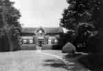
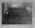
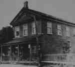
- Residence of John Dryden

 This brick house was built in 1835 on lot 20 of Concession 7 in Whitby Township. It was located on the north side of the the 7th Concession, east of Thickson Road. A second story was added to the house in 1926. It was the residence of James Dryden (1806-1881), …
 This brick house was built in 1835 on lot 20 of Concession 7 in Whitby Township. It was located on the north side of the the 7th Concession, east of …Whitby Public Library
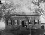
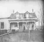
 - Residence of Sylvester Lynde

 This stone house was located on lot 30 on the north side of Concession 3 (Rossland Road) east of McQuay Blvd (D'Hilliar Street) in Whitby Township. It was built in the 1840s or 1850s for Sylvester Lynde (1800-1883), a son of Jabez Lynde. The house was destroyed by fire on …
 This stone house was located on lot 30 on the north side of Concession 3 (Rossland Road) east of McQuay Blvd (D'Hilliar Street) in Whitby Township. It was built in …Whitby Public Library
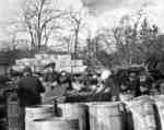
 - Lick Family Orchard

 The Lick family orchard was located on the south side of Highway 2/Dundas between Thickson and Kendalwood Roads in Whitby Township. It was one of the leading orchards in the province of Ontario.
 The Lick family orchard was located on the south side of Highway 2/Dundas between Thickson and Kendalwood Roads in Whitby Township. It was one of the leading orchards in the …Whitby Public Library
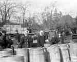
 - Lick Family Orchard

 The Lick family orchard was located on the south side of Highway 2/Dundas between Thickson and Kendalwood Roads in Whitby Township. It was one of the leading orchards in the province of Ontario.
 The Lick family orchard was located on the south side of Highway 2/Dundas between Thickson and Kendalwood Roads in Whitby Township. It was one of the leading orchards in the …Whitby Public Library
 - Tennis at Maple Shade Farm

 This brick house was built in 1835 on lot 20 of Concession 7 in Whitby Township. It was located on the north side of the the 7th Concession, east of Thickson Road. A second story was added to the house in 1926. It was the residence of James Dryden (1806-1881), …
 This brick house was built in 1835 on lot 20 of Concession 7 in Whitby Township. It was located on the north side of the the 7th Concession, east of …Whitby Public Library
 - Residence of James Tweedie

 This brick house was built in 1845 on lot 29 of Rossland Road near Cochrane Street in Whitby Township. The farm, known as Broadfield, was settled in 1835 by James Tweedie (1803-1857). The house was demolished in 1993.
 This brick house was built in 1845 on lot 29 of Rossland Road near Cochrane Street in Whitby Township. The farm, known as Broadfield, was settled in 1835 by James …Whitby Public Library
 - Residence of Sylvester Lynde

 The stone house was located on lot 30 on the north side of Rossland Road (Concession 3)and east of McQuay Blvd. (D'Hilliar Street) in Whitby Township. It was built in the 1840s or 1850s for Sylvester Lynde (1800-1883), a son of Jabez Lynde. The house was destroyed by fire on …
 The stone house was located on lot 30 on the north side of Rossland Road (Concession 3)and east of McQuay Blvd. (D'Hilliar Street) in Whitby Township. It was built in …Whitby Public Library
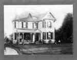
 - Residence of John Joshua Fothergill

 The residence of John Joshua Fothergill was built in 1883 on lot 32, concession 1 on the south side of Highway 2 in Whitby Township. The house was moved a short distance away from its original location in 1987. It was demolished shortly thereafter in May 1994.
 The residence of John Joshua Fothergill was built in 1883 on lot 32, concession 1 on the south side of Highway 2 in Whitby Township. The house was moved a …Whitby Public Library
 - The Tweedie Farm


 This farm on lot 29 of Concession 3 (Rossland Road) at the north-west corner of Rossland and Chocrane Street was also known as Broadfield. It was settled about 1837 by James Tweedie (1803-1857). The brick house on the property was built in 1845.

 This farm on lot 29 of Concession 3 (Rossland Road) at the north-west corner of Rossland and Chocrane Street was also known as Broadfield. It was settled about 1837 by …Whitby Public Library
 - Residence of Emanuel Sleep, c.1900
 This brick farm house was built about 1879 for Emanuel Sleep on the south side of Victoria Street, east of South Blair Street (lot 24, Broken Front Concession). The bricks were brought from the Don Valley brick yard in Toronto and the stairs and library bookcases were built by Capt. …
  This brick farm house was built about 1879 for Emanuel Sleep on the south side of Victoria Street, east of South Blair Street (lot 24, Broken Front Concession). The bricks …Whitby Public Library
 - Residence of John Allin
 The residence of John Allin was on the west side of Hopkins Street north of the Grand Trunk Railway (Canadian National Railway) on lot 23 of Broken Front Concession in Whitby Township. The house was built before 1877 and demolished in 1980.
  The residence of John Allin was on the west side of Hopkins Street north of the Grand Trunk Railway (Canadian National Railway) on lot 23 of Broken Front Concession in …Whitby Public Library
 - Senior Officials at Ontario County Land Registry Office
 The Ontario Country Registry Office was built in 1873 at the south-west corner of Centre and Gilbert Streets. Additions were made in 1929 and 1954. It stood on the same block as the Ontario County Courthouse. The office closed in 1987.
  The Ontario Country Registry Office was built in 1873 at the south-west corner of Centre and Gilbert Streets. Additions were made in 1929 and 1954. It stood on the same …Whitby Public Library
 - Family of Charles Lynde
 Jabez Lynde (1773-1856) was born in Brookfield, MA. He married Clarissa Woodruff (1774-1830) in 1796. In 1803 Jabez and Clarissa emigrated to Canada, settling at the area now known as Lynde Creek in 1804. Sylvester Bernard Lynde (1800-1883), eldest son of Jabez and Clarissa, married Louisa Mary Smith in 1822 …
  Jabez Lynde (1773-1856) was born in Brookfield, MA. He married Clarissa Woodruff (1774-1830) in 1796. In 1803 Jabez and Clarissa emigrated to Canada, settling at the area now known as …Whitby Public Library
 - Family of Charles Lynde

 Jabez Lynde (1773-1856) was born in Brookfield, MA. He married Clarissa Woodruff (1774-1830) in 1796. In 1803 Jabez and Clarissa emigrated to Canada, settling at the area now known as Lynde Creek in 1804. Sylvester Bernard Lynde (1800-1883), eldest son of Jabez and Clarissa, married Louisa Mary Smith in 1822 …
 Jabez Lynde (1773-1856) was born in Brookfield, MA. He married Clarissa Woodruff (1774-1830) in 1796. In 1803 Jabez and Clarissa emigrated to Canada, settling at the area now known as …Whitby Public Library
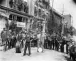
 - Cornet Band on Brock Street
 A black and white photograph of a band holding their instruments on Brock Street north of Dundas Street in Whitby. In the background of this photo are the stores on the west side of Brock Street between Dundas and Elm Streets. The street is decorated with flags and evergreen trees. …
  A black and white photograph of a band holding their instruments on Brock Street north of Dundas Street in Whitby. In the background of this photo are the stores on …Whitby Public Library
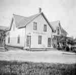
 - Myrtle House Hotel
 Myrtle Station was founded at the junction of Highway 12 and the Ontario and Quebec Railway which was built through Whitby Township in 1884. After the hotel shown in this photograph was destroyed by fire a second hotel and store were built. Later, they too were destroyed by fire.
  Myrtle Station was founded at the junction of Highway 12 and the Ontario and Quebec Railway which was built through Whitby Township in 1884. After the hotel shown in this …Whitby Public Library
 - Myrtle Station
 Myrtle Station was founded at the junction of Highway 12 and the Ontario and Quebec Railway which was built through Whitby Township in 1884. After the first hotel and store were destroyed by fire a second hotel and store were built. Later, they too were destroyed by fire.
  Myrtle Station was founded at the junction of Highway 12 and the Ontario and Quebec Railway which was built through Whitby Township in 1884. After the first hotel and store …Whitby Public Library
 - Alfred C. Elliott Store
 This store was located at 50 Baldwin Street. It was built on lot 62 Campbell and Way Plan, by Henry Daniels and was demolished in 1971.
  This store was located at 50 Baldwin Street. It was built on lot 62 Campbell and Way Plan, by Henry Daniels and was demolished in 1971.Whitby Public Library
 - Residence of Frederick Scurrah, c.1900
 This house was located on the south west corner of Highway 12 and Myrtle Road (9th Concession).Whitby’s house numbering system was provided by Rev. Dr. James Roy Van Wyck (1877-1941), a retired Presbyterian minister. Van Wyck provided this service to the town, free of charge, during the Great Depression. By …
  This house was located on the south west corner of Highway 12 and Myrtle Road (9th Concession).Whitby’s house numbering system was provided by Rev. Dr. James Roy Van Wyck (1877-1941), …Whitby Public Library
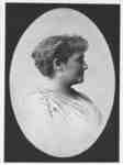
 - May Irwin, c.1900
 May Irwin was a Canadian singer, songwriter, and comic performer who enjoyed popularity and prestige on the American stage from the late 1890s until the end of the 1910s. Key to Irwin’s popularity was her role as a “coon-shouter” and a performer of “coon songs,” deeply racist forms that emerge …
  May Irwin was a Canadian singer, songwriter, and comic performer who enjoyed popularity and prestige on the American stage from the late 1890s until the end of the 1910s. Key …Whitby Public Library

