Résultats
Nous avons trouvé 9 éléments semblables.


Page 1 de 1
- Loon : Ontario (East)
 Map housed at the Brodie Resource Library
  Map housed at the Brodie Resource LibraryThunder Bay Public Library
 - Black Bay : Data Base Map
 Map housed at the Brodie Resource Library
  Map housed at the Brodie Resource LibraryThunder Bay Public Library
 - Chart of Thunder Bay : Lake Superior
 Map housed at the Brodie Resource Library
  Map housed at the Brodie Resource LibraryThunder Bay Public Library
 - Loon : Thunder Bay District
 Map housed at the Brodie Resource Library
  Map housed at the Brodie Resource LibraryThunder Bay Public Library
 - The Township of McTavish : District of Thunder Bay
 Map housed at the Brodie Resource Library
  Map housed at the Brodie Resource LibraryThunder Bay Public Library
 - Thunder Bay
 CrimeStoppers - North of Superior Explorer Map Series Map housed at the Brodie Resource Library
  CrimeStoppers - North of Superior Explorer Map Series Map housed at the Brodie Resource LibraryThunder Bay Public Library
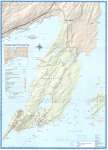
 - Sleeping Giant : Interior Trails
 This is verso of the Sleeping Giant Provincial Park Map 208. Housed at the Brodie Resource Library
  This is verso of the Sleeping Giant Provincial Park Map 208. Housed at the Brodie Resource LibraryThunder Bay Public Library
 - Black Bay Peninsula : Thunder Bay District
 Map housed at the Brodie Resource Library
  Map housed at the Brodie Resource LibraryThunder Bay Public Library
 - Sleeping Giant Provincial Park
 Map housed at the Brodie Resource Library
  Map housed at the Brodie Resource LibraryThunder Bay Public Library
Page 1 de 1

