Résultats
Nous avons trouvé 52 éléments semblables.


- Highway 12 looking south from Canadian Pacific Railway (C.P.R.) tracks
 The Methodist Church in this photograph was built in 1908-9.
  The Methodist Church in this photograph was built in 1908-9.Whitby Public Library
 - Masons General Store
 This brick store and post office were operated from 1947 to 1953 by Murray Arnold Mason. The store was located north of the Canadian Pacific Railway (C.P.R.) tracks on the east side of Highway 12.
  This brick store and post office were operated from 1947 to 1953 by Murray Arnold Mason. The store was located north of the Canadian Pacific Railway (C.P.R.) tracks on the …Whitby Public Library
 - Myrtle House Hotel
 The hotel shown in this photograph was destroyed by fire on March 29, 1919. The hotel keeper was George Birnie. The Myrtle Station Hotel was located on the north side of the Canadian Pacific Railway (C.P.R.) tracks.
  The hotel shown in this photograph was destroyed by fire on March 29, 1919. The hotel keeper was George Birnie. The Myrtle Station Hotel was located on the north side …Whitby Public Library
 - Railway Station and Grain Elevator looking east
 The grain elevator was built in 1887 and was destroyed by fire on January 25, 1968. The railway station was built in 1884 and demolished about 1977.
  The grain elevator was built in 1887 and was destroyed by fire on January 25, 1968. The railway station was built in 1884 and demolished about 1977.Whitby Public Library
 - Railway Station and Livery Stable looking west
 The livery stable was demolished in 1927. The livery stable was operated by T.W. Ross at the time of this picture.
  The livery stable was demolished in 1927. The livery stable was operated by T.W. Ross at the time of this picture.Whitby Public Library
 - Post Office and General Store, Myrtle Station
 J.E. Beacock's General Store was located on the east side of Highway 12 north of the C.P.R. tracks. The store was destroyed by fire on October 6, 1933.
  J.E. Beacock's General Store was located on the east side of Highway 12 north of the C.P.R. tracks. The store was destroyed by fire on October 6, 1933.Whitby Public Library
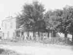
 - Myrtle Station looking east from Highway 12
 A black and white photograph of the store and a shed on the east side of Highway 12, north of the Canadian Pacific Railway (C.P.R.) tracks.
  A black and white photograph of the store and a shed on the east side of Highway 12, north of the Canadian Pacific Railway (C.P.R.) tracks.Whitby Public Library
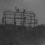
 - Barn Raising at James Dickson Farm
 A black and white photograph of the construction of a barn at James Dickson's farm.
  A black and white photograph of the construction of a barn at James Dickson's farm.Whitby Public Library
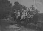
 - James Dickson Family on Wagon
 A black and white photograph of James Dickson's family sitting in a hay wagon. The woman at the far left of the photograph is Jessie Dickson. The man at the centre is James Dickson.
  A black and white photograph of James Dickson's family sitting in a hay wagon. The woman at the far left of the photograph is Jessie Dickson. The man at the …Whitby Public Library
 - Myrtle Station, c.1911
 A street scene of Myrtle Station. At left is the Methodist Church, built in 1908/09.
  A street scene of Myrtle Station. At left is the Methodist Church, built in 1908/09.Whitby Public Library
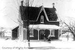
 - House at Myrtle Station, c.1910
 This picture, taken in winter shows a brick farm house, the first house south of the Methodist Church, on the east side of Highway 12 at Myrtle Station.
  This picture, taken in winter shows a brick farm house, the first house south of the Methodist Church, on the east side of Highway 12 at Myrtle Station.Whitby Public Library
 - Myrtle Station Store and Hotel, c.1900
 The store and hotel at Myrtle Station were located on the north side of the tracks east of Highway 12. They were the second hotel and store on the site and like the first, were destroyed by fire.
  The store and hotel at Myrtle Station were located on the north side of the tracks east of Highway 12. They were the second hotel and store on the site …Whitby Public Library


