Résultats
Nous avons trouvé 3 éléments semblables.


Page 1 de 1
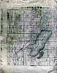
- Map of Strong Township, Machar


 Photocopy of an early concession map for Strong Township. The township is divided into 14 x 30 plots. Lake Bernard is still Stony Lake at this time. Pool Lake and Lake Wallace are also shown. The main road Distress Road is in the middle of the map. The townships on …

 Photocopy of an early concession map for Strong Township. The township is divided into 14 x 30 plots. Lake Bernard is still Stony Lake at this time. Pool Lake and …Sundridge - Strong Union PL
 - Tremaine's Map of the County of Halton 1858 – Township of Esquesing II


 This map lays out the land division and ownership of the northern Esquesing region as of 1858. It is one of eight maps of the Halton townships. It also includes depictions of important local buildings including the Canadian Collegiate Institute, the residence of James Barber Esquire, and Credit Paper Mills. …

 This map lays out the land division and ownership of the northern Esquesing region as of 1858. It is one of eight maps of the Halton townships. It also includes …Oakville Public Library
 - Tremaine's Map of the County of Halton - Township of Nelson II


 This map lays out the land division and ownership of the Nelson township region as of 1858. It is one of eight maps of the Halton townships. It also includes depictions of important local buildings including H.P. Zimmerman’s Crist & Flouring Mills, the residence of K.H. Munn Esquire, and Bronte …

 This map lays out the land division and ownership of the Nelson township region as of 1858. It is one of eight maps of the Halton townships. It also includes …Oakville Public Library
Page 1 de 1


