Résultats
Nous avons trouvé 34 éléments semblables.


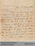
- Letter from W.G. Keele to Hiram Capron Confirming Land Sales

 This letter is a follow-up to an earlier 1835 correspondence between Keele and Capron concerning land grants. Keele reports on the progress he has made in confirming these grants, and the work remaining to be done.
 This letter is a follow-up to an earlier 1835 correspondence between Keele and Capron concerning land grants. Keele reports on the progress he has made in confirming these grants, and …
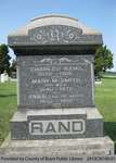
 - Rand Family Headstone

 Range 12-14
 Range 12-14County of Brant Public Library
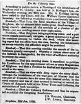
 - The Birth of Brighton

 ...
... 
 ...Brighton Digital Archives
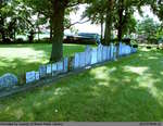
 - St. Abner's Cemetery

 St. Abner's Cemetery is an inactive cemetery in Brant County, under the jurisdiction of the Corporation of the County of Brant. It is located at 77 Henderson Rd., North-East of Burford. The stones have been moved from their original spot, and are now lined up in a row. All but …
 St. Abner's Cemetery is an inactive cemetery in Brant County, under the jurisdiction of the Corporation of the County of Brant. It is located at 77 Henderson Rd., North-East of …County of Brant Public Library
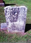
 - James Pepper

 Papple Cemetery is an inactive cemetery in Brant County, under the jurisdiction of the Corporation of the County of Brant. It is located on Brant County Highway # 99, 2.5 kms east of the St George Road (Brant County Road # 13). Range 4-4
 Papple Cemetery is an inactive cemetery in Brant County, under the jurisdiction of the Corporation of the County of Brant. It is located on Brant County Highway # 99, 2.5 …County of Brant Public Library
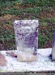
 - James Pepper?


 Papple Cemetery is an inactive cemetery in Brant County, under the jurisdiction of the Corporation of the County of Brant. It is located on Brant County Highway # 99, 2.5 kms east of the St George Road (Brant County Road # 13). Range 6-2

 Papple Cemetery is an inactive cemetery in Brant County, under the jurisdiction of the Corporation of the County of Brant. It is located on Brant County Highway # 99, 2.5 …County of Brant Public Library
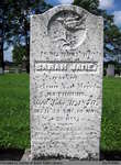
 - Sarah Jane Rathbun


 Harley Cemetery is an active cemetery in Brant County (Burford Township), under the jurisdiction of the Corporation of the County of Brant. It is located at 125 Harley Rd (Brant Road #202). Range 2-13

 Harley Cemetery is an active cemetery in Brant County (Burford Township), under the jurisdiction of the Corporation of the County of Brant. It is located at 125 Harley Rd (Brant …County of Brant Public Library
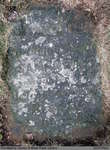
 - Samantha Brown


 Range 5-3

 Range 5-3County of Brant Public Library
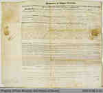
 - Grant of Dumfries Land to Thomas Gadd


 This grant from the Province of Upper Canada gives Thomas Gadd 446 acres of land in Paris (then the Township of Dumfries), north of Dundas Street. His land is described as bordering Capron's.

 This grant from the Province of Upper Canada gives Thomas Gadd 446 acres of land in Paris (then the Township of Dumfries), north of Dundas Street. His land is described …
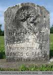
 - Angeline Allen


 Range 1-15

 Range 1-15County of Brant Public Library
 - William Sulman

 Range 4-6
 Range 4-6County of Brant Public Library
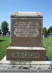
 - Waugh Family Headstone

 Range 5-8
 Range 5-8County of Brant Public Library
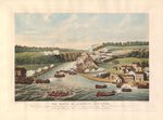
 - The Battle of Queenston Heights October 13th 1813. By Thomas Sutherland
 An ink print created after James Dennis's drawing of the Battle of Queenston Heights. Note the flags, the colouring of the uniforms and their locations which is different from the James Dennis original. It is historically inaccurate as it portrays Americans defending Queenston Heights and the British attacking (with French …
  An ink print created after James Dennis's drawing of the Battle of Queenston Heights. Note the flags, the colouring of the uniforms and their locations which is different from the …
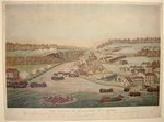
 - The Battle of Queenston Heights October 13th 1813. By Thomas Sutherland
 An ink print created after James Dennis's drawing of the Battle of Queenston Heights. Note the flags, the colouring of the uniforms and their locations which is different from the James Dennis original.
  An ink print created after James Dennis's drawing of the Battle of Queenston Heights. Note the flags, the colouring of the uniforms and their locations which is different from the …
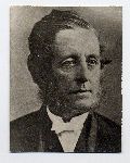
 - Dr. William Tassie
 Reprint
  ReprintOakville Historical Society
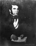
 - Portrait of Peter Perry, 1836

 Mr. Cook painted two portraits, one of Peter Perry and one of his wife, Mary Ham Perry. The paintings were donated to the Town of Whitby by the decedents of Peter Perry, Mr. R. L. Cowan and family of Bracebridge, Ontario in July 1972. The paintings hung in the Peter …
 Mr. Cook painted two portraits, one of Peter Perry and one of his wife, Mary Ham Perry. The paintings were donated to the Town of Whitby by the decedents of …Whitby Public Library
 - Welland Canal Survey of Lands Abraham Neff, 1836
 Survey map and description of Abraham Neff's land created by The Welland Canal Company. Included is a written description of the land along with a drawing of the land. Noteable features include; line between A. Neff and Jacob Neffs land, line between lots, canal, bridge. The land totals 7 acres …
  Survey map and description of Abraham Neff's land created by The Welland Canal Company. Included is a written description of the land along with a drawing of the land. Noteable …Brock University Archives
 - Welland Canal Survey of Lands William Chisholm 1836
 Survey map and description of William Chisholm's land created by The Welland Canal Company. Included is a written description of the land along with a drawing of the land. Noteable features include; line between Elias Adams and Chisholm's land, line between Chisholm and Shipman's land, canal. The land is a …
  Survey map and description of William Chisholm's land created by The Welland Canal Company. Included is a written description of the land along with a drawing of the land. Noteable …Brock University Archives
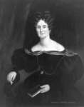
 - Mrs. Peter Perry (Mary Ham), 1836
 Mr. Cook painted two portraits, one of Peter Perry and one of his wife, Mary Ham Perry. The paintings were donated to the Town of Whitby by the decedents of Peter Perry, Mr. R. L. Cowan and family of Bracebridge, Ontario in July 1972. The paintings hung in the Peter …
  Mr. Cook painted two portraits, one of Peter Perry and one of his wife, Mary Ham Perry. The paintings were donated to the Town of Whitby by the decedents of …Whitby Public Library
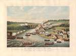
 - The Battle of Queenston Heights, October 13, 1913
 An ink print created after James Dennis's drawing of the Battle of Queenston Heights. The Battle of Queenston Heights by eyewitness James B. Dennis depicts the unsuccessful American landing on 13 October 1812. The village of Queenston is in the right foreground, with Queenston Heights behind. Lewiston is in the …
  An ink print created after James Dennis's drawing of the Battle of Queenston Heights. The Battle of Queenston Heights by eyewitness James B. Dennis depicts the unsuccessful American landing on …

