Résultats
Nous avons trouvé 7845 éléments semblables.


- Ear Falls Generating Station
 Photo shows the emergency exit at the Ear Falls Generating Station, September 12, 1942.
  Photo shows the emergency exit at the Ear Falls Generating Station, September 12, 1942.Ear Falls Public Library
 - Ear Falls Generating Station
 Photo of the emergency exit, Lac Seul/Ear Falls generating station, September 12, 1942.
  Photo of the emergency exit, Lac Seul/Ear Falls generating station, September 12, 1942.Ear Falls Public Library
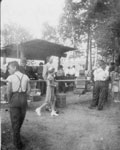
 - Eagle Lake Picnic Booth, July 1, 1942
 Black and white photograph of a booth near the tree line. There are crates in front of the booth. There are people beginning to line up. The line goes out of the picture.
  Black and white photograph of a booth near the tree line. There are crates in front of the booth. There are people beginning to line up. The line goes out …South River - Machar Union PL
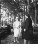
 - Eagle Lake Picnic - Three Ladies, July 1, 1942
 Black and white photograph of three women standing on stone near picnic tables in the woods. A child can be seen standing near an adult on one of the picnic tables.
  Black and white photograph of three women standing on stone near picnic tables in the woods. A child can be seen standing near an adult on one of the picnic …South River - Machar Union PL
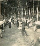
 - Eagle Lake Picnic, July 1, 1942
 In background is a group of people mingling at the Eagle Lake Picnic, and in the foreground is the front end of a truck. The picnic is outside with the edge of the forest in the background.
  In background is a group of people mingling at the Eagle Lake Picnic, and in the foreground is the front end of a truck. The picnic is outside with the …South River - Machar Union PL
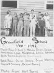
 - Greenfield School S.S. #3
 (Condition: Good.) Front Row (l to r): Marion Grier, Ernie Moorhead, Lloyd Moorhead, Leslie Webster, Keith Burns, Paul Burns. Back Row: Calvin Steacy, Bryce Warren, Russell Steacy, Bessy Burns.
  (Condition: Good.) Front Row (l to r): Marion Grier, Ernie Moorhead, Lloyd Moorhead, Leslie Webster, Keith Burns, Paul Burns. Back Row: Calvin Steacy, Bryce Warren, Russell Steacy, Bessy Burns.Leeds & Thousand Islands Public Library
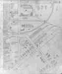
 - Fire Insurance Map 1942, Map 16
 Fire Insurance map from 1942 of north central Waterloo in two sections, along Albert Street from Dearborn (later University Avenue) to North (later Columbia) Street, considered the city limits; and along King Street from Schneider's Road (later University Avenue) to North (later Columbia Street). Also shown is Hill Street at …
  Fire Insurance map from 1942 of north central Waterloo in two sections, along Albert Street from Dearborn (later University Avenue) to North (later Columbia) Street, considered the city limits; and …Waterloo Public Library
 - Fire Insurance Map 1942, Map 5
 Fire Insurance map from 1942 of the southeast business district of Waterloo, Erb Street to the north, George Street to the south, King Street to the west and Willow Street (not visible) to the east. Some of the businesses visible on the map include: L.J. Klopp, Dry Goods; Rennel Drugs; …
  Fire Insurance map from 1942 of the southeast business district of Waterloo, Erb Street to the north, George Street to the south, King Street to the west and Willow Street …Waterloo Public Library
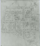
 - Fire Insurance Map 1942, Map 6
 Earl Street became Severn Avenue. Fischer Street became Belmont Avenue. Victoria Street became Avondale Avenue.
  Earl Street became Severn Avenue. Fischer Street became Belmont Avenue. Victoria Street became Avondale Avenue.Waterloo Public Library
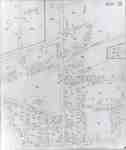
 - Fire Insurance Map 1942, Map 13
 1946, 1951 and 1956 show a service station and White Rose Inn and restaurant at 188 King north. Unclear if the service station and inn were jointly owned or two separate businesses. Main Street became Lodge Street. Schneider's Road became University Avenue at King Street. Snider Street became Fountain Street. …
  1946, 1951 and 1956 show a service station and White Rose Inn and restaurant at 188 King north. Unclear if the service station and inn were jointly owned or two …Waterloo Public Library
 - Fire Insurance Map 1942, Map 14
 Fire Insurance map from 1942 of a northwest section of of Waterloo, Erb Street between McDougall Avenue and Amos Avenue. A separate section showing Bridgeport Road and Margaret Avenue is included.
  Fire Insurance map from 1942 of a northwest section of of Waterloo, Erb Street between McDougall Avenue and Amos Avenue. A separate section showing Bridgeport Road and Margaret Avenue is …Waterloo Public Library
 - Fire Insurance Map 1942, Map 15
 Victoria Street became Avondale Avenue. Shantz Street became Canbar Avenue and no longer exists. Knox Avenue no longer exists. Elizabeth Street became Beverley Street. Rudy Street became Roslin Avenue. Charles Street became Dunbar Avenue.
  Victoria Street became Avondale Avenue. Shantz Street became Canbar Avenue and no longer exists. Knox Avenue no longer exists. Elizabeth Street became Beverley Street. Rudy Street became Roslin Avenue. Charles …Waterloo Public Library
 - Thessalon Red Cross Hospital, 1942
 The official opening of the hospital was on May 12, 1942. All services having to do with patient care were located on the main floor. Living quarters were all on the upper floor. Funds to help make the new hospital possible were presented by Ontario Hydro in the amount of …
  The official opening of the hospital was on May 12, 1942. All services having to do with patient care were located on the main floor. Living quarters were all on …Thessalon Union Public Library
 - Allan King in Uniform, circa 1940

 This photo can be found in the Tweedsmuir History created by the Sunnyside Women's Institute.
 This photo can be found in the Tweedsmuir History created by the Sunnyside Women's Institute.Thessalon Union Public Library
 - Elwood Seabrook, in Uniform, circa 1940

 This photo can be found in the Tweedsmuir History created by the Sunnyside Women's Institute.
 This photo can be found in the Tweedsmuir History created by the Sunnyside Women's Institute.Thessalon Union Public Library
 - Whitby Collegiate Institute Cadets on Parade, 1942
 Whitby Collegiate Institute was built in 1873 and was located on the south side of Colborne Street between King and Centre Streets. The school was demolished in 1975-1976.
  Whitby Collegiate Institute was built in 1873 and was located on the south side of Colborne Street between King and Centre Streets. The school was demolished in 1975-1976.Whitby Public Library
 - Group of Cadets, 1942
 Whitby Collegiate Institute was built in 1873 and was located on the south side of Colborne Street between King and Centre Streets. The school was demolished in 1975-1976.
  Whitby Collegiate Institute was built in 1873 and was located on the south side of Colborne Street between King and Centre Streets. The school was demolished in 1975-1976.Whitby Public Library
 - King Street School Grade Eight Class, 1942-1943
 King Street School was built in 1921 on the block bounded by King, Dunlop, Henry, and Gilbert Streets. It was built to replace Henry Street School which burned down in 1920. In 1979 it was renamed R.A. Sennett Public School in honour of its first principal who served from 1921-1952.
  King Street School was built in 1921 on the block bounded by King, Dunlop, Henry, and Gilbert Streets. It was built to replace Henry Street School which burned down in …Whitby Public Library
 - Seibers Lumber Mill, 1942

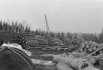
 Black and white photograph of the Seibere Mill log dump. There are four stacks of logs and a crane in front of one of the stacks. In the lower left corner is the back of a horse in a harness. There is forest off in the distance.
 Black and white photograph of the Seibere Mill log dump. There are four stacks of logs and a crane in front of one of the stacks. In the lower left …Sundridge - Strong Union PL
 - Union School Section Number Four Class, 1942
 Union School Section Number Four was located on Base Line in East Whitby Township.
  Union School Section Number Four was located on Base Line in East Whitby Township.Whitby Public Library


