Résultats
Nous avons trouvé 1205 éléments semblables.


- Rutherglen Women's Institute Archives
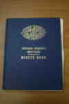
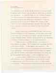
 Transcription of hand-written text: Minutes of Regular Monthly, Executive and Directors’ Meetings Oct.17/78 The Oct. meeting was held at the home of Mrs. Kochut. Ten members were present with one new member joining, Mrs. Rita Kunkel. The meeting was opened with the Ode and Mary Stewart Collect. The Sept. minutes …
  Transcription of hand-written text: Minutes of Regular Monthly, Executive and Directors’ Meetings Oct.17/78 The Oct. meeting was held at the home of Mrs. Kochut. Ten members were present with one …Bonfield Public Library
 - Rutherglen Women's Institute Archives
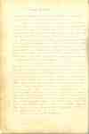
 Transcription of hand-written text: INSIDE COVER The 4-H Pledge is I Pledge- My Head to clearer thinking My Heart to greater loyalty My Hands to larger service My Health to better living for my Club, my community and my country. (end of entry) PAGE 1 Garden Club 1st Meeting The …
  Transcription of hand-written text: INSIDE COVER The 4-H Pledge is I Pledge- My Head to clearer thinking My Heart to greater loyalty My Hands to larger service My Health to …Bonfield Public Library
 - Floor and Foundation plans of Bandshell in Victoria Park
 Floor and Foundation plans of Bandshell in Victoria Park Source: P. Climo Acquired: June 22, 1987
  Floor and Foundation plans of Bandshell in Victoria Park Source: P. Climo Acquired: June 22, 1987Cobourg Public Library
 - Engineer’s Report to the Band stand Committee and to The Board of Park Management
 Engineer’s Report to the Band stand Committee and to The Board of Park Management Source: P. Climo Acquired: June 22, 1987
  Engineer’s Report to the Band stand Committee and to The Board of Park Management Source: P. Climo Acquired: June 22, 1987Cobourg Public Library
 - Wade Papers
 Wade Papers Source: The Toronto Archives Acquired: December 18, 1992
  Wade Papers Source: The Toronto Archives Acquired: December 18, 1992Cobourg Public Library
 - Pioneer Settlers on the Lake Ontario Strand: The Wade Letters(1819-67)
 Pioneer Settlers on the Lake Ontario Strand: The Wade Letters(1819-67) Source: Unknown Acquired: February 2008
  Pioneer Settlers on the Lake Ontario Strand: The Wade Letters(1819-67) Source: Unknown Acquired: February 2008Cobourg Public Library
 - Letter to the Editor at The Cobourg Daily Star
 Letter to the Editor at The Cobourg Daily Star Source: Unknown Acquired: January 14, 1991
  Letter to the Editor at The Cobourg Daily Star Source: Unknown Acquired: January 14, 1991Cobourg Public Library
 - Indenture between Archibald Waldie and Lydia Mabel Waldie
 Indenture between Archibald Waldie and Lydia Mabel Waldie Source: Unknown Acquired: July 3, 1991
  Indenture between Archibald Waldie and Lydia Mabel Waldie Source: Unknown Acquired: July 3, 1991Cobourg Public Library
 - Agreement between Robert Waldie and Harrison George
 Agreement between Robert Waldie and Harrison George Source: Unknown Acquired: July 3, 1991
  Agreement between Robert Waldie and Harrison George Source: Unknown Acquired: July 3, 1991Cobourg Public Library
 - A copy of the estate of George Waldie
 A copy of the estate of George Waldie Source: Unknown Acquired: July 3, 1991
  A copy of the estate of George Waldie Source: Unknown Acquired: July 3, 1991Cobourg Public Library
 - Deed of Land from Maude Carruthers to Isabella C. Montgomery
 Deed of Land from Maude Carruthers to Isabella C. Montgomery Source: Unknown Acquired: July 3, 1991
  Deed of Land from Maude Carruthers to Isabella C. Montgomery Source: Unknown Acquired: July 3, 1991Cobourg Public Library
 - Welland Canal Survey of Lands James Gordon
 Survey map and description of James Gordon's land created by The Welland Canal Company. Included is a written description of the land along with a drawing of the land. The map contains a large pond and notes the seperation between lots 20 and 21. No scale is noted, but chains …
  Survey map and description of James Gordon's land created by The Welland Canal Company. Included is a written description of the land along with a drawing of the land. The …Brock University Archives
 - Welland Canal Survey of Lands William May Jr., 1826
 Survey map and description of William May Jr.'s land created by The Welland Canal Company. Included is a written description of the land along with a drawing of the land. The land is described as having 2 good acres and the rest being swamp. The property borders 12 mile creek …
  Survey map and description of William May Jr.'s land created by The Welland Canal Company. Included is a written description of the land along with a drawing of the land. …Brock University Archives
 - Welland Canal Survey of Lands Peter May, 1826
 Survey map and description of Peter May's land created by The Welland Canal Company. Included is a written description of the land along with a drawing of the land. Noteable features include; a large pond, the original bed of the 12 Mile Creek. Surveyor notes are seen in pencil on …
  Survey map and description of Peter May's land created by The Welland Canal Company. Included is a written description of the land along with a drawing of the land. Noteable …Brock University Archives
 - Welland Canal Survey of Lands Christian May, 1831
 Updated survey description of William May's land created by The Welland Canal Company. The land is now in the posession of Christian May as he was the heir for the property. The drawing for the property is the same drawing that goes with Peter May's land. It is marked as …
  Updated survey description of William May's land created by The Welland Canal Company. The land is now in the posession of Christian May as he was the heir for the …Brock University Archives
 - Welland Canal Survey of Lands Robert Brown, 1827
 Survey map and description of Robert Brown's land created by The Welland Canal Company. Included is a two page written description of the land along with a drawing of the land. Noteable features include; line between Grantham and Louth townships, bed of the 12 mile creek. Surveyor notes are seen …
  Survey map and description of Robert Brown's land created by The Welland Canal Company. Included is a two page written description of the land along with a drawing of the …Brock University Archives
 - Welland Canal Survey of Lands Robert Brown 1827, land description #2
 Survey map and description of Robert Brown's land created by The Welland Canal Company. Included is a two page written description of the land along with a drawing of the land. Noteable features include; line between Grantham and Louth townships, bed of the 12 mile creek. Surveyor notes are seen …
  Survey map and description of Robert Brown's land created by The Welland Canal Company. Included is a two page written description of the land along with a drawing of the …Brock University Archives
 - Welland Canal Survey of Lands John Martindale
 Survey map and description of John Martindale's land created by The Welland Canal Company. Included is a written description of the land along with a drawing of the land. Noteable features include; property line between Martindale and Tenbroeck properties, original bed of 12 mile creek, tpw path diagram for the …
  Survey map and description of John Martindale's land created by The Welland Canal Company. Included is a written description of the land along with a drawing of the land. Noteable …Brock University Archives
 - Welland Canal Survey of Lands Jacob Tenbroeck, 1828
 Survey map and description of Jacob TenBrock's land created by The Welland Canal Company. Included is a written description of the land along with a drawing of the land. Noteable features include; tow path, 12 mile creek, property line between Peter May and Jacob Tenbroeck. The land includes part of …
  Survey map and description of Jacob TenBrock's land created by The Welland Canal Company. Included is a written description of the land along with a drawing of the land. Noteable …Brock University Archives
 - John R. Tenbroeck, 1828
 Survey map and description of John R. Tenbroeck's land created by The Welland Canal Company. Included is a written description of the land along with a drawing of the land. Noteable features include; the canal, bank of 12 mile creek. Surveyor notes are seen in pencil on the map. The …
  Survey map and description of John R. Tenbroeck's land created by The Welland Canal Company. Included is a written description of the land along with a drawing of the land. …Brock University Archives

