Résultats
Nous avons trouvé 2720 éléments semblables.


- Transfer Plan of part of a Highway (Route No.2) in the Village of Colborne, 4 September 1959

 Village of Colborne, Concessions 1 & 2; Lot 31 & Lots 26-31 - Registered plan of village of Colborne - 1 inch=200 feet. Also includes an identification plan of the Township of Cramahe - Scale: 1 inch=i mile
 Village of Colborne, Concessions 1 & 2; Lot 31 & Lots 26-31 - Registered plan of village of Colborne - 1 inch=200 feet. Also includes an identification plan of the …Cramahe Township Public Library
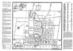
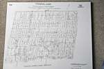
 - Oakville Town Map, 1948

 This map was sent to Mr. Stuart Wark and has been kept in the original envelope. To see the envelope, either click on the map image or open up "Page 2".
 This map was sent to Mr. Stuart Wark and has been kept in the original envelope. To see the envelope, either click on the map image or open up "Page …Trafalgar Township Historical Society
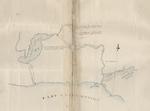
 - Map of the North Shore of Lake Ontario, the Trent River, and Rice Lake, 1792

 Catalogued by Toronto Public Library Digital Archive and downloaded from their site. See external link to the right of this record to access the original source of this map. Map of the North Shore of Lake Ontario, the Trent River, and Rice Lake Collins, John, d.1795 Map, 1792, English Notes …
 Catalogued by Toronto Public Library Digital Archive and downloaded from their site. See external link to the right of this record to access the original source of this map. Map …Cramahe Township Public Library
 - Cramahe Township map detail, A map of the province of Upper Canada describing all the settlements and townships &c. with the countries adjacent from Quebec to Lake Huron, 1818

 A screenshot of this map was taken to illustrate Cramahe Township.
 A screenshot of this map was taken to illustrate Cramahe Township.Cramahe Township Public Library
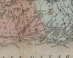
 - Cramahe Township map detail, Upper Canada, Tanner's Universal Atlas, 1836

 A detail of the original map was taken to illustrate the location identified as Colborne.
 A detail of the original map was taken to illustrate the location identified as Colborne.Cramahe Township Public Library
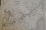
 - Maps of Upper Canada, North America & Europe in 1846

 These maps are taken from the Atlas published in 1846 by W. E. Chambers & Sons, Edinburgh.
 These maps are taken from the Atlas published in 1846 by W. E. Chambers & Sons, Edinburgh.Trafalgar Township Historical Society
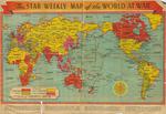
 - The Star Weekly Map of the World at War, 1944

 This is a map that was published in The Star Weekly, Toronto newspaper. The map was published on December 23, 1944 and shows the land that was occupied by the Allies and Axis powers, as well as the land that belonged to the British Empire and neutral countries. The map …
 This is a map that was published in The Star Weekly, Toronto newspaper. The map was published on December 23, 1944 and shows the land that was occupied by the …Waterloo Public Library
 - 1904 Map of the County of Halton, Showing Proposed County Good Roads System, Marked in Red

 Thank you to Halton Region, Heritage Services for this colour scan of the full map.
 Thank you to Halton Region, Heritage Services for this colour scan of the full map.Trafalgar Township Historical Society
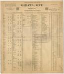
 - LHM043 Insurance Plan of the City of Oshawa, Ontario

 First page of the 1948 fire insurance plan for Oshawa.
 First page of the 1948 fire insurance plan for Oshawa.Oshawa Public Libraries
 - Hand drawn map of acreage and boundary line between Haldimand and Cramahe, 1903

 Hand drawn map outlining acreage owned by several families.
 Hand drawn map outlining acreage owned by several families.Cramahe Township Public Library
 - 1806 Trafalgar Township Map


 This copy of the Wilmot survey map of Trafalgar Township was photographed from a wonderful display copy. It looks like Mr. Wilmot signed his name, "Sam L. Wilmot", but it is actually "Sam S. Wilmot".

 This copy of the Wilmot survey map of Trafalgar Township was photographed from a wonderful display copy. It looks like Mr. Wilmot signed his name, "Sam L. Wilmot", but it …Trafalgar Township Historical Society
 - Transfer Plan of part of a Highway (Route No.2) in the Village of Colborne, 26 August 1959

 Village of Colborne, Concession 2 Lot 31 & Lot 32 - Registered plan of village of Colborne - 1 inch=200 feet. Also includes an identification plan of the Township of Cramahe - Scale: 1 inch=1 mile
 Village of Colborne, Concession 2 Lot 31 & Lot 32 - Registered plan of village of Colborne - 1 inch=200 feet. Also includes an identification plan of the Township of …Cramahe Township Public Library
 - Land Plan of part of Lot 27, Conc.1 & 2 and part of Lots 210 and 211, 2 February 1955

 Land Plan of part of Lot 27, Conc.1 & 2 and part of Lots 210 and 211, Plan of village of Colborne
 Land Plan of part of Lot 27, Conc.1 & 2 and part of Lots 210 and 211, Plan of village of ColborneCramahe Township Public Library
 - Plan to illustrate description of part of Lot 180 Registered Plan of the Village of Colborne, March 1952

 Land Plan of part of Lot 30, Conc. 2, Plan of village of Colborne, the Director, the Veterans' Land Act
 Land Plan of part of Lot 30, Conc. 2, Plan of village of Colborne, the Director, the Veterans' Land ActCramahe Township Public Library
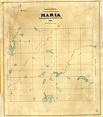
 - Maria Township ca. 1886


 Early surveyors, like William E. Logan, used Rochon micrometer telescopes and targets (disk on a calibrated pole) to measure distance. Each microscope had a different calibration and therefore a different range. The instruments were calibrated against a distance measured with a surveyors chain (also known as Gunter’s chain). One chain …

 Early surveyors, like William E. Logan, used Rochon micrometer telescopes and targets (disk on a calibrated pole) to measure distance. Each microscope had a different calibration and therefore a different …Head, Clara and Maria Public Library
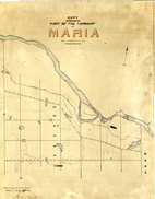
 - Maria Township ca. 1866


 Early surveyors, like William E. Logan, used Rochon micrometer telescopes and targets (disk on a calibrated pole) to measure distance. Each microscope had a different calibration and therefore a different range. The instruments were calibrated against a distance measured with a surveyors chain (also known as Gunter’s chain). One chain …

 Early surveyors, like William E. Logan, used Rochon micrometer telescopes and targets (disk on a calibrated pole) to measure distance. Each microscope had a different calibration and therefore a different …Head, Clara and Maria Public Library
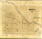
 - Maria Township ca.1869


 Early surveyors, like William E. Logan, used Rochon micrometer telescopes and targets (disk on a calibrated pole) to measure distance. Each microscope had a different calibration and therefore a different range. The instruments were calibrated against a distance measured with a surveyors chain (also known as Gunter’s chain). One chain …

 Early surveyors, like William E. Logan, used Rochon micrometer telescopes and targets (disk on a calibrated pole) to measure distance. Each microscope had a different calibration and therefore a different …Head, Clara and Maria Public Library
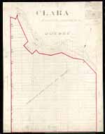
 - Clara Township Map ca.1885


 Early surveyors, like William E. Logan, used Rochon micrometer telescopes and targets (disk on a calibrated pole) to measure distance. Each microscope had a different calibration and therefore a different range. The instruments were calibrated against a distance measured with a surveyors chain (also known as Gunter’s chain). One chain …

 Early surveyors, like William E. Logan, used Rochon micrometer telescopes and targets (disk on a calibrated pole) to measure distance. Each microscope had a different calibration and therefore a different …Head, Clara and Maria Public Library
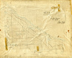
 - Head Township ca.1859


 Early surveyors, like William E. Logan, used Rochon micrometer telescopes and targets (disk on a calibrated pole) to measure distance. Each microscope had a different calibration and therefore a different range. The instruments were calibrated against a distance measured with a surveyors chain (also known as Gunter’s chain). One chain …

 Early surveyors, like William E. Logan, used Rochon micrometer telescopes and targets (disk on a calibrated pole) to measure distance. Each microscope had a different calibration and therefore a different …Head, Clara and Maria Public Library
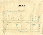
 - Map of Head Township


 Early surveyors, like William E. Logan, used Rochon micrometer telescopes and targets (disk on a calibrated pole) to measure distance. Each microscope had a different calibration and therefore a different range. The instruments were calibrated against a distance measured with a surveyors chain (also known as Gunter’s chain). One chain …

 Early surveyors, like William E. Logan, used Rochon micrometer telescopes and targets (disk on a calibrated pole) to measure distance. Each microscope had a different calibration and therefore a different …Head, Clara and Maria Public Library


