Résultats
Nous avons trouvé 4 éléments semblables.


Page 1 de 1
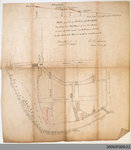
- Plan of the Burford Station Yard, 1890
 This 1890 plan shows the Burford Station Yard. It was prepared by Joseph Hobson, Chief Engineer of the Grand Trunk Railway Drawing Office in Hamilton. The station yard was located on Lots 4 and 5 of Concession 7, with Burford Road running through the tracks. This picture is Zoomify enabled! …
  This 1890 plan shows the Burford Station Yard. It was prepared by Joseph Hobson, Chief Engineer of the Grand Trunk Railway Drawing Office in Hamilton. The station yard was located …County of Brant Public Library
 - Brantford, Norfolk & Port Burwell Railway Profile of Burford Township, 1880
 This 1880 plan was prepared by the Brantford, Norfolk and Port Burwell Railway as an overview of Burford Township, possibly with the intent of preparing a railway line. It begins at the Brantford/Burford townline and continues through the entirety of Burford Township to the Burford/North Norwich townline. This picture is …
  This 1880 plan was prepared by the Brantford, Norfolk and Port Burwell Railway as an overview of Burford Township, possibly with the intent of preparing a railway line. It begins …County of Brant Public Library
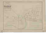
 - Plan of the Town of Paris, 1847

 This is the earliest existing town plan of Paris, which was created in 1847 by F. Herbst based on a survey by Thomas Allchin, the deputy provincial surveyor. The earliest town plan was prepared by Lewis Burwell, but no copies are known to exist. The plan shows all of the …
 This is the earliest existing town plan of Paris, which was created in 1847 by F. Herbst based on a survey by Thomas Allchin, the deputy provincial surveyor. The earliest …County of Brant Public Library
 - Plan of Paris showing the Nith River Area, 1869
 This item was digitized on November 14th, 2009, during a Digitization Days event at the Paris Branch of the County of Brant Public Library.
  This item was digitized on November 14th, 2009, during a Digitization Days event at the Paris Branch of the County of Brant Public Library.County of Brant Public Library
Page 1 de 1


