Résultats
Nous avons trouvé 2726 éléments semblables.


- Tweedsmuir Histories

 Federated Women's Institutes of Ontario
 - Maps

 Group of all digitized maps from the Ellis Little Local History Room.
 Group of all digitized maps from the Ellis Little Local History Room.Waterloo Public Library
 - Fire Insurance Map, 1942


 Waterloo Public Library
 - Oshawa Map Index


 This group includes information for all maps held in the Local History Room at the McLaughlin Branch of the Oshawa Public Library.

 This group includes information for all maps held in the Local History Room at the McLaughlin Branch of the Oshawa Public Library.Oshawa Public Libraries
 - Tweedsmuir Histories


 Milton Public Library
 - Little Britain Exhibit Group


 Synopsis of the life and times of Dr. George Wesley Hall and his son Dr. George C.R. Hall.

 Synopsis of the life and times of Dr. George Wesley Hall and his son Dr. George C.R. Hall.Kawartha Lakes Public Library
 - Nelson Tweedsmuir Histories


 Burlington Public Library
 - Lutheran Church of Our Saviour (Owen Sound, Ont.)
 This group contains photographs and programs of the Lutheran Church of Our Saviour in Owen Sound, Ontario, a congregation of the Eastern Synod of the Evangelical Lutheran Church in Canada.
  This group contains photographs and programs of the Lutheran Church of Our Saviour in Owen Sound, Ontario, a congregation of the Eastern Synod of the Evangelical Lutheran Church in Canada.Wilfrid Laurier University Library
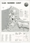
 - Map of Glen Bernard Camp, circa 1985
 Black and white map of Glen Bernard Camp. The camp is near Sundridge Ontario. The map is on the top half of the image. In the lower half of the image is a legend and scale.
  Black and white map of Glen Bernard Camp. The camp is near Sundridge Ontario. The map is on the top half of the image. In the lower half of the …Sundridge - Strong Union PL
 - "Plan of Part of the Niagara Frontier Showing the Communications from Thence to the 15 Mile Creek July 1814"
 This photograph of a plan is titled “Plan of Part of the Niagara Frontier Showing the Communications from Thence to the 15 Mile Creek July 1814”. It was obtained by the Museum from the “National Archives of Canada, Cartographic and Architectural Archives Division” with the call number NMC-21586. It shows …
  This photograph of a plan is titled “Plan of Part of the Niagara Frontier Showing the Communications from Thence to the 15 Mile Creek July 1814”. It was obtained by …
 - Diagram Explaining Where Sir Isaac Brock fell in Queenston
 This document is a diagram with explanations of the place where Sir Isaac Brock fell according to some who claim to have witness the event.
  This document is a diagram with explanations of the place where Sir Isaac Brock fell according to some who claim to have witness the event.
 - The Village of Sundridge, Kent, England

 A replica map of Sundridge, Kent England in 1640. The map is accompanied by a two page history of Sundridge, Kent, England. The history goes into the origins of the British Sundridge, what the area is like today, the history of the church in the area, and the impact of …
 A replica map of Sundridge, Kent England in 1640. The map is accompanied by a two page history of Sundridge, Kent, England. The history goes into the origins of the …Sundridge - Strong Union PL
 - Land holding map for Thessalon area, 1966


 The map does not include a scale. This map and legend can be found in the Tweedsmuir History created by the Princess Elizabeth Women's Institute.

 The map does not include a scale. This map and legend can be found in the Tweedsmuir History created by the Princess Elizabeth Women's Institute.Thessalon Union Public Library
 - 1876 Plan of the Town of Paris

 This 1876 town map shows Paris as it was at the time. The lots are numbered individually. A number of notable town landmarks are indicated, with the key in the lower centre of the map.
 This 1876 town map shows Paris as it was at the time. The lots are numbered individually. A number of notable town landmarks are indicated, with the key in the …County of Brant Public Library
 - Map of the Town of Paris, 1932

 Pages 2 through 4 of this map appear to have been cropped from an originally larger map, and cut off abruptly at the edges.
 Pages 2 through 4 of this map appear to have been cropped from an originally larger map, and cut off abruptly at the edges.County of Brant Public Library
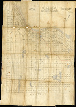
 - Plan of the township of Clara, Renfrew County
ca. 1888

 The Map came from Andre Boissonneault, a contractor. The map is hand written on an oil cloth, and covers a total area of 63922 (unit of measure unknown). Early surveyors, like William E. Logan, used Rochon micrometer telescopes and targets (disk on a calibrated pole) to measure distance. Each microscope …
 The Map came from Andre Boissonneault, a contractor. The map is hand written on an oil cloth, and covers a total area of 63922 (unit of measure unknown). Early surveyors, …Head, Clara and Maria Public Library
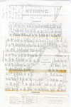
 - Map of Strong Township, 1942

 A map of Strong Township, produced in 1942. It shows the division of property in Strong Township and names of the land owners. Lake Bernard is near the center of the township. There is a legend at the bottom of the map. Machar Township borders on the north, Chapman on …
 A map of Strong Township, produced in 1942. It shows the division of property in Strong Township and names of the land owners. Lake Bernard is near the center of …Sundridge - Strong Union PL
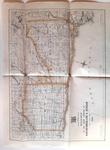
 - Road Map of United Counties of Northumberland and Durham. Dated 1928.

 Road Map of United Counties of Northumberland and Durham. Dated 1928.
 Road Map of United Counties of Northumberland and Durham. Dated 1928.Cobourg Museum Foundation
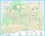
 - Oakville Community Map 2018


 Oakville Public Library
 - Oakville Cycleways Map 2018

 ...
... 
 ...Oakville Public Library

