Résultats
Nous avons trouvé 137 éléments semblables.


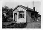
- Scott's Dairy

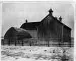
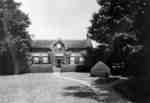
 Scott's Dairy was operated by Herman Scott from the late 1920s to the late 1930s. It was located on the north side of Kingston Road/Highway 2, east of the brick house at the north-west corner of Kingston Road/Highway 2 and Scott Street. It was converted into a house in the …
 Scott's Dairy was operated by Herman Scott from the late 1920s to the late 1930s. It was located on the north side of Kingston Road/Highway 2, east of the brick …Whitby Public Library
 - Thornton's Corners

 This view is looking east from the residence of Peter Lofthouse which was located on the top of the hill on the south side of Kingston Road (Highway 2) at the west side of the valley where the Whitby-East Whitby border was located.
 This view is looking east from the residence of Peter Lofthouse which was located on the top of the hill on the south side of Kingston Road (Highway 2) at …Whitby Public Library
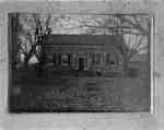
 - Residence of Sylvester Lynde

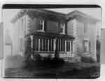
 The stone house was located on lot 30 on the north side of Rossland Road (Concession 3)and east of McQuay Blvd. (D'Hilliar Street) in Whitby Township. It was built in the 1840s or 1850s for Sylvester Lynde (1800-1883), a son of Jabez Lynde. The house was destroyed by fire on …
 The stone house was located on lot 30 on the north side of Rossland Road (Concession 3)and east of McQuay Blvd. (D'Hilliar Street) in Whitby Township. It was built in …Whitby Public Library
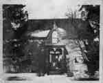
 - Ruins of Sylvester Lynde Residence

 The stone house was located on lot 30 on the north side of Rossland Road (Concession 3)and east of McQuay Blvd. (D'Hilliar Street) in Whitby Township. It was built in the 1840s or 1850s for Sylvester Lynde (1800-1883), a son of Jabez Lynde. The house was destroyed by fire on …
 The stone house was located on lot 30 on the north side of Rossland Road (Concession 3)and east of McQuay Blvd. (D'Hilliar Street) in Whitby Township. It was built in …Whitby Public Library
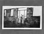
 - Mildmay Camp 1943

 Mildmay Camp was an Anglican Church camp located on the shore of Lake Ontario, west of the Cranberry Marsh. It operated from the 1920s to the 1960s.
 Mildmay Camp was an Anglican Church camp located on the shore of Lake Ontario, west of the Cranberry Marsh. It operated from the 1920s to the 1960s.Whitby Public Library
 - Scott's Dairy

 Scott's Dairy was operated by Herman Scott from the late 1920s to the late 1930s. It was located on the north side of Kingston Road/Highway 2, east of the brick house at the north-west corner of Kingston Road/Highway 2 and Scott Street. It was converted into a house in the …
 Scott's Dairy was operated by Herman Scott from the late 1920s to the late 1930s. It was located on the north side of Kingston Road/Highway 2, east of the brick …Whitby Public Library
 - Home of Joshua Crawforth

 This farmhouse was built about 1850 by Joshua Crawforth, on lot 20 of Thickson Road (Concession 1) on the north side of Victoria Street (Base Line)in Whitby Township. It was likely demolished about 1939 when Highway 401 was built through the Crawforth farm.
 This farmhouse was built about 1850 by Joshua Crawforth, on lot 20 of Thickson Road (Concession 1) on the north side of Victoria Street (Base Line)in Whitby Township. It was …Whitby Public Library
 - Barns at Joshua Crawforth Farm

 These barns, part of the Joshua Crawforth farm, were located on the north side of Victoria Street (Base Line) on lot 20 of Thickson Road (Concession 1) in Whitby Township. They were moved about 1939 for construction of Highway 401 and were later demolished.
 These barns, part of the Joshua Crawforth farm, were located on the north side of Victoria Street (Base Line) on lot 20 of Thickson Road (Concession 1) in Whitby Township. …Whitby Public Library
 - John Allin Farmhouse

 This brick house was built for John Allin before 1877 on lot 23 of Broken Front Concession in Whitby Township. It was demolished in 1980.
 This brick house was built for John Allin before 1877 on lot 23 of Broken Front Concession in Whitby Township. It was demolished in 1980.Whitby Public Library
 - John Allin Farmhouse

 This brick farmhouse was built for John Allin before 1877 on lot 23 of Broken Front Concession in Whitby Township. It was demolished in 1980.
 This brick farmhouse was built for John Allin before 1877 on lot 23 of Broken Front Concession in Whitby Township. It was demolished in 1980.Whitby Public Library
 - Residence of Sylvester Lynde

 This stone house was located on lot 30 on the north side of Concession 3 (Rossland Road) east of McQuay Blvd (D'Hilliar Street) in Whitby Township. It was built in the 1840s or 1850s for Sylvester Lynde (1800-1883), a son of Jabez Lynde. The house was destroyed by fire on …
 This stone house was located on lot 30 on the north side of Concession 3 (Rossland Road) east of McQuay Blvd (D'Hilliar Street) in Whitby Township. It was built in …Whitby Public Library
 - Residence of John Dryden

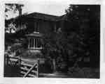
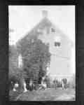
 This brick house was built in 1835 on lot 20 of Concession 7 in Whitby Township. It was located on the north side of the the 7th Concession, east of Thickson Road. A second story was added to the house in 1926. It was the residence of James Dryden (1806-1881), …
 This brick house was built in 1835 on lot 20 of Concession 7 in Whitby Township. It was located on the north side of the the 7th Concession, east of …Whitby Public Library
 - Driving First Spike for Toronto and Eastern Railway

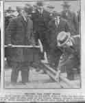
 Toronto Daily Star (1892-1971), 31 October 1923 The Toronto and Eastern Railway was built along Mary Street starting in 1913. Work was suspended during the First World War and resumed in 1923. The railway was never completed and the rails were torn up in 1927. It was intended to be a commuter railway from Toronto to Oshawa.
 Toronto Daily Star (1892-1971), 31 October 1923 The Toronto and Eastern Railway was built along Mary Street starting in 1913. Work was suspended during the First World War and resumed in 1923. The railway was never completed …Whitby Public Library
 - "The Name is Thunder Bay"
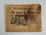
 Condition: Good
  Condition: GoodSchreiber Heritage & Tourism Committee
 - Residence of Charles Lynde

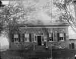
 This brick farmhouse was located on lot 32 of Concession 4 on the east side of Coronation Road in Whitby Township. It was called Maple Dell Farm.
 This brick farmhouse was located on lot 32 of Concession 4 on the east side of Coronation Road in Whitby Township. It was called Maple Dell Farm.Whitby Public Library
 - Residence of Charles Lynde

 This home was built on lot 32 of Concession 4 in Whitby Township. It was replaced with a brick house around 1867.
 This home was built on lot 32 of Concession 4 in Whitby Township. It was replaced with a brick house around 1867.Whitby Public Library
 - Residence of Jeremiah Lick

 This stone farmhouse was built by the Pearson family of Ashburn for Jeremiah Lick in 1884. It is located on lot 20 on the south side Concession 1 (Highway 2) between Kendalwood Road and Thickson Road. Since the 1950s it has been a nursing home and is the current location …
 This stone farmhouse was built by the Pearson family of Ashburn for Jeremiah Lick in 1884. It is located on lot 20 on the south side Concession 1 (Highway 2) …Whitby Public Library
 - Residence of Charles Kempthorne

 The Charles Kempthorne Residence was located at the south-east corner of Highway 2 and the Whitby-Pickering town line. It was part of the community of Almonds. The house was demolished in March 1969. Charles Kempthorne was a blacksmith at Almonds.
 The Charles Kempthorne Residence was located at the south-east corner of Highway 2 and the Whitby-Pickering town line. It was part of the community of Almonds. The house was demolished …Whitby Public Library
 - Residence of John Allin

 The residence of John Allin was on the west side of Hopkins Street north of the Grand Trunk Railway (Canadian National Railway) on lot 23 of Broken Front Concession in Whitby Township. The house was built before 1877 and demolished in 1980.
 The residence of John Allin was on the west side of Hopkins Street north of the Grand Trunk Railway (Canadian National Railway) on lot 23 of Broken Front Concession in …Whitby Public Library
 - Barn on John Allin's Farm

 This barn on the John Allin farm was on the west side of Hopkins Street north of the Grand Trunk Railway (Canadian National Railway) on lot 23 of Broken Front Concession in Whitby Township. The barn has since been demolished.
 This barn on the John Allin farm was on the west side of Hopkins Street north of the Grand Trunk Railway (Canadian National Railway) on lot 23 of Broken Front …Whitby Public Library


