Résultats
Nous avons trouvé 62 éléments semblables.


- Pickering College
 Photocopy of a black and white postcard. This building was erected in 1877 and was the Society of Friends (Quaker) College. It was co-ed and students came from all over the world. It was not a requirement to be a Quaker as the teaching was non-sectarian. From 1885-1892, the college …
  Photocopy of a black and white postcard. This building was erected in 1877 and was the Society of Friends (Quaker) College. It was co-ed and students came from all over …Ajax Public Library
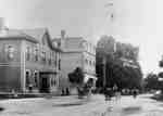
 - Water Street, looking east from Brant Street, 1907
 Laser prints of an original postcard.
  Laser prints of an original postcard.Burlington Historical Society
 - Port Nelson School, 1907
 This postcard was mailed from the Port Nelson Post Office on July 30 / 31, 1907, by William Bamford to his son, C. H. S. (who had married Lillie Wilson in June 1903), in Winnipeg.
  This postcard was mailed from the Port Nelson Post Office on July 30 / 31, 1907, by William Bamford to his son, C. H. S. (who had married Lillie Wilson …Burlington Historical Society
 - Brant House and Annex, 1907
 ...
...  ...Burlington Historical Society
 - Burk's Falls Ont. West Side of Town
 Colour illustrated postcard of the village of Burk's Falls from the west side of town. In the foreground there's a factory with lumber in its yard, possibly the Knight Brother's Factory. Behind the factory is the Magnetawan River. Across the river are houses. On the back of the postcard is …
  Colour illustrated postcard of the village of Burk's Falls from the west side of town. In the foreground there's a factory with lumber in its yard, possibly the Knight Brother's …Whitestone Public Library
 - Boston, Mass. King's Chapel
 King’s Chapel was founded in 1686 as the first Anglican Church in New England during the reign of King James II. This structure dates from 1754, and in 1785 it became a Unitarian Church.
  King’s Chapel was founded in 1686 as the first Anglican Church in New England during the reign of King James II. This structure dates from 1754, and in 1785 it …Oakville Public Library
 - Waterloo Park
 See reverse for name and postage stamp. Postmarked 1907. Waterloo Park was established in 1890.
  See reverse for name and postage stamp. Postmarked 1907. Waterloo Park was established in 1890.Waterloo Public Library
 - King Street, Waterloo, Ontario
 See reverse for correspondence and postage stamp. Postmarked 1907.
  See reverse for correspondence and postage stamp. Postmarked 1907.Waterloo Public Library
 - Dundas Street looking west from Brock Street
 A black and white photographic postcard of Dundas Street looking west from Brock Street. There is a man standing at the street corner. An ad can be seen for Diamond Dyes on the wall of Allin's drugstore..
  A black and white photographic postcard of Dundas Street looking west from Brock Street. There is a man standing at the street corner. An ad can be seen for Diamond …Whitby Public Library
 - Brock Street looking north from Colborne Street
 The Queen's Hotel is in the foreground at left. The town hall is at right.
  The Queen's Hotel is in the foreground at left. The town hall is at right.Whitby Public Library
 - Baldwin Street looking north from Campbell Street
 A black and white photograph of Baldwin Street looking north from Campbell Street. At left is the Brooklin Hotel (located at the north west corner of Baldwin and Campbell Streets). The white building beside it is the T.J. Holliday grocery and dry-goods store. At right is a bridge over Lynde …
  A black and white photograph of Baldwin Street looking north from Campbell Street. At left is the Brooklin Hotel (located at the north west corner of Baldwin and Campbell Streets). …Whitby Public Library
 - Brooklin Public School and Bell Tower, 1907

 The Brooklin School was built in the early 1870s at 72 Winchester Road East (on the north side of Winchester Road west of Queen Street). An addition was put on the east side in 1880. The school's bell tower was blown down in a storm and replaced by another tower …
 The Brooklin School was built in the early 1870s at 72 Winchester Road East (on the north side of Winchester Road west of Queen Street). An addition was put on …Whitby Public Library
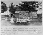
 - Ashburn School Class
 The Ashburn School was located at 780 Myrtle Road West. It was built about 1861 on the north side of the 9th Concession of Whitby Township west of Ashburn Road. It was built by a stone mason named Pearson. Since 1967 this building has been used as a community centre.
  The Ashburn School was located at 780 Myrtle Road West. It was built about 1861 on the north side of the 9th Concession of Whitby Township west of Ashburn Road. …Whitby Public Library
 - Ashburn General Store
 Ashburn General store was located at 8990 Ashburn Road (on the south-west corner of Ashburn Road at the 9th concession of Whitby Township). The view in this photograph is looking west along the 9th Concession at Ashburn.
  Ashburn General store was located at 8990 Ashburn Road (on the south-west corner of Ashburn Road at the 9th concession of Whitby Township). The view in this photograph is looking …Whitby Public Library
 - Burns Presbyterian Church, Ashburn
 Burns Presbyterian Church is located at 765 Myrtle Road West in Ashburn. It was built in 1857 on the south side of the 9th Concession of Whitby Township west of Ashburn Road. It stood nearly opposite the school. The church was destroyed by fire on February 12, 1967 and was …
  Burns Presbyterian Church is located at 765 Myrtle Road West in Ashburn. It was built in 1857 on the south side of the 9th Concession of Whitby Township west of …Whitby Public Library
 - Burns Presbyterian Church, Ashburn (Interior)
 Burns Presbyterian Church is located at 765 Myrtle Road West in Ashburn. It was built in 1857 on the south side of the 9th Concession of Whitby Township west of Ashburn Road. It stood nearly opposite the school. The church was destroyed by fire on February 12, 1967 and was …
  Burns Presbyterian Church is located at 765 Myrtle Road West in Ashburn. It was built in 1857 on the south side of the 9th Concession of Whitby Township west of …Whitby Public Library
 - Ashburn Ontario Looking East
 This picture shows the 9th Concession of Whitby Township looking east towards the corners of Ashburn. At left is the school yard fence. The Ashburn School was located at 780 Myrtle Road West.
  This picture shows the 9th Concession of Whitby Township looking east towards the corners of Ashburn. At left is the school yard fence. The Ashburn School was located at 780 …Whitby Public Library
 - Beacock Residence, c.1907
 James Beacock was the storekeeper and post master at Myrtle station. His residence was located on the east side of Highway 12, north of the railway tracks.Whitby’s house numbering system was provided by Rev. Dr. James Roy Van Wyck (1877-1941), a retired Presbyterian minister. Van Wyck provided this service to …
  James Beacock was the storekeeper and post master at Myrtle station. His residence was located on the east side of Highway 12, north of the railway tracks.Whitby’s house numbering system …Whitby Public Library
 - Bridge over Lynde Creek
 A black and white photograph of the Highway 12 bridge over Lynde Creek. In the background is a large brick house north west of the bridge.
  A black and white photograph of the Highway 12 bridge over Lynde Creek. In the background is a large brick house north west of the bridge.Whitby Public Library
 - St. Thomas Anglican Church
 St. Thomas Anglican Church building was located at 101 Winchester Road East. It was built in 1869 on the south east corner of Anderson Street and Winchester Road.
  St. Thomas Anglican Church building was located at 101 Winchester Road East. It was built in 1869 on the south east corner of Anderson Street and Winchester Road.Whitby Public Library


