Résultats
Nous avons trouvé 14 éléments semblables.


Page 1 de 1
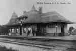
- Whitby Junction Station, 1906


 The Whitby Junction Station was built at the foot of Byron Street on the Grand Trunk Railway in 1903 near the current GO Transit platform. In 1914, it was the scene of an unsolved murder. It closed in 1969 and in 1970 was moved to the north-east corner of Victoria …

 The Whitby Junction Station was built at the foot of Byron Street on the Grand Trunk Railway in 1903 near the current GO Transit platform. In 1914, it was the …Whitby Public Library
 - All Saints' Anglican Church, 1906
 All Saints' Anglican Church was built in 1865-66 at 300 Dundas Street West.
  All Saints' Anglican Church was built in 1865-66 at 300 Dundas Street West.Whitby Public Library
 - View of Ontario Ladies' College, 1906
 This is a black and white photograph of a view from the roof of the Ontario Ladies' College, looking west.
  This is a black and white photograph of a view from the roof of the Ontario Ladies' College, looking west.Whitby Public Library
 - Whitby House Hotel

 This building was located at 207 Dundas Street West. It was built by Joseph A. Bandel in 1880 on the south side of Dundas Street between Byron and Centre Streets, following the buring of his first hotel in December 1879. The hotel was owned and operated by the Bandel family …
 This building was located at 207 Dundas Street West. It was built by Joseph A. Bandel in 1880 on the south side of Dundas Street between Byron and Centre Streets, …Whitby Public Library
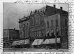
 - East side of Brock Street south of Dundas Street
 A black and white photographic postcard of the stores on the east side of Brock Street. From left to right: Dominion Bank; A.T. Lawler Groceries; Ross. Bros. Clothing; J.E. Willis Druggist; J.E. Waterhouse Groceries; Mrs. Allin Books; M.W. Collins Shoes; unidentified; Andrew M. Ross Groceries and Clothing.
  A black and white photographic postcard of the stores on the east side of Brock Street. From left to right: Dominion Bank; A.T. Lawler Groceries; Ross. Bros. Clothing; J.E. Willis …Whitby Public Library
 - Buildings at north east corner of Brock and Dundas Streets
 The photograph is of buildings at 101-121 Brock Street North. McMillan’s Block was built in 1864. Hatch block was built in 1874. Odd Fellows Hall was built in ca. 1873-75 and demolished in 1964. Dominion Warerooms was built in 1866 and demolished in 1964.
  The photograph is of buildings at 101-121 Brock Street North. McMillan’s Block was built in 1864. Hatch block was built in 1874. Odd Fellows Hall was built in ca. 1873-75 …Whitby Public Library
 - The Armories, c.1906
 The armories were located at 105 Dundas Street East, on the south side, between Brock Street and Green Street. The building was constructed in 1878 for the Wolfenden marble works, and from about 1899 to 1946 it was a government armory. The building later became a car dealership and was …
  The armories were located at 105 Dundas Street East, on the south side, between Brock Street and Green Street. The building was constructed in 1878 for the Wolfenden marble works, …Whitby Public Library
 - Brock Street, Whitby, c.1906
 A colour photographic postcard of Brock Street looking north from Colborne Street.
  A colour photographic postcard of Brock Street looking north from Colborne Street.Whitby Public Library
 - Methodist Tabernacle (St. Mark's United Church), 1906
 The Methodist Tabernacle was built in 1875-76 at 201 Centre Street South. It became the Whitby United Church in 1925 and St. Mark's United Church in 1962.
  The Methodist Tabernacle was built in 1875-76 at 201 Centre Street South. It became the Whitby United Church in 1925 and St. Mark's United Church in 1962.Whitby Public Library
 - Centre Street, 1906
 Black and white negative of a photograph of a postcard showing Centre Street looking north from Dunlop Street. In the background is the steeple of All Saints' Anglican Church. The steeple of the Methodist Tabernacle is visible at right. The postcard has been framed with a fancy border.
  Black and white negative of a photograph of a postcard showing Centre Street looking north from Dunlop Street. In the background is the steeple of All Saints' Anglican Church. The …Whitby Public Library
 - Looking South-east from Euclid Street Water Tower, 1906
 Black and white negative of a photograph of a postcard of an aerial view of Whitby taken from the water tower on Euclid Street. View looking south-east shows All Saints' Anglican Church (left) and the Methodist Tabernacle (right).
  Black and white negative of a photograph of a postcard of an aerial view of Whitby taken from the water tower on Euclid Street. View looking south-east shows All Saints' …Whitby Public Library
 - Centre Street Looking North, 1906
 See also record #16-000-026.
  See also record #16-000-026.Whitby Public Library
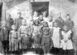
 - Spencer Public School Class, 1906
 Spencer School was built in 1877 on lot 30, Concession 7 in Whitby Township. It was known as S.S. No.6. The school closed in 1965 but the building was used as Spencer Community Centre from 1967.
  Spencer School was built in 1877 on lot 30, Concession 7 in Whitby Township. It was known as S.S. No.6. The school closed in 1965 but the building was used …Whitby Public Library
 - Ontario County House of Refuge
 The Ontario County House of Refuge was built between 1901-1903. It was located on the west side of High Street opposite John Street. It served as a house of refuge from 1903-1951 when it was replaced by Fairview Lodge. The building was used as apartments from 1951 until a fire …
  The Ontario County House of Refuge was built between 1901-1903. It was located on the west side of High Street opposite John Street. It served as a house of refuge …Whitby Public Library
Page 1 de 1


