Résultats
Nous avons trouvé 3027 éléments semblables.


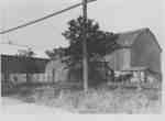
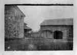
- Barns at Mark Crawforth Farm

 These barns were located on the north side of the Base Line and were demolished in 1939 to build Highway 401. The farm was located on lot 20 of Concession 1, Base Line.
 These barns were located on the north side of the Base Line and were demolished in 1939 to build Highway 401. The farm was located on lot 20 of Concession …Whitby Public Library
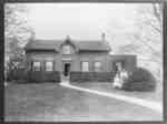
 - Residence of John Dryden

 This brick house was built in 1835 on lot 20 of Concession 7 in Whitby Township. It was located on the north side of the the 7th Concession, east of Thickson Road. A second story was added to the house in 1926. It was the residence of James Dryden (1806-1881), …
 This brick house was built in 1835 on lot 20 of Concession 7 in Whitby Township. It was located on the north side of the the 7th Concession, east of …Whitby Public Library
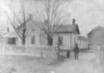
 - Arksey Homestead

 The Arksey Homestead was located on lot 23 on Taunton Road in Whitby Township.
 The Arksey Homestead was located on lot 23 on Taunton Road in Whitby Township.Whitby Public Library
 - Residence of James Tweedie

 This brick house was built in 1845 on lot 29 of Rossland Road near Cochrane Street in Whitby Township. The farm, known as Broadfield, was settled in 1835 by James Tweedie (1803-1857). The house was demolished in 1993.
 This brick house was built in 1845 on lot 29 of Rossland Road near Cochrane Street in Whitby Township. The farm, known as Broadfield, was settled in 1835 by James …Whitby Public Library
 - Residence of William Sinclair

 The Glenrath farmhouse was built by William Sinclair (1810-1899) about 1861 on lot 18 of broken front Concession in Whitby Township. The Sinclair farm was acquired by the British government about 1940 for use as the spy training base, Camp X. The farmhouse was destroyed by a fire department training …
 The Glenrath farmhouse was built by William Sinclair (1810-1899) about 1861 on lot 18 of broken front Concession in Whitby Township. The Sinclair farm was acquired by the British government …Whitby Public Library
 - Lofthouse Home

 This frame house was located on lot 18 of Concession 1 on the south side of Highway 2, near the Oshawa border in Whitby Township. It was probably built as early as the 1830s and this picture shows the building shortly after dormer windows were put in the roof and …
 This frame house was located on lot 18 of Concession 1 on the south side of Highway 2, near the Oshawa border in Whitby Township. It was probably built as …Whitby Public Library
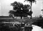
 - Lynde Creek c.1930

 This scene was taken from the top of the large clay cliff known as Whiteface. This portion of the creek is north of the end of Wellington Street.
 This scene was taken from the top of the large clay cliff known as Whiteface. This portion of the creek is north of the end of Wellington Street.Whitby Public Library
 - Thomas Manderson Residence


 This frame house was built by the Manderson family on lot 11 of Concession 1 on the north-west corner of Highway 12 and the Whitby-Reach Town Line in Reach Township. The Mandersons were closely associated with Myrtle Station and Ashburn and are buried in Burns' Presbyterian Church Cemetery at Ashburn. …

 This frame house was built by the Manderson family on lot 11 of Concession 1 on the north-west corner of Highway 12 and the Whitby-Reach Town Line in Reach Township. …Whitby Public Library
 - Scott's Dairy

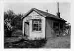
 Scott's Dairy was operated by Herman Scott from the late 1920s to the late 1930s. It was located on the north side of Kingston Road/Highway 2, east of the brick house at the north-west corner of Kingston Road/Highway 2 and Scott Street. It was converted into a house in the …
 Scott's Dairy was operated by Herman Scott from the late 1920s to the late 1930s. It was located on the north side of Kingston Road/Highway 2, east of the brick …Whitby Public Library
 - Thornton's Corners

 This view is looking east from the residence of Peter Lofthouse which was located on the top of the hill on the south side of Kingston Road (Highway 2) at the west side of the valley where the Whitby-East Whitby border was located.
 This view is looking east from the residence of Peter Lofthouse which was located on the top of the hill on the south side of Kingston Road (Highway 2) at …Whitby Public Library
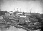
 - Patly Mills


 Patly Mills was located on the south half of lot 28, on the north side of Taunton Road, east of Chochrane Street. The Patley Mills were established by James Mitchell in 1851 and they processed oatmeal and flour. James Mitchell was drowned in a boating accident on Lake Ontario in …

 Patly Mills was located on the south half of lot 28, on the north side of Taunton Road, east of Chochrane Street. The Patley Mills were established by James Mitchell …Whitby Public Library
 - Sylvester Lynde Residence and Carriage Shed

 This stone house was located on lot 30 on the north side of Rossland Road, east of McQuay Blvd. in Whitby Township. It was built in the 1840s or 1850s for Sylvester Lynde (1800-1883), a son of Jabez Lynde. The house was destroyed by fire on 10 June 1913, when …
 This stone house was located on lot 30 on the north side of Rossland Road, east of McQuay Blvd. in Whitby Township. It was built in the 1840s or 1850s …Whitby Public Library
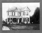
 - Residence of John Joshua Fothergill

 The residence of John Joshua Fothergill was built in 1883 on lot 32, concession 1 on the south side of Highway 2 in Whitby Township. The house was moved a short distance away from its original location in 1987. It was demolished shortly thereafter in May 1994.
 The residence of John Joshua Fothergill was built in 1883 on lot 32, concession 1 on the south side of Highway 2 in Whitby Township. The house was moved a …Whitby Public Library
 - Jeffrey Flats/Lynde Creek

 Jeffrey Flats was the land south of Highway 2 (Kingston Road) through which runs Lynde Creek. The land was settled by William Jeffrey in 1834. The picture is a detail in the lower centre of a photo of the business and professional men of Whitby in 1895.
 Jeffrey Flats was the land south of Highway 2 (Kingston Road) through which runs Lynde Creek. The land was settled by William Jeffrey in 1834. The picture is a detail …Whitby Public Library
 - Residence of Sylvester Lynde

 The stone house was located on lot 30 on the north side of Rossland Road (Concession 3)and east of McQuay Blvd. (D'Hilliar Street) in Whitby Township. It was built in the 1840s or 1850s for Sylvester Lynde (1800-1883), a son of Jabez Lynde. The house was destroyed by fire on …
 The stone house was located on lot 30 on the north side of Rossland Road (Concession 3)and east of McQuay Blvd. (D'Hilliar Street) in Whitby Township. It was built in …Whitby Public Library
 - Residence of John Dryden

 This brick house was built in 1835 on lot 20 of Concession 7 in Whitby Township. It was located on the north side of the the 7th Concession, east of Thickson Road. A second story was added to the house in 1926. It was the residence of James Dryden (1806-1881), …
 This brick house was built in 1835 on lot 20 of Concession 7 in Whitby Township. It was located on the north side of the the 7th Concession, east of …Whitby Public Library
 - Ruins of Sylvester Lynde Residence

 The stone house was located on lot 30 on the north side of Rossland Road (Concession 3)and east of McQuay Blvd. (D'Hilliar Street) in Whitby Township. It was built in the 1840s or 1850s for Sylvester Lynde (1800-1883), a son of Jabez Lynde. The house was destroyed by fire on …
 The stone house was located on lot 30 on the north side of Rossland Road (Concession 3)and east of McQuay Blvd. (D'Hilliar Street) in Whitby Township. It was built in …Whitby Public Library
 - Mildmay Camp 1943

 Mildmay Camp was an Anglican Church camp located on the shore of Lake Ontario, west of the Cranberry Marsh. It operated from the 1920s to the 1960s.
 Mildmay Camp was an Anglican Church camp located on the shore of Lake Ontario, west of the Cranberry Marsh. It operated from the 1920s to the 1960s.Whitby Public Library
 - Scott's Dairy

 Scott's Dairy was operated by Herman Scott from the late 1920s to the late 1930s. It was located on the north side of Kingston Road/Highway 2, east of the brick house at the north-west corner of Kingston Road/Highway 2 and Scott Street. It was converted into a house in the …
 Scott's Dairy was operated by Herman Scott from the late 1920s to the late 1930s. It was located on the north side of Kingston Road/Highway 2, east of the brick …Whitby Public Library
 - Home of Joshua Crawforth

 This farmhouse was built about 1850 by Joshua Crawforth, on lot 20 of Thickson Road (Concession 1) on the north side of Victoria Street (Base Line)in Whitby Township. It was likely demolished about 1939 when Highway 401 was built through the Crawforth farm.
 This farmhouse was built about 1850 by Joshua Crawforth, on lot 20 of Thickson Road (Concession 1) on the north side of Victoria Street (Base Line)in Whitby Township. It was …Whitby Public Library

