Résultats
Nous avons trouvé 445 éléments semblables.


- Canadian Pacific Railway Station

 The station was on the south side of the track. It was built in 1913 and closed in 1971 being demolished in 1977.
 The station was on the south side of the track. It was built in 1913 and closed in 1971 being demolished in 1977.Whitby Public Library
 - Bradley-Coakwell-Batty Residence

 This brick house was built for John Bradley in 1864. It was located on lot 25 of Concession 5 in Whitby Township. The house was later owned by Thomas Coakwell and William Franklin Batty. The veranda around the house was destroyed by Hurricane Hazel in October 1954. This house was …
 This brick house was built for John Bradley in 1864. It was located on lot 25 of Concession 5 in Whitby Township. The house was later owned by Thomas Coakwell …Whitby Public Library
 - Residence of Charles Kempthorne

 The Charles Kempthorne Residence was located at the south-east corner of Highway 2 and the Whitby-Pickering town line. It was part of the community of Almonds. The house was demolished in March 1969. Charles Kempthorne was a blacksmith at Almonds.
 The Charles Kempthorne Residence was located at the south-east corner of Highway 2 and the Whitby-Pickering town line. It was part of the community of Almonds. The house was demolished …Whitby Public Library
 - Residence of Henry Hannam

 This frame house was built by Henry Hannam (1811-1873) about 1853 and was demolished in December 2000 after a number of renovations had been made. At the time of this photograph the house was occupied by his son Alfred Hannam (1858-1943). The house was located on lot 22 of Concession …
 This frame house was built by Henry Hannam (1811-1873) about 1853 and was demolished in December 2000 after a number of renovations had been made. At the time of this …Whitby Public Library
 - Barn Raising on Lynde Farm

 The Lynde farm, also called Maple Dell Farm, was located on Concession 4 east of Coronation Road in Whitby Township.
 The Lynde farm, also called Maple Dell Farm, was located on Concession 4 east of Coronation Road in Whitby Township.Whitby Public Library
 - LH2046 Panoramic Bird's Eye View
 Colour panoramic postcard of downtown Oshawa.
  Colour panoramic postcard of downtown Oshawa.Oshawa Public Libraries
 - Residence of James Sawdon after renovations, c.1915
 This home was located on the east side of Byron Street between Colborne and Dunlop Streets (at 207 Byron Street South). This house was demolished in January 1974.
  This home was located on the east side of Byron Street between Colborne and Dunlop Streets (at 207 Byron Street South). This house was demolished in January 1974.Whitby Public Library
 - Whitestone Township Soldiers, 1915
 Portrait photograph of four soldiers from Whitestone Township who fought in the First World War. The two soldiers standing are Jim Craig and Alex Clelland. The seated soldiers are David Simpson and Tom Clelland.
  Portrait photograph of four soldiers from Whitestone Township who fought in the First World War. The two soldiers standing are Jim Craig and Alex Clelland. The seated soldiers are David …Whitestone Public Library
 - Portrait Postcard of Bessie Fraser, Circa 1915
 A black and white postcard done in an oval mat. The young woman in the photo is identified as Bessie Fraser who appears to be in her late teens. She wears a white blouse with a sailor type collar and her hair is pinned up loosely.
  A black and white postcard done in an oval mat. The young woman in the photo is identified as Bessie Fraser who appears to be in her late teens. She …Huron Shores Museum
 - Cedarmere
 Cedarmere was on the lake shore at the foot of Love Lane (now Ontario Street). It was originally built by Arthur McBean, and later occupied by the Castle family. Mrs. Castle was a sister of the Hon. James Cockburn. James Crowther, whose wife was the Castle's daughter, turned the home …
  Cedarmere was on the lake shore at the foot of Love Lane (now Ontario Street). It was originally built by Arthur McBean, and later occupied by the Castle family. Mrs. …Cobourg Public Library
 - Margaret Louise Gray
 Margaret Louise, daughter of William and Mary Louise Gray, was born on 22 March 1907 and died on 25 December 1984. She is buried in Mount View Cemetery, Cambridge, Ontario. According to Vernon's Town of Galt directories, Margaret's father, William Gray, resided at 170 Main Street East, Galt, Ontario between …
  Margaret Louise, daughter of William and Mary Louise Gray, was born on 22 March 1907 and died on 25 December 1984. She is buried in Mount View Cemetery, Cambridge, Ontario. …Kitchener Public Library
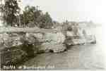
 - Cliffs at Burlington, ca 1915
 A photograph of an original postcard. This view appears to be a model, along with another postcard of Highway # 2, for Paul Duff's painting for the back cover of Burlington: The Growing Years, published by the Burlington Historical Society in 1992.
  A photograph of an original postcard. This view appears to be a model, along with another postcard of Highway # 2, for Paul Duff's painting for the back cover of …Burlington Historical Society
 - Back of Postcard
 (Condition: Fair.)
  (Condition: Fair.)Leeds & Thousand Islands Public Library
 - Main Street Beamsville East
 Looking east on Main St. (King St. Reg. Rd. 81) Several buggies are parked on the left and several automobiles are on the right. The tracks and overhead wires of the Hamilton, Grimsby & Beamsville Electric Railway (HG&B)can been seen just right of centre. A fire hydrant can be seen …
  Looking east on Main St. (King St. Reg. Rd. 81) Several buggies are parked on the left and several automobiles are on the right. The tracks and overhead wires of …Lincoln Pelham Public Library
 - Waterloo Park Bicycle Track
 The bicycle track was laid out in 1892. The covered grandstand was built by Alois Bauer in 1894 and accomodated spectators for local sports events, bicycle and motorcycle and dog races. The grandstand was sold to the city in 1920 by the Waterloo Grandstand Company. It was demolished in 1953.
  The bicycle track was laid out in 1892. The covered grandstand was built by Alois Bauer in 1894 and accomodated spectators for local sports events, bicycle and motorcycle and dog …Waterloo Public Library
 - Edward Witzel, Waterloo, Ontario
 Licence plate is dated 1915.
  Licence plate is dated 1915.Waterloo Public Library
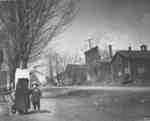
 - Louie Cassady and his Mother in Ashburn
 This picture shows Ashburn Road looking north into the village. The brick building at center is the Wilson House Hotel on the north-east corner of Ashburn Road and the 9th Concession of Whitby Township. Wagon wheels can be seen outside some of the stores. The trees in this photograph have …
  This picture shows Ashburn Road looking north into the village. The brick building at center is the Wilson House Hotel on the north-east corner of Ashburn Road and the 9th …Whitby Public Library
 - Myrtle Station looking east from Highway 12
 A black and white photograph of the store and a shed on the east side of Highway 12, north of the Canadian Pacific Railway (C.P.R.) tracks.
  A black and white photograph of the store and a shed on the east side of Highway 12, north of the Canadian Pacific Railway (C.P.R.) tracks.Whitby Public Library
 - Waterloo Park
 See reverse for correspondence and postage stamp. Postmarked 1915.
  See reverse for correspondence and postage stamp. Postmarked 1915.Waterloo Public Library
 - Houses on Mill Street (Cassels Road), c.1915

 The houses in this photograh from left to right were owned by Dr. James Moore, Uriah Jones, Bill Blight.Whitby’s house numbering system was provided by Rev. Dr. James Roy Van Wyck (1877-1941), a retired Presbyterian minister. Van Wyck provided this service to the town, free of charge, during the Great …
 The houses in this photograh from left to right were owned by Dr. James Moore, Uriah Jones, Bill Blight.Whitby’s house numbering system was provided by Rev. Dr. James Roy Van …Whitby Public Library


