Résultats
Nous avons trouvé 3658 éléments semblables.


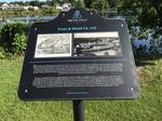
- Frost & Wood Co. Ltd. plaque, Smiths Falls


 The plaque reads: "What began as a simple shop on Gould's Island, with a few stove and ploughs in 1893, developed into Smiths Falls most successful company and largest employer for 116 years. In 1846, company founder Ebenezer Frost partnered with Alexander Wood and by 1865 virtually every company in …

 The plaque reads: "What began as a simple shop on Gould's Island, with a few stove and ploughs in 1893, developed into Smiths Falls most successful company and largest employer …Smiths Falls Public Library
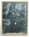
 - Loyal Orange Lodge Photograph


 Framed black and white photograph of the late Mrs. Singleton with the 1960 Battle of Boyne Flag.

 Framed black and white photograph of the late Mrs. Singleton with the 1960 Battle of Boyne Flag.Schreiber Heritage & Tourism Committee
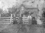
 - Thomas Park (Crawforth) House


 This brick house is located in the south-east portion of lot 25, Concession 4 in Whitby Township. It was purchased by Thomas Park in 1861. At the time of this photograph the house was the home of Matthew Crawforth and his wife Eliza, daughter of Thomas Park. The house was …

 This brick house is located in the south-east portion of lot 25, Concession 4 in Whitby Township. It was purchased by Thomas Park in 1861. At the time of this …Whitby Public Library
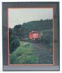
 - Framed Photograph of Unit 3076

 This engine and passenger train provided the town of Schreiber a bit of amusement when, in the summer of 1993 during Heritage Days, it was used to transport locals for a quick trip to Marathon, reminiscent of the time passenger trains were available in this area.
 This engine and passenger train provided the town of Schreiber a bit of amusement when, in the summer of 1993 during Heritage Days, it was used to transport locals for …Schreiber Heritage & Tourism Committee
 - The Tweedie Farm


 This farm on lot 29 of Concession 3 (Rossland Road) at the north-west corner of Rossland and Chocrane Street was also known as Broadfield. It was settled about 1837 by James Tweedie (1803-1857). The brick house on the property was built in 1845.

 This farm on lot 29 of Concession 3 (Rossland Road) at the north-west corner of Rossland and Chocrane Street was also known as Broadfield. It was settled about 1837 by …Whitby Public Library
 - Residence of Barnabus Gibson


 Unknown, Illustrated Historical Atlas of the County of Ontario, Ont. (Toronto, Ontario: J.H. Beers & Co., 1877), 1877 This brick house was built in 1876 on the south east corner of Hopikins and Victoria Streets on lot 22 in Whitby Township. The house was severely damaged by fire in June 2006. Barnabus Gibson was a railway contractor who later moved to Toronto.

 Unknown, Illustrated Historical Atlas of the County of Ontario, Ont. (Toronto, Ontario: J.H. Beers & Co., 1877), 1877 This brick house was built in 1876 on the south east corner of Hopikins and Victoria Streets on lot 22 in Whitby Township. The house was severely damaged by fire …Whitby Public Library
 - Mildmay Camp


 Mildmay Camp was located on the shore of Lake Ontario, east of the Cranberry Marsh in Whitby Township. It was an Anglican Church camp which was operated from around 1927 to 1953 by the Mildmay Institute of Toronto.

 Mildmay Camp was located on the shore of Lake Ontario, east of the Cranberry Marsh in Whitby Township. It was an Anglican Church camp which was operated from around 1927 …Whitby Public Library
 - Port Whitby and Port Perry Railway Engine House


 The brick engine house is located at 400 Mary Street East on the north-east corner of Mary and Hickory Streets. It was built in 1876 to replace an engine house that burned down in 1875. The building was altered in the 1960s and made into a garage.

 The brick engine house is located at 400 Mary Street East on the north-east corner of Mary and Hickory Streets. It was built in 1876 to replace an engine house …Whitby Public Library
 - Whitby Junction Station, 1906


 The Whitby Junction Station was built at the foot of Byron Street on the Grand Trunk Railway in 1903 near the current GO Transit platform. In 1914, it was the scene of an unsolved murder. It closed in 1969 and in 1970 was moved to the north-east corner of Victoria …

 The Whitby Junction Station was built at the foot of Byron Street on the Grand Trunk Railway in 1903 near the current GO Transit platform. In 1914, it was the …Whitby Public Library
 - Ear Falls, Hydro Colony

 The new permanent homes in the Hydro Colony housed radio operator Jack Schwass, and his wife, line foreman Art Westran and his wife Ena, station maintenance man Harold Evans and his wife, operator Ed Smith, his wife and son, operator Royden and Gladys McDonald, Andy and Petra (MOM) Inguard. Clara …
 The new permanent homes in the Hydro Colony housed radio operator Jack Schwass, and his wife, line foreman Art Westran and his wife Ena, station maintenance man Harold Evans and …Ear Falls Public Library
 - Ear Falls Generating Station

 Photo of turbine used for generating power at the station. The gentleman in the photo is unidentified.
 Photo of turbine used for generating power at the station. The gentleman in the photo is unidentified.Ear Falls Public Library
 - Ear Falls Hydro Colony

 Construction of the Hydro colony began in 1937 to house employees and their families. However, when the second unit of the power plant was installed, the construction camp was built on the west side of the dam away from the Hydro colony, at the present site of the transformer yard …
 Construction of the Hydro colony began in 1937 to house employees and their families. However, when the second unit of the power plant was installed, the construction camp was built …Ear Falls Public Library
 - Lac Seul Dam - aerial view (1957)

 An aerial view (looking south to the U.S). of Lac Seul Dam, Ear Falls Generating station on the English River, November 22, 1957.
 An aerial view (looking south to the U.S). of Lac Seul Dam, Ear Falls Generating station on the English River, November 22, 1957.Ear Falls Public Library
 - Group of Prospectors, One Man Holding Gold Brick


 Group of unidentified prospectors, one of them holding a gold brick.

 Group of unidentified prospectors, one of them holding a gold brick.Greenstone Public Library
 - Little Long Lac Mine and Townsite (~1937)

 Aerial view looking northeast across Barton Bay. Inscription reads 'Little Long Lac Gold mine'. In the foreground is the clearing for Errington Avenue. It would later be called Arena Road and in 1939, it would become part of Highway 11. At the extreme left is the townsite of Little Long …
 Aerial view looking northeast across Barton Bay. Inscription reads 'Little Long Lac Gold mine'. In the foreground is the clearing for Errington Avenue. It would later be called Arena Road …Greenstone Public Library
 - Mosher Mine

 Greenstone, Geraldton, Mosher mine, mining, mines, gold, Ontario
 Greenstone, Geraldton, Mosher mine, mining, mines, gold, OntarioGreenstone Public Library
 - Hydro Colony - Ear Falls (1957)

 Aerial photograph of the Hydro colony of Ear Falls, Ontario 1957. The area was created to house the hydro workers and their families.
 Aerial photograph of the Hydro colony of Ear Falls, Ontario 1957. The area was created to house the hydro workers and their families.Ear Falls Public Library
 - Groupe d'homme / Group of men


 Reproduction of the photo

 Reproduction of the photoMusée Sturgeon River House Museum
 - Cornish Home


 Condition: Fine. Image is dirty and slightly faded

 Condition: Fine. Image is dirty and slightly fadedSt. Marys Museum
 - The Doupe Family


 Condition: Fair. Image is dirty and matte is very worn.

 Condition: Fair. Image is dirty and matte is very worn.St. Marys Museum

