Résultats
Nous avons trouvé 2 éléments semblables.


Page 1 de 1
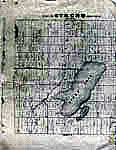
- Map of Strong Township, Machar


 Photocopy of an early concession map for Strong Township. The township is divided into 14 x 30 plots. Lake Bernard is still Stony Lake at this time. Pool Lake and Lake Wallace are also shown. The main road Distress Road is in the middle of the map. The townships on …

 Photocopy of an early concession map for Strong Township. The township is divided into 14 x 30 plots. Lake Bernard is still Stony Lake at this time. Pool Lake and …Sundridge - Strong Union PL
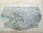
 - 1891 Town of Waterloo Map

 The printed date in the right hand corner of the second version of the map is incorrect. The map can be dated to ca. 1891 based on other copies and the presence of St. Louis Roman Catholic Church on Allen St.
 The printed date in the right hand corner of the second version of the map is incorrect. The map can be dated to ca. 1891 based on other copies and …Waterloo Public Library
Page 1 de 1


