Résultats


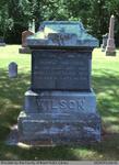
- James, Sarah A. (Bailet), George, William Henry, and Mary Elizabeth Wilson
 Located right next to the Salt Springs Church on the Grand River, the Salt Springs Cemetery has been in operation since 1822. The cemetery is still active under the management of the Salt Springs Cemetery Board of Trustees. There is a plaque on the property that tells the history of …
  Located right next to the Salt Springs Church on the Grand River, the Salt Springs Cemetery has been in operation since 1822. The cemetery is still active under the management …County of Brant Public Library
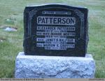
 - Alexander, Marion (Morton), Janet S. Balfour, Marion E. Griffith, Martha E., Clarence A., and Frieda M. (Deagle) Patterson
 This headstone is located in the Second Onondaga Baptist Church Cemetery which was established after the church was built in 1854. The Church and Cemetery are located on 330 Baptist Church Road, 0.3 km south of Mulligan Road. Location: 16-7
  This headstone is located in the Second Onondaga Baptist Church Cemetery which was established after the church was built in 1854. The Church and Cemetery are located on 330 Baptist …County of Brant Public Library
 - Registrations of Marriages, Listed Geographically, 1869-1911

 A list of registrations of marriages in Ontario, listed geographically that are on microfilm reels. The ones that are highlighted in yellow are ones that the library has in its collection that can be accessed in the library. The registrations of marriages span the years of 1869-1911 and 1920-1926.
 A list of registrations of marriages in Ontario, listed geographically that are on microfilm reels. The ones that are highlighted in yellow are ones that the library has in its …Stirling-Rawdon Public Library
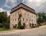
 - Snowball Grist Mill

 Summary The construction process of the mill began in 1869 and went on for three years, culminating in a stone building built by local stonemason Mr Reith. Goldie and McCulloch supplied two ten inch wide Leffel water wheels and over five hundred feet of flume pipe. By the fall of …
 Summary The construction process of the mill began in 1869 and went on for three years, culminating in a stone building built by local stonemason Mr Reith. Goldie and McCulloch …County of Brant Public Library
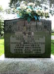
 - William, Minnie (Shellington), Ada, and Ruby Hammond

 Harley Cemetery is an active cemetery in Brant County (Burford Township), under the jurisdiction of the Corporation of the County of Brant. It is located at 125 Harley Rd (Brant Road #202). Range 6-1
 Harley Cemetery is an active cemetery in Brant County (Burford Township), under the jurisdiction of the Corporation of the County of Brant. It is located at 125 Harley Rd (Brant …County of Brant Public Library
 - Maggie and Rosetta Hill


 Hill Cemetery is an inactive cemetery in Brant County (Burford Township), under the jurisdiction of the Corporation of the County of Brant. It is located on Middle Townline Road (Brant County Road # 25), about 0.7 kms north of Burford/Delhi Town Road in Burford Township. Range 9-3

 Hill Cemetery is an inactive cemetery in Brant County (Burford Township), under the jurisdiction of the Corporation of the County of Brant. It is located on Middle Townline Road (Brant …County of Brant Public Library
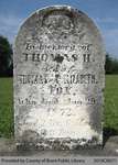
 - Thomas H. Fox

 Range 1-1
 Range 1-1County of Brant Public Library
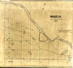
 - Maria Township ca.1869


 Early surveyors, like William E. Logan, used Rochon micrometer telescopes and targets (disk on a calibrated pole) to measure distance. Each microscope had a different calibration and therefore a different range. The instruments were calibrated against a distance measured with a surveyors chain (also known as Gunter’s chain). One chain …

 Early surveyors, like William E. Logan, used Rochon micrometer telescopes and targets (disk on a calibrated pole) to measure distance. Each microscope had a different calibration and therefore a different …Head, Clara and Maria Public Library

