Résultats
Nous avons trouvé 10 éléments semblables.


Page 1 de 1
- Hand Drawn Map of Sundridge, circa 1880 - 1890, with Typed Legend
 The maps were on two pieces of 8.5" x 11" paper which were stitched together with Photoshop Elements
  The maps were on two pieces of 8.5" x 11" paper which were stitched together with Photoshop ElementsSundridge - Strong Union PL
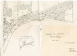
 - Village of Sundridge Map, Lots 21 - 25 Con. 10, Township of Strong
 Map of the village of Sundridge 1957. It includes all the main streets and secondary streets of Sundridge. The map shows the deed numbers of all the properties in the village.
  Map of the village of Sundridge 1957. It includes all the main streets and secondary streets of Sundridge. The map shows the deed numbers of all the properties in the …Sundridge - Strong Union PL
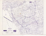
 - The District of Parry Sound Map, "Vacationland Properties for Sale"
 Map of the district of Parry Sound by A. H. McKee Land & Resort Sales Co. The map was created to show vacation property in the area for sale. The ink on the map is purple.
  Map of the district of Parry Sound by A. H. McKee Land & Resort Sales Co. The map was created to show vacation property in the area for sale. The …Sundridge - Strong Union PL
 - Newspaper Clipping of a Map of Many Townships in the Sundridge Area
 There's a small rip on the right side of the clipping.
  There's a small rip on the right side of the clipping.Sundridge - Strong Union PL
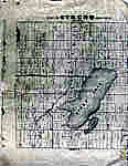
 - Map of Strong Township, Machar


 Photocopy of an early concession map for Strong Township. The township is divided into 14 x 30 plots. Lake Bernard is still Stony Lake at this time. Pool Lake and Lake Wallace are also shown. The main road Distress Road is in the middle of the map. The townships on …

 Photocopy of an early concession map for Strong Township. The township is divided into 14 x 30 plots. Lake Bernard is still Stony Lake at this time. Pool Lake and …Sundridge - Strong Union PL
 - Map Of The North Channel And Surrounding Townships, Circa 1980
 In addition to showing the location of the Townships and various islands it notes the 4 places where ships could enter Georgian Bay.
  In addition to showing the location of the Townships and various islands it notes the 4 places where ships could enter Georgian Bay.Huron Shores Museum
 - LHM001 Village of Oshawa Map
 Illustrated Historical Atlas of the County of Ontario, Ont. (Toronto, Ontario: J.H. Beers & Co., 1877), 1877 This is a copy from the 1877 atlas of Ontario County.
  Illustrated Historical Atlas of the County of Ontario, Ont. (Toronto, Ontario: J.H. Beers & Co., 1877), 1877 This is a copy from the 1877 atlas of Ontario County.Oshawa Public Libraries
 - LHM003 Mosaic Air Map of Greater Oshawa in 1928
 "This composite picture of Greater Oshawa is made up of thirteen aerial photographs taken at a height of ten thousand feet. It has just been completed for the Government and is reproduced here for the first time by special permission of the Department of Militia and Defence. The reader will …
  "This composite picture of Greater Oshawa is made up of thirteen aerial photographs taken at a height of ten thousand feet. It has just been completed for the Government and …Oshawa Public Libraries
 - Land holding map for Thessalon area, 1966


 The map does not include a scale. This map and legend can be found in the Tweedsmuir History created by the Princess Elizabeth Women's Institute.

 The map does not include a scale. This map and legend can be found in the Tweedsmuir History created by the Princess Elizabeth Women's Institute.Thessalon Union Public Library
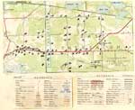
 - Map of Strong Township, 1942

 A map of Strong Township, produced in 1942. It shows the division of property in Strong Township and names of the land owners. Lake Bernard is near the center of the township. There is a legend at the bottom of the map. Machar Township borders on the north, Chapman on …
 A map of Strong Township, produced in 1942. It shows the division of property in Strong Township and names of the land owners. Lake Bernard is near the center of …Sundridge - Strong Union PL
Page 1 de 1


