Résultats
Nous avons trouvé 29 éléments semblables.


- Thomas Holmes house, December 1998
 This house was located at 408 Byron Street South. It was built in 1853 as a one-storey Regency cottage. A Mansard roof designed by Henry Langley, Toronto Architect, was added around 1875. This is a front view of the house after it was restored in 1977-1978.
  This house was located at 408 Byron Street South. It was built in 1853 as a one-storey Regency cottage. A Mansard roof designed by Henry Langley, Toronto Architect, was added …Whitby Public Library
 - Thomas Holmes house, December 1998
 This house was located at 408 Byron Street South. It was built in 1853 as a one-storey Regency cottage. A Mansard roof designed by Henry Langley, Toronto Architect, was added around 1875. This is a front view of the house after it was restored in 1977-1978.
  This house was located at 408 Byron Street South. It was built in 1853 as a one-storey Regency cottage. A Mansard roof designed by Henry Langley, Toronto Architect, was added …Whitby Public Library
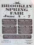
 - Brooklin Spring Fair
 Poster for the Brooklin Spring Fair, indicating dates, times, and locations for various activities
  Poster for the Brooklin Spring Fair, indicating dates, times, and locations for various activitiesWhitby Public Library
 - Aerial View of Cochrane Street looking North, October 7, 1998
 A colour slide of an aerial view of Cochrane Street looking north in Whitby, Ontario.
  A colour slide of an aerial view of Cochrane Street looking north in Whitby, Ontario.Whitby Public Library
 - Aerial View of Cochrane Street looking North, October 7, 1998
 A colour slide of an aerial view of Cochrane Street looking north in Whitby, Ontario. This view is of Cochrane Street south of Bonacord Avenue.
  A colour slide of an aerial view of Cochrane Street looking north in Whitby, Ontario. This view is of Cochrane Street south of Bonacord Avenue.Whitby Public Library
 - Aerial View of Cochrane Street, October 7, 1998
 A colour slide of an aerial view of Cochrane Street looking north in Whitby, Ontario. This view is of Cochrane Street at Bonacord Avenue.
  A colour slide of an aerial view of Cochrane Street looking north in Whitby, Ontario. This view is of Cochrane Street at Bonacord Avenue.Whitby Public Library
 - Aerial View of Whitby Shores, October 7, 1998
 A colour slide of an aerial view of the subdivision of Whitby Shores under construction. Lynde Shores Conservation area is on the left side of the photograph.
  A colour slide of an aerial view of the subdivision of Whitby Shores under construction. Lynde Shores Conservation area is on the left side of the photograph.Whitby Public Library
 - Aerial View of Whitby looking North, October 7, 1998
 A colour slide of an aerial view of Whitby looking north. In this view the subdivision of West Lynde is in the foreground. Highway 2 (Dundas Street) is in the centre of the photograph.
  A colour slide of an aerial view of Whitby looking north. In this view the subdivision of West Lynde is in the foreground. Highway 2 (Dundas Street) is in the …Whitby Public Library
 - Aerial View of Whitby looking North, October 7, 1998
 A colour slide of an aerial view of Whitby looking north. In this view the intersection of Cochrane Street and Highway 2 (Dundas Street) is on the right side of the photograph.
  A colour slide of an aerial view of Whitby looking north. In this view the intersection of Cochrane Street and Highway 2 (Dundas Street) is on the right side of …Whitby Public Library
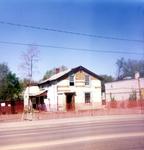
 - House on Brock Street
 Pictured is a house formerly located on Brock Street in Whitby. The house was torn down in 1998.
  Pictured is a house formerly located on Brock Street in Whitby. The house was torn down in 1998.Whitby Public Library
 - Catharine Tunney, c.1991
 Catharine Tunney was born at Peterborough, Ontario, on 18 September 1955 and was raised in Oshawa. She move to Brooklin in 1982. Mrs. Tunney served six years in the 1980s as the Whitby representative on the Durham Catholic District School Board, three of which were as chairwoman. In 1992 she …
  Catharine Tunney was born at Peterborough, Ontario, on 18 September 1955 and was raised in Oshawa. She move to Brooklin in 1982. Mrs. Tunney served six years in the 1980s …Whitby Public Library
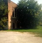
 - Old School on Brock Street
 Pictured is the old school formerly located on Brock Street South in Whitby. The school was torn down in 1998.
  Pictured is the old school formerly located on Brock Street South in Whitby. The school was torn down in 1998.Whitby Public Library
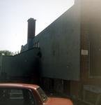
 - Back of Old School on Brock Street
 Pictured is the back of the old school formerly located on Brock Street in Whitby. The school was torn down in 1998.
  Pictured is the back of the old school formerly located on Brock Street in Whitby. The school was torn down in 1998.Whitby Public Library
 - New houses under construction at Garden and Dundas
 Pictured is a construction site of new homes being built at the corner of Garden and Dundas Streets.
  Pictured is a construction site of new homes being built at the corner of Garden and Dundas Streets.Whitby Public Library
 - Aerial View of Whitby looking South, October 7, 1998
 A colour slide of an aerial view of Whitby looking south. In the centre of the photograph is the subdivision of Whitby Shores under construction. Lynde Creek is to the left of the photograph.
  A colour slide of an aerial view of Whitby looking south. In the centre of the photograph is the subdivision of Whitby Shores under construction. Lynde Creek is to the …Whitby Public Library
 - Aerial View of Whitby looking East, October 7, 1998
 A colour slide of an aerial view of Whitby looking east. In the centre of the photograph is the subdivision of Whitby Shores under construction. Lynde Creek and Lake Ontario are in the foreground.
  A colour slide of an aerial view of Whitby looking east. In the centre of the photograph is the subdivision of Whitby Shores under construction. Lynde Creek and Lake Ontario …Whitby Public Library
 - Aerial View of Whitby looking West, October 7, 1998
 A colour slide of an aerial view of Whitby looking west. In this view Highway 401 is in the centre of the photograph. The West Lynde subdivision is on the right side of the photograph.
  A colour slide of an aerial view of Whitby looking west. In this view Highway 401 is in the centre of the photograph. The West Lynde subdivision is on the …Whitby Public Library
 - Aerial View of Whitby looking West, October 7, 1998
 A colour slide of an aerial view of Whitby looking west. In this view Highway 401 is at the top of the photograph. The Whitby Shores subdivision is at the bottom of the photograph.
  A colour slide of an aerial view of Whitby looking west. In this view Highway 401 is at the top of the photograph. The Whitby Shores subdivision is at the …Whitby Public Library
 - Aerial View of Whitby Shores, October 7, 1998
 A colour slide of an aerial view of the subdivision of Whitby Shores under construction. Lynde Shores Conservation area is on the left side of the photograph. Victoria Street West can be seen in the background.
  A colour slide of an aerial view of the subdivision of Whitby Shores under construction. Lynde Shores Conservation area is on the left side of the photograph. Victoria Street West …Whitby Public Library
 - Aerial View of Cochrane Street, October 7, 1998
 A colour slide of an aerial view of Cochrane Street looking north to Rossland Road.
  A colour slide of an aerial view of Cochrane Street looking north to Rossland Road.Whitby Public Library


