Résultats
Nous avons trouvé 257 éléments semblables.


- Bankfield Mine - First Gold Brick (1937)
 Inscription reads 'First Gold Brick - Bankfield Consolidated Mine June 12, 1937'. The first brick weighed in at 601.19 ounces. The Bankfield Mine was one of the most modern mills in the gold mining industry for the time. The whole mill was entirely powered by electricity.
  Inscription reads 'First Gold Brick - Bankfield Consolidated Mine June 12, 1937'. The first brick weighed in at 601.19 ounces. The Bankfield Mine was one of the most modern mills …Greenstone Public Library
 - Tombill Mine (~1937)
 View looking west at Tombill mine. Note the water line to a short water tower in the foreground of the photo. Tombill Gold Mines was incorporated in 1935 and shaft-sinking began the following year. By 1938, Tombill mine became a producer, the sixth in the Geraldton district.
  View looking west at Tombill mine. Note the water line to a short water tower in the foreground of the photo. Tombill Gold Mines was incorporated in 1935 and shaft-sinking …Greenstone Public Library
 - MacLeod-Cockshutt Mine (1937)
 Aerial view looking northwest. Inscription reads 'MacLeod Cockshutt Gold Mine showing Hard Rock Gold mine in the foreground, December, 1937.' Upper portion shows the hills on which MacLeod Townsite is rising, and beyond it, the clearing for the Kenogamisis Golf Course. There is no sign of the future Highway 11 …
  Aerial view looking northwest. Inscription reads 'MacLeod Cockshutt Gold Mine showing Hard Rock Gold mine in the foreground, December, 1937.' Upper portion shows the hills on which MacLeod Townsite is …Greenstone Public Library
 - The Power House at Ear Falls (~1937)
 The rapid development of mines in the vicinity of Red Lake made it necessary to install another unit on the English River system. It was also necessary to redesign the electrical control and protection systems, and the high and low voltage switching arrangements. Provision was made in the redesign, for …
  The rapid development of mines in the vicinity of Red Lake made it necessary to install another unit on the English River system. It was also necessary to redesign the …Ear Falls Public Library
 - St. Joseph's School of Nursing, Hotel Dieu Hospital Kingston, Class of 1937
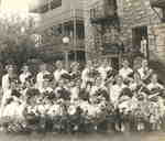
 Photograph of the graduates of the St. Joseph's School of Nursing, Hotel Dieu Hospital, Kingston, Ontario, Class of 1937. Depicted are: Back row: Leona Dore, Mary Sullivan, Kathleen Meraw, Elizabeth Jenner, Mary Boyer, Eileen Campbell, Frances Johnson, Clara McDade, Bernadette Morrissey Front row: Alice Kearney, Jessie Coulter, Elizabeth McNulty, Eileen …
  Photograph of the graduates of the St. Joseph's School of Nursing, Hotel Dieu Hospital, Kingston, Ontario, Class of 1937. Depicted are: Back row: Leona Dore, Mary Sullivan, Kathleen Meraw, Elizabeth …St. Joseph Region Archives of the RHSJ
 - Flood of 1937 at the dam
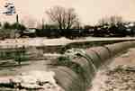
 Condition: Copy is good.
  Condition: Copy is good.St. Marys Museum
 - Flood of 1937 on Park Street
 Condition: Copy is good - not the best reproduction.
  Condition: Copy is good - not the best reproduction.St. Marys Museum
 - Corner of Water Street and Queen Street during 1937 flood
 Condition: Copy is good - but not the best reproduction.
  Condition: Copy is good - but not the best reproduction.St. Marys Museum
 - Queen Street looking west towards Water Street at the time of a flood, 1937
 Condition: Copy is good.
  Condition: Copy is good.St. Marys Museum
 - CPR Shops, Schreiber (~1937)
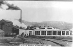
 A photograph of the Canadian Pacific Railway Shops in Schreiber, near Manitoba St. (~1937). 4.3'wide x 3.1'high b&w photo
  A photograph of the Canadian Pacific Railway Shops in Schreiber, near Manitoba St. (~1937). 4.3'wide x 3.1'high b&w photoSchreiber Public Library
 - Schreiber Senior Hockey Team (1937)
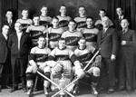
 hockey team; group portrait; 1937; hockey equipment; team sports; sports; recreation; Schreiber; hockey; uniforms
  hockey team; group portrait; 1937; hockey equipment; team sports; sports; recreation; Schreiber; hockey; uniformsSchreiber Public Library
 - First Bus to Schreiber (1937)
 The first bus to arrive in Schreiber, 1937. The photograph is looking down Scotia Street. 4.3'wide x 3.1'high b&w photo
  The first bus to arrive in Schreiber, 1937. The photograph is looking down Scotia Street. 4.3'wide x 3.1'high b&w photoSchreiber Public Library
 - Junction of the CNR and CPR Tracks (1937)
 A work crew at the junction of the CN and CP tracks where they enter the Lake Sulphite property. Also visible are horse barns in the the background and a water tower to the right of the photograph.
  A work crew at the junction of the CN and CP tracks where they enter the Lake Sulphite property. Also visible are horse barns in the the background and a …Red Rock Public Library
 - Town site of Red Rock (Aug 1937)
 A group of unidentified men standing by a clearing of land that is the future town site of Red Rock, Ontario 1937.
  A group of unidentified men standing by a clearing of land that is the future town site of Red Rock, Ontario 1937.Red Rock Public Library
 - Canadian National Executives in Red Rock (1937)

 A photograph of CNR executives standing in front of the original train station in Red Rock. Note the system used for transporting vehicles by rail between Nipigon and Red Rock.
 A photograph of CNR executives standing in front of the original train station in Red Rock. Note the system used for transporting vehicles by rail between Nipigon and Red Rock.Red Rock Public Library
 - Clearing the Way for the Canadian National Railway (1937)
 Black and white photo of equipment used during the construction of the Canadian National Railway.
  Black and white photo of equipment used during the construction of the Canadian National Railway.Red Rock Public Library
 - Construction of Canadian National Tracks (1937)
 Another view of construction of the CN tracks near Red Rock, May 19,1937. Note the pile of ties in the foreground.
  Another view of construction of the CN tracks near Red Rock, May 19,1937. Note the pile of ties in the foreground.Red Rock Public Library
 - Construction of Canadian National Tracks (1937)
 Construction of the Canadian National Railway tracks, Red Rock, Ontario.
  Construction of the Canadian National Railway tracks, Red Rock, Ontario.Red Rock Public Library
 - CNR Executives (1937)
 A photograph of CNR executives standing in front of the original train station in Red Rock. Note the system used for transporting vehicles by rail between Nipigon and Red Rock.
  A photograph of CNR executives standing in front of the original train station in Red Rock. Note the system used for transporting vehicles by rail between Nipigon and Red Rock.Red Rock Public Library
 - Highway to Lake Sulphite Property (1937)
 A photograph showing the construction of the bridge crossing Trout Creek. The CNR depot rail car is in the background.
  A photograph showing the construction of the bridge crossing Trout Creek. The CNR depot rail car is in the background.Red Rock Public Library


