Résultats
Nous avons trouvé 36 éléments semblables.


- Tremaine's Map of the County of Halton 1858 – Township of Esquesing II


 This map lays out the land division and ownership of the northern Esquesing region as of 1858. It is one of eight maps of the Halton townships. It also includes depictions of important local buildings including the Canadian Collegiate Institute, the residence of James Barber Esquire, and Credit Paper Mills. …

 This map lays out the land division and ownership of the northern Esquesing region as of 1858. It is one of eight maps of the Halton townships. It also includes …Oakville Public Library
 - Tremaine's Map of the County of Halton 1858 - Nelson
 This map lays out the land division and ownership of the Nelson region as of 1858. It is one of eight maps of the Halton townships. It also includes depictions of important local buildings including the Bronte Steam Mills, Wellington Square Steam Mills, and the Residence of John Triller Esq. …
  This map lays out the land division and ownership of the Nelson region as of 1858. It is one of eight maps of the Halton townships. It also includes depictions …Oakville Public Library
 - Tremaine's Map of the County of Halton 1858 - Southern Trafalgar Township
 This map lays out the land division and ownership of the southern Trafalgar township region as of 1858. It is one of eight maps of the Halton townships. It also includes depictions of important local buildings including the residence of Robert. K. Chisholm Esq., the Canadian Hotel, and Oakville Steam …
  This map lays out the land division and ownership of the southern Trafalgar township region as of 1858. It is one of eight maps of the Halton townships. It also …Oakville Public Library
 - Tremaine's Map of the County of Halton 1858 - Trafalgar Township
 This map lays out the land division and ownership of the Trafalgar township region as of 1858. It is one of eight maps of the Halton townships. It also includes depictions of important local buildings including the residence of George K. Chisholm Esq., Chisholm Brothers’ Grist Mill, and the residence …
  This map lays out the land division and ownership of the Trafalgar township region as of 1858. It is one of eight maps of the Halton townships. It also includes …Oakville Public Library
 - Tremaine's Map of the County of Halton - Township of Nelson II


 This map lays out the land division and ownership of the Nelson township region as of 1858. It is one of eight maps of the Halton townships. It also includes depictions of important local buildings including H.P. Zimmerman’s Crist & Flouring Mills, the residence of K.H. Munn Esquire, and Bronte …

 This map lays out the land division and ownership of the Nelson township region as of 1858. It is one of eight maps of the Halton townships. It also includes …Oakville Public Library
 - Tremaine's Map of the County of Halton 1858 – Township of Nassagaweya

 This map lays out the land division and ownership of the Nassagaweya region as of 1858. It is one of four maps of the Halton townships. It also includes depictions of important local buildings including the Halton County Courthouse, Nassagaweya Mills, the residence of P.W. Dayfoot Esq., and Pine and …
 This map lays out the land division and ownership of the Nassagaweya region as of 1858. It is one of four maps of the Halton townships. It also includes depictions …Oakville Public Library
 - Tremaine's Map of the County of Halton 1858 – Township of Esquesing
 This map lays out the land division and ownership of the Esquesing region as of 1858. It is one of eight maps of the Halton townships. It also includes depictions of important local buildings including the Credit Paper Mills, Gage Hacaman & Company, and the Residence of William Pickard Esq. …
  This map lays out the land division and ownership of the Esquesing region as of 1858. It is one of eight maps of the Halton townships. It also includes depictions …Oakville Public Library
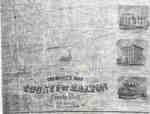
 - Tremaine's Map of the County of Halton 1858
 Shows land owners' names, lots, concessions, buildings and subscribers' directory for the County of Halton.
  Shows land owners' names, lots, concessions, buildings and subscribers' directory for the County of Halton.Oakville Public Library
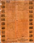
 - Map of the Town of Milton, County of Halton, Canada West
 Coloured engraved map of the Town of Milton showing wards, lot lines and numbers, property owners, outlines of buildings and ward boundaries. Details include engravings (clockwise from top left): "ladies Seminary, John Sproat, Esq. Proprietor", "Residence of John Martin Esq.", "Halton Mills, Messrs. White & Martin Proprietors", "Grammar & Common …
  Coloured engraved map of the Town of Milton showing wards, lot lines and numbers, property owners, outlines of buildings and ward boundaries. Details include engravings (clockwise from top left): "ladies …Milton Historical Society
 - J. Nourse and Co. Store Lithograph
 Perry's Block was located opposite the outlet at Elm Street. It was built by John Ham Perry in 1858. The building was destroyed by fire on June 10, 1864 and was replaced by McMillan's Block the same year.
  Perry's Block was located opposite the outlet at Elm Street. It was built by John Ham Perry in 1858. The building was destroyed by fire on June 10, 1864 and …Whitby Public Library
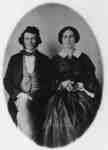
 - Mr. James and Mrs. Orilla Holden, 1858
 James Holden was born at Markham, Ontario February 29, 1828. Orilla Fitchett was born at Prince Albert, Reach Township on December 24, 1839 and was adopted by her Uncle, Samuel Barber. They married at Prince Albert, Ontario, near Port Perry on April 6, 1858. They moved to Whitby in 1864. …
  James Holden was born at Markham, Ontario February 29, 1828. Orilla Fitchett was born at Prince Albert, Reach Township on December 24, 1839 and was adopted by her Uncle, Samuel …Whitby Public Library
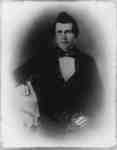
 - James Holden, c. 1858
 James Holden was born on February 29, 1828 at Markham, Ontario and was engaged in mercantile business there until 1857 when he moved to Prince Albert, a village south of Port Perry. In Prince Albert he published a newspaper called the North Ontario Observer. In 1864 Mr. Holden was appointed …
  James Holden was born on February 29, 1828 at Markham, Ontario and was engaged in mercantile business there until 1857 when he moved to Prince Albert, a village south of …Whitby Public Library
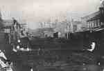
 - Queen Street looking west up hill
 Negative.
  Negative.St. Marys Museum
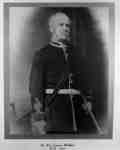
 - James Wallace, c.1858
 James Wallace was born in Kincardineshire, Scotland on March 3, 1814 and came to Whitby before 1840. He was a businessman who worked as a contractor, newspaper editor and owner of a soap works and clock factory. He organized and financed the Whitby Highland Rifle Company and took part in …
  James Wallace was born in Kincardineshire, Scotland on March 3, 1814 and came to Whitby before 1840. He was a businessman who worked as a contractor, newspaper editor and owner …Whitby Public Library
 - Susan Sands

 The Lang Cemetery is behind the barn on the east corner of Hwy No.2 and the Madden Road. It is no more than half an acre in size. There are a number of graves without stones. Most of the stones had foot stones that have been removed. This is a …
 The Lang Cemetery is behind the barn on the east corner of Hwy No.2 and the Madden Road. It is no more than half an acre in size. There are …County of Brant Public Library
 - Graf Coverlet - Double Rose Pattern


 2005.17.1

 2005.17.1Port Colborne Historical and Marine Museum
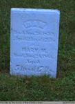
 - Idam and Mary M. Sager
 Located right next to the Salt Springs Church on the Grand River, the Salt Springs Cemetery has been in operation since 1822. The cemetery is still active under the management of the Salt Springs Cemetery Board of Trustees. There is a plaque on the property that tells the history of …
  Located right next to the Salt Springs Church on the Grand River, the Salt Springs Cemetery has been in operation since 1822. The cemetery is still active under the management …County of Brant Public Library
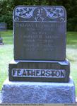
 - Thomas, Charlotte (Skimin), and Walter James Featherston
 Located right next to the Salt Springs Church on the Grand River, the Salt Springs Cemetery has been in operation since 1822. The cemetery is still active under the management of the Salt Springs Cemetery Board of Trustees. There is a plaque on the property that tells the history of …
  Located right next to the Salt Springs Church on the Grand River, the Salt Springs Cemetery has been in operation since 1822. The cemetery is still active under the management …County of Brant Public Library
 - Eliza R. Metcalf


 Range 16-2

 Range 16-2County of Brant Public Library
 - Eliza Ellen Miles

 Range 14-11
 Range 14-11County of Brant Public Library


