Résultats
Nous avons trouvé 32 éléments semblables.


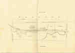
- Second Welland Canal - Book 1, Survey Map 11 - St. Catharines and Locks 3 and 4


 Survey map of the Second Welland Canal created by the Welland Canal Company showing the Town of St. Catharines. Identified structures associated with the Canal include Lock 3 and its Lock House, Lock 4 and its Lock House, Hydraulic Race, and a floating tow path. The surveyors' measurements and notes …

 Survey map of the Second Welland Canal created by the Welland Canal Company showing the Town of St. Catharines. Identified structures associated with the Canal include Lock 3 and its …Brock University Archives
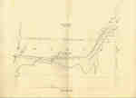
 - Second Welland Canal - Book 1, Survey Map 12 - St. Catharines and Lock 4


 Survey map of the Second Welland Canal created by the Welland Canal Company showing the Town of St. Catharines. Identified structures associated with the Canal include Lock 4, Hydraulic Race, floating tow path, and the Canal waterway itself. The surveyors' measurements and notes can be seen in red and black …

 Survey map of the Second Welland Canal created by the Welland Canal Company showing the Town of St. Catharines. Identified structures associated with the Canal include Lock 4, Hydraulic Race, …Brock University Archives
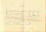
 - Second Welland Canal - Book 1, Survey Map 13 - St. Catharines and Locks 4 and 5

 Survey map of the Second Welland Canal created by the Welland Canal Company showing the Town of St. Catharines. Identified structures associated with the Canal include Lock 4, Lock House, Lock 5, Small Lock House, the towing path, and Gasometer for Canal. The surveyors' measurements and notes can be seen …
 Survey map of the Second Welland Canal created by the Welland Canal Company showing the Town of St. Catharines. Identified structures associated with the Canal include Lock 4, Lock House, …Brock University Archives
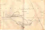
 - Second Welland Canal - Book 2, Survey Map 1 - Locks 5, 6 and 7 in Grantham

 Survey map of the Second Welland Canal created by the Welland Canal Company showing the Grantham Township just southeast of the Town of St. Catharines. Identified structures associated with the Canal include Locks 5, 6, and 7, two Lock House Lots, Small Lock House, waste weir, and the towing path. …
 Survey map of the Second Welland Canal created by the Welland Canal Company showing the Grantham Township just southeast of the Town of St. Catharines. Identified structures associated with the …Brock University Archives
 - Second Welland Canal - Book 2, Survey Map 3 - Locks 8, 9 and 10 in Grantham

 Survey map of the Second Welland Canal created by the Welland Canal Company showing the Grantham Township between the Town of St. Catharines and Merritton. Identified structures associated with the Canal include Locks 8, 9, and 10, waste weirs, the towing path, and several floating bridges. The surveyors' measurements and …
 Survey map of the Second Welland Canal created by the Welland Canal Company showing the Grantham Township between the Town of St. Catharines and Merritton. Identified structures associated with the …Brock University Archives
 - Second Welland Canal - Book 2, Survey Map 4 - Locks 11, 12, 13, 14 and 15 in Grantham


 Survey map of the Second Welland Canal created by the Welland Canal Company showing the Grantham Township along the outskirts of Merritton. Identified structures associated with the Canal include Locks 11, 12, 13, 14, and 15, Lock House Lot, and the towing path. The surveyors' measurements and notes can be …

 Survey map of the Second Welland Canal created by the Welland Canal Company showing the Grantham Township along the outskirts of Merritton. Identified structures associated with the Canal include Locks …Brock University Archives
 - Second Welland Canal - Book 2, Survey Map 6 - Locks 19, 20, 21 and 22 in Grantham

 Survey map of the Second Welland Canal created by the Welland Canal Company showing south Merritton along the boundary between the Grantham and Thorold Townships. Identified structures associated with the Canal include Locks 19, 20, 21, and 22, Lock Tenders House, and the towing path. The surveyors' measurements and notes …
 Survey map of the Second Welland Canal created by the Welland Canal Company showing south Merritton along the boundary between the Grantham and Thorold Townships. Identified structures associated with the …Brock University Archives
 - Second Welland Canal - Book 2, Survey Map 7 - Locks 23, 24 and 25 in Thorold

 Survey map of the Second Welland Canal created by the Welland Canal Company showing the canal as it passes through the Village of Thorold. Identified structures associated with the Canal include Locks 23, 24, and 25, a Guard Gate, Lock House Lot, the Little Deep Cut, and the towing path. …
 Survey map of the Second Welland Canal created by the Welland Canal Company showing the canal as it passes through the Village of Thorold. Identified structures associated with the Canal …Brock University Archives
 - Second Welland Canal - Book 2, Survey Map 10 - Through Thorold

 Survey map of the Second Welland Canal created by the Welland Canal Company showing the canal in Thorold Township. Identified structures associated with the Canal include the towing path. The surveyors' measurements and notes can be seen in red and black ink and pencil. Local area landmarks are also identified …
 Survey map of the Second Welland Canal created by the Welland Canal Company showing the canal in Thorold Township. Identified structures associated with the Canal include the towing path. The …Brock University Archives
 - Second Welland Canal - Book 2, Survey Map 12 - Through Thorold

 Survey map of the Second Welland Canal created by the Welland Canal Company showing the canal in Thorold Township. Identified structures associated with the Canal include the towing path. The surveyors' measurements and notes can be seen in red and black ink and pencil. Local area landmarks are also identified …
 Survey map of the Second Welland Canal created by the Welland Canal Company showing the canal in Thorold Township. Identified structures associated with the Canal include the towing path. The …Brock University Archives
 - Second Welland Canal - Book 2, Survey Map 13 - Through Thorold

 Survey map of the Second Welland Canal created by the Welland Canal Company showing the canal in Thorold Township northwest of Allanburgh. Identified structures associated with the Canal include the towing path. The surveyors' measurements and notes can be seen in red and black ink and pencil. Local area landmarks …
 Survey map of the Second Welland Canal created by the Welland Canal Company showing the canal in Thorold Township northwest of Allanburgh. Identified structures associated with the Canal include the …Brock University Archives
 - Second Welland Canal - Book 2, Survey Map 16 - Deep Cut in Thorold

 Survey map of the Second Welland Canal created by the Welland Canal Company showing the canal in the Thorold Township between Allanburg and Port Robinson. Identified structures and features associated with the Canal include the Deep Cut and the towing path. The surveyors' measurements and notes can be seen in …
 Survey map of the Second Welland Canal created by the Welland Canal Company showing the canal in the Thorold Township between Allanburg and Port Robinson. Identified structures and features associated …Brock University Archives
 - Second Welland Canal - Book 1, Survey Map 1 - Entrance, Lock 1 and Port Dalhousie


 Survey map of the Second Welland Canal created by the Welland Canal Company showing the areas in and around Port Dalhousie and Grantham Township. Identified structures associated with the Canal include Lock 1, Lighthouse, Lighthouse Keeper's House, East and West Piers, Harbour, Waste Weir, Store House, Collector's Office, Collector Assistant …

 Survey map of the Second Welland Canal created by the Welland Canal Company showing the areas in and around Port Dalhousie and Grantham Township. Identified structures associated with the Canal …Brock University Archives
 - Second Welland Canal - Book 1, Survey Map 2 - Lock 1 and Port Dalhousie

 Survey map of the Second Welland Canal created by the Welland Canal Company showing the areas in and around Port Dalhousie and Grantham Township. Identified structures associated with the Canal include Lock 1, East and West Piers, Collector's Office, Lock Tender's House and the new towing path. The surveyors' measurements …
 Survey map of the Second Welland Canal created by the Welland Canal Company showing the areas in and around Port Dalhousie and Grantham Township. Identified structures associated with the Canal …Brock University Archives
 - Second Welland Canal - Book 1, Survey Map 4 - Through Grantham Township

 Survey map of the Second Welland Canal created by the Welland Canal Company showing a portion of the Grantham Township. Identified structures associated with the Canal include the floating tow path and the canal itself. The surveyors' measurements and notes can be seen in red and black ink and pencil. …
 Survey map of the Second Welland Canal created by the Welland Canal Company showing a portion of the Grantham Township. Identified structures associated with the Canal include the floating tow …Brock University Archives
 - Second Welland Canal - Book 1, Survey Map 6 - Through Grantham and Louth Townships

 Survey map of the Second Welland Canal created by the Welland Canal Company showing the area between the Townships of Grantham and Louth. Identified structures associated with the Canal include the floating tow path. The surveyors' measurements and notes can be seen in red and black ink and pencil. Features …
 Survey map of the Second Welland Canal created by the Welland Canal Company showing the area between the Townships of Grantham and Louth. Identified structures associated with the Canal include …Brock University Archives
 - Second Welland Canal - Book 1, Survey Map 8 - Through Grantham and Louth Townships

 Survey map of the Second Welland Canal created by the Welland Canal Company showing the area between the Townships of Louth and Grantham. Identified structures associated with the Canal include the floating tow path. It is not labelled, but runs along the bottom of the map. The surveyors' measurements and …
 Survey map of the Second Welland Canal created by the Welland Canal Company showing the area between the Townships of Louth and Grantham. Identified structures associated with the Canal include …Brock University Archives
 - Second Welland Canal - Book 1, Survey Map 7 - Through Grantham Township

 Survey map of the Second Welland Canal created by the Welland Canal Company showing a portion of the Grantham Township. Identified structures associated with the Canal include the floating tow path. The surveyors' measurements and notes can be seen in red and black ink and pencil. Local area landmarks are …
 Survey map of the Second Welland Canal created by the Welland Canal Company showing a portion of the Grantham Township. Identified structures associated with the Canal include the floating tow …Brock University Archives
 - Second Welland Canal - Book 1, Survey Map 10 - St. Catharines


 Survey map of the Second Welland Canal created by the Welland Canal Company along the western edge of the Town of St. Catharines. Although not labelled, the Second Welland Canal can be seen running through the map along with its tow path, which is located on the southwestern edge of …

 Survey map of the Second Welland Canal created by the Welland Canal Company along the western edge of the Town of St. Catharines. Although not labelled, the Second Welland Canal …Brock University Archives
 - Second Welland Canal - Book 3, Survey Map 18 - Through Humberstone

 Survey map of the Second Welland Canal created by the Welland Canal Company showing the area through Humberstone Township. Identified structures associated with the Canal are the north and south back ditches, Towing Path and spoil banks. Surveyor measurements and notes can be seen in red and black ink and …
 Survey map of the Second Welland Canal created by the Welland Canal Company showing the area through Humberstone Township. Identified structures associated with the Canal are the north and south …Brock University Archives

