Résultats
Nous avons trouvé 21 éléments semblables.


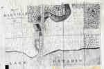
- Plan of Oakville, Township of Trafalgar, Upper Canada, 1835
 A map from 1835 showing the town of Oakville from Brock Street to Allan Street, including the Sixteen Mile Creek. This map features the church, market square, wharf and an intended damn site north of the Colborne Street bridge.
  A map from 1835 showing the town of Oakville from Brock Street to Allan Street, including the Sixteen Mile Creek. This map features the church, market square, wharf and an …Oakville Public Library
 - Welland Canal Survey of Lands Jacob Neff Jr., 1835
 Survey map and description of Jacob Neff Js.'s land created by The Welland Canal Company. Included is a written description of the land along with a drawing of the land. Noteable features include; canal, line between Jacob Neff and Jacob Augustine's land. The land totals 14 acres and 1 road. …
  Survey map and description of Jacob Neff Js.'s land created by The Welland Canal Company. Included is a written description of the land along with a drawing of the land. …Brock University Archives
 - Welland Canal Survey of Lands Village of Marshville - Milton, 1835
 See Pages 164-165
  See Pages 164-165Brock University Archives
 - Welland Canal Survey of Lands John Hellems, 1835
 Survey map and description of John Hellem's land created by The Welland Canal Company. Included is a written description of the land along with a drawing of the land. Noteable features include; W. Crooks land, concession lines, basin, bridges, guard lock, reservoir, tow path, Lyons Creek. The survey was done …
  Survey map and description of John Hellem's land created by The Welland Canal Company. Included is a written description of the land along with a drawing of the land. Noteable …Brock University Archives
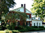
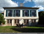
 - 19 Navy Street, Oakville Ontario
 ...
...  ...Oakville Public Library
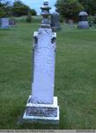
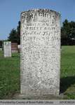
 - Abram, Catherine, Guy, Sarah Jane, Mary J., Annie, Jennet, and John Dinsmore
 This headstone is located in the Second Onondaga Baptist Church Cemetery which was established after the church was built in 1854. The Church and Cemetery are located on 330 Baptist Church Road, 0.3 km south of Mulligan Road. Location: 7-1
  This headstone is located in the Second Onondaga Baptist Church Cemetery which was established after the church was built in 1854. The Church and Cemetery are located on 330 Baptist …County of Brant Public Library
 - George Taylor Weller
 George Weller is the son of William Weller.
  George Weller is the son of William Weller.Cobourg Public Library
 - Report of the Engineer appointed to examine the works upon the Welland Canal, 1835.
 Excerpt from Report of the Engineer appointed to examine the works upon the Welland Canal, 1835, which described the Gravelly Bay lighthouse requiring temporary repair from gale.
  Excerpt from Report of the Engineer appointed to examine the works upon the Welland Canal, 1835, which described the Gravelly Bay lighthouse requiring temporary repair from gale.Port Colborne Historical and Marine Museum
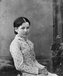
 - Lucy Maud Montgomery's mother as a child or possibly Lucy Maud Montgomery's aunt Emily Mcneill
 Lucy Maud Montgomery's ancestors & parents.
  Lucy Maud Montgomery's ancestors & parents.Lucy Maud Montgomery Images McLaughlin Library, University of Guelph
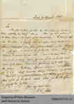
 - Letter from W.G. Keele to Hiram Capron

 In this letter, Keele reports on the status of several of Capron’s confirmed land claims and requests documentation about others in order to finish settling accounts. Their conversation on land sales continue in a letter from Keele in 1836
 In this letter, Keele reports on the status of several of Capron’s confirmed land claims and requests documentation about others in order to finish settling accounts. Their conversation on land …
 - Thomas House

 Summary Originally located in the Cainsville area on what is now Colborne Street, the Thomas House was constructed in 1835 for John Thomas by William Abbot. Peanut butter was manufactured at the house by the Taylor family from 1920 until the middle of the Second World War when it became …
 Summary Originally located in the Cainsville area on what is now Colborne Street, the Thomas House was constructed in 1835 for John Thomas by William Abbot. Peanut butter was manufactured …County of Brant Public Library
 - Rachel Freeland

 Range 15-11
 Range 15-11County of Brant Public Library
 - Jane Buckberrough

 Range 16-5
 Range 16-5County of Brant Public Library
 - Lula Maud Griffin, Hannah Elizabeth Misener


 Papple Cemetery is an inactive cemetery in Brant County, under the jurisdiction of the Corporation of the County of Brant. It is located on Brant County Highway # 99, 2.5 kms east of the St George Road (Brant County Road # 13). Range 2-1

 Papple Cemetery is an inactive cemetery in Brant County, under the jurisdiction of the Corporation of the County of Brant. It is located on Brant County Highway # 99, 2.5 …County of Brant Public Library
 - James Swim


 Deagle Mason Cemetery is an inactive cemetery in Brant County (Onondaga Township), under the jurisdiction of the Corporation of the County of Brant. It is located at 115 Campbell Rd. The headstones have been moved together at the top of the hill in the cemetery and laid flat. Range 2-9

 Deagle Mason Cemetery is an inactive cemetery in Brant County (Onondaga Township), under the jurisdiction of the Corporation of the County of Brant. It is located at 115 Campbell Rd. …County of Brant Public Library
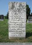
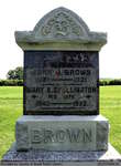
 - John J. and Mary A. (Shellington) Brown

 Harley Cemetery is an active cemetery in Brant County (Burford Township), under the jurisdiction of the Corporation of the County of Brant. It is located at 125 Harley Rd (Brant Road #202). Range 1-4
 Harley Cemetery is an active cemetery in Brant County (Burford Township), under the jurisdiction of the Corporation of the County of Brant. It is located at 125 Harley Rd (Brant …County of Brant Public Library
 - Diantha (Beebe) Beecham

 Range 6-2
 Range 6-2County of Brant Public Library
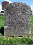
 - Edmund H., Sarah Ann, and Martha E. Smith


 Harley Cemetery is an active cemetery in Brant County (Burford Township), under the jurisdiction of the Corporation of the County of Brant. It is located at 125 Harley Rd (Brant Road #202). Range 3-5

 Harley Cemetery is an active cemetery in Brant County (Burford Township), under the jurisdiction of the Corporation of the County of Brant. It is located at 125 Harley Rd (Brant …County of Brant Public Library
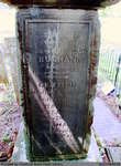
 - James, Griffith, David, and Emma Buchan


 Old Paris Cemetery is an inactive cemetery in Brant County, under the jurisdiction of the Corporation of the County of Brant. It is located on the south side of Church Street in Paris soon after turning off Dundas Street West (Highway #2). Range 8-1

 Old Paris Cemetery is an inactive cemetery in Brant County, under the jurisdiction of the Corporation of the County of Brant. It is located on the south side of Church …County of Brant Public Library
 - Frances B. Bingham

 Range 2-42
 Range 2-42County of Brant Public Library

