Résultats
Nous avons trouvé 2 éléments semblables.


Page 1 de 1
- Head Township ca.1859


 Early surveyors, like William E. Logan, used Rochon micrometer telescopes and targets (disk on a calibrated pole) to measure distance. Each microscope had a different calibration and therefore a different range. The instruments were calibrated against a distance measured with a surveyors chain (also known as Gunter’s chain). One chain …

 Early surveyors, like William E. Logan, used Rochon micrometer telescopes and targets (disk on a calibrated pole) to measure distance. Each microscope had a different calibration and therefore a different …Head, Clara and Maria Public Library
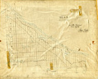
 - Abstract of Title to Lot 30 West of the Grand River, with Map

 This abstract of title provides the transactional history of the portions of Lot 30 in Dumfries, which had at various times belonged to Thomas Clark, William Dickson, John Holme, Samuel Street and Hiram Capron. It was prepared in 1855 at the time of the incorporation of Paris in order to …
 This abstract of title provides the transactional history of the portions of Lot 30 in Dumfries, which had at various times belonged to Thomas Clark, William Dickson, John Holme, Samuel …
Page 1 de 1


