Résultats
Nous avons trouvé 132 éléments semblables.


- Model Canoe Representing Chief's Canoe in War of 1812

 Image of a model representing a Chief's Canoe in War of 1812, created by Jean-Baptiste Assiginack, an Odawa chief, who was a veteran of the War of 1812. After the war, he worked as a translator for the Indian Department and was an influential voice for his people in their …
 Image of a model representing a Chief's Canoe in War of 1812, created by Jean-Baptiste Assiginack, an Odawa chief, who was a veteran of the War of 1812. After the …
 - Letter from Alexander McPherson to his mother, 13 June 1825

 Content warning: Racism, Slavery, and Colonialism The Alexander McPherson letters contain discussion of slavery and managing a plantation and may contain violent descriptions. Some of this information may be difficult to absorb. These ideologies are not condoned by Archives at Whitby Public Library, but the Archives has preserved such records …
 Content warning: Racism, Slavery, and Colonialism The Alexander McPherson letters contain discussion of slavery and managing a plantation and may contain violent descriptions. Some of this information may be difficult …Whitby Public Library
 - Letter from Alexander McPherson to his mother, 7 December 1825

 Content warning: Racism, Slavery, and Colonialism The Alexander McPherson letters contain discussion of slavery and managing a plantation and may contain violent descriptions. Some of this information may be difficult to absorb. These ideologies are not condoned by Archives at Whitby Public Library, but the Archives has preserved such records …
 Content warning: Racism, Slavery, and Colonialism The Alexander McPherson letters contain discussion of slavery and managing a plantation and may contain violent descriptions. Some of this information may be difficult …Whitby Public Library
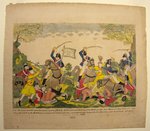
 - Col. Johnson's Mounted Men Charging a Party of British Artillerists. By Dr. Gabriel F. S. Miesse
 A coloured ink print believed to have been created in the United States of America. Below the image it reads: "Col. Johnsons mounted men charging a party of British Artillerists and Indians at the Battle fought near Moravian Town October 2nd 1813 when the whole of the British force commanded …
  A coloured ink print believed to have been created in the United States of America. Below the image it reads: "Col. Johnsons mounted men charging a party of British Artillerists …
 - Henry Bate, c.1820
 Henry Bate was born in 1800 in Devonshire, England and came to Canada with his wife and three daughters in 1840. They settled in Hamer's Corners in Whitby and Mr. Bate was the first organist as St. John's Anglican church, Port Whitby in 1846. He was a music teacher and …
  Henry Bate was born in 1800 in Devonshire, England and came to Canada with his wife and three daughters in 1840. They settled in Hamer's Corners in Whitby and Mr. …Whitby Public Library
 - Scierie Hamilton - Hamilton Sawmill
 Les billots rassemblés aux moulins de 1811 à 1868
  Les billots rassemblés aux moulins de 1811 à 1868Bibliothèque publique de Hawkesbury
 - Welland Canal Survey of Lands William C. Chace 1826
 Survey map and description of William C. Chace's land created by The Welland Canal Company. Included is a written description of the land along with a drawing of the land. Noteable features include; concession line. The land totals 1/4 of an acre. The survey was signed and submitted on August …
  Survey map and description of William C. Chace's land created by The Welland Canal Company. Included is a written description of the land along with a drawing of the land. …Brock University Archives
 - Welland Canal Survey of Lands Isabella Steward and William Sanderson, 1826
 This image contains two seperate surveys.
  This image contains two seperate surveys.Brock University Archives
 - Welland Canal Survey of Lands Francis Goring Parnell, 1826
 Survey map and description of Francis Goring Parnell's land created by The Welland Canal Company. Included is a written description of the land along with a drawing of the land. Noteable features include; line between Widow Secord and Parnell's land, line between Rykert and Parnell's land. The deed for the …
  Survey map and description of Francis Goring Parnell's land created by The Welland Canal Company. Included is a written description of the land along with a drawing of the land. …Brock University Archives
 - Welland Canal Survey of Lands Zachariah Rykert, 1827
 urvey map and description of Zachariah Rykert's land created by The Welland Canal Company. Included is a written description of the land along with a drawing of the land. Noteable features include; line between Rykert and Parnell's land, lot divisions. The land totals 5.5 acres. Surveyor notes are seen in …
  urvey map and description of Zachariah Rykert's land created by The Welland Canal Company. Included is a written description of the land along with a drawing of the land. Noteable …Brock University Archives
 - Welland Canal Survey of Lands John Soper, 1826
 Survey map and description of John Soper's land created by The Welland Canal Company. Included is a written description of the land along with a drawing of the land. Noteable features include; line between lots, high water mark of canal, concession line. The land totals 1 acre. The survey was …
  Survey map and description of John Soper's land created by The Welland Canal Company. Included is a written description of the land along with a drawing of the land. Noteable …Brock University Archives
 - Welland Canal Survey of Lands Peter Vanevery, 1827
 Survey map and description of Peter Vanevery's land created by The Welland Canal Company. Included is a written description of the land along with a drawing of the land. Noteable features include; lines between lots, L. Carrol's and E. Bouke's land. The land totals 100 acres. Deed from Jacob Stule …
  Survey map and description of Peter Vanevery's land created by The Welland Canal Company. Included is a written description of the land along with a drawing of the land. Noteable …Brock University Archives
 - Welland Canal Survey of Lands Samuel Swayze, 1827
 Survey map and description of Samuel Swayze's land created by The Welland Canal Company. Included is a written description of the land along with a drawing of the land. Noteable features include; lot division. The land totals 65 acres and 12 perches. The deed from Hall Davis to the Welland …
  Survey map and description of Samuel Swayze's land created by The Welland Canal Company. Included is a written description of the land along with a drawing of the land. Noteable …Brock University Archives
 - Welland Canal Survey of Lands Garrett Vanderburgh, 1826
 Survey map and description of Garret Vanderburgh's land created by The Welland Canal Company. Included is a written description of the land along with a drawing of the land. Noteable features include; division between Swayze and Carl's land. The deed for the land is dated November 9th, 1826. The land …
  Survey map and description of Garret Vanderburgh's land created by The Welland Canal Company. Included is a written description of the land along with a drawing of the land. Noteable …Brock University Archives
 - Welland Canal Survey of Lands John Brown, 1827
 Survey map and description of John Brown's land created by The Welland Canal Company. Included is a written description of the land along with a drawing of the land. Noteable features include; Welland river, towpath, canal, lock, side line between Broan and Carl. The land totals 6 acres, 3 roads …
  Survey map and description of John Brown's land created by The Welland Canal Company. Included is a written description of the land along with a drawing of the land. Noteable …Brock University Archives
 - Welland Canal Survey of Lands Widow Griffith, 1824
 Survey map and description of Widow Griffith's land created by The Welland Canal Company. Included is a written description of the land along with a drawing of the land. Noteable features include; the Chippewa river, canal, bridge, road. The deed is from Jonathan and Sarah Silverthorn and is dated August …
  Survey map and description of Widow Griffith's land created by The Welland Canal Company. Included is a written description of the land along with a drawing of the land. Noteable …Brock University Archives
 - The Lang Cemetery
 A list of plots shows that there should be a headstone for Truman A. Westbrook on range 2 plot 7, but we have no image of it. Truman A. was the son of Truman W. and Phebe Westbrook and was the brother of Alvin Westbrook. He passed away September 9 …
  A list of plots shows that there should be a headstone for Truman A. Westbrook on range 2 plot 7, but we have no image of it. Truman A. was …County of Brant Public Library
 - Cynthia Westbrook

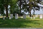
 The Lang Cemetery is behind the barn on the east corner of Hwy No.2 and the Madden Road. It is no more than half an acre in size. There are a number of graves without stones. Most of the stones had foot stones that have been removed. This is a …
 The Lang Cemetery is behind the barn on the east corner of Hwy No.2 and the Madden Road. It is no more than half an acre in size. There are …County of Brant Public Library
 - Elizabeth Jane Vanderlip

 The Lang Cemetery is behind the barn on the east corner of Hwy No.2 and the Madden Road. It is no more than half an acre in size. There are a number of graves without stones. Most of the stones had foot stones that have been removed. This is a …
 The Lang Cemetery is behind the barn on the east corner of Hwy No.2 and the Madden Road. It is no more than half an acre in size. There are …County of Brant Public Library
 - A View of Col. Johnson's Engagement with the Savages (commanded by Tecumseh) near the Moravian Town, October 5, 1812.
 Hand-coloured woodcut illustration from: "History of the Discovery of America" by Henry Trumbull. The print gives a vivid account of the war between the Native Americans led by Tecumseh (1768?-1813), chief of the Shawnee, and the U.S. cavalry led by Colonel Richard M. Johnson (1780 or 81-1850). These same three …
  Hand-coloured woodcut illustration from: "History of the Discovery of America" by Henry Trumbull. The print gives a vivid account of the war between the Native Americans led by Tecumseh (1768?-1813), …


